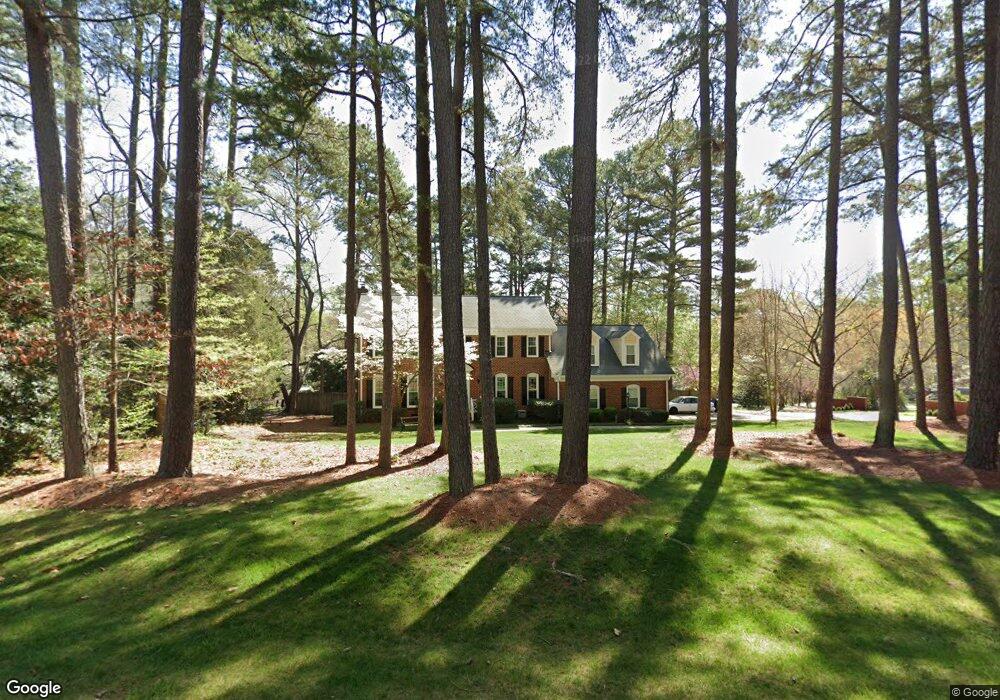
1524 Bridgeport Dr Raleigh, NC 27615
Six Forks NeighborhoodEstimated Value: $593,000 - $732,000
4
Beds
3
Baths
2,762
Sq Ft
$241/Sq Ft
Est. Value
About This Home
This home is located at 1524 Bridgeport Dr, Raleigh, NC 27615 and is currently estimated at $665,863, approximately $241 per square foot. 1524 Bridgeport Dr is a home located in Wake County with nearby schools including Lead Mine Elementary School, Carroll Middle, and Sanderson High School.
Ownership History
Date
Name
Owned For
Owner Type
Purchase Details
Closed on
May 28, 1998
Sold by
Farnsworth Gilbert L
Bought by
Walker Swen A and Walker Patricia
Current Estimated Value
Home Financials for this Owner
Home Financials are based on the most recent Mortgage that was taken out on this home.
Original Mortgage
$183,000
Outstanding Balance
$36,801
Interest Rate
7.11%
Estimated Equity
$629,062
Create a Home Valuation Report for This Property
The Home Valuation Report is an in-depth analysis detailing your home's value as well as a comparison with similar homes in the area
Home Values in the Area
Average Home Value in this Area
Purchase History
| Date | Buyer | Sale Price | Title Company |
|---|---|---|---|
| Walker Swen A | $233,000 | -- |
Source: Public Records
Mortgage History
| Date | Status | Borrower | Loan Amount |
|---|---|---|---|
| Open | Walker Swen A | $183,000 |
Source: Public Records
Tax History Compared to Growth
Tax History
| Year | Tax Paid | Tax Assessment Tax Assessment Total Assessment is a certain percentage of the fair market value that is determined by local assessors to be the total taxable value of land and additions on the property. | Land | Improvement |
|---|---|---|---|---|
| 2025 | $4,603 | $525,524 | $205,000 | $320,524 |
| 2024 | $4,584 | $525,524 | $205,000 | $320,524 |
| 2023 | $4,208 | $384,182 | $140,000 | $244,182 |
| 2022 | $3,910 | $384,182 | $140,000 | $244,182 |
| 2021 | $3,758 | $384,182 | $140,000 | $244,182 |
| 2020 | $3,690 | $384,182 | $140,000 | $244,182 |
| 2019 | $3,919 | $336,456 | $142,000 | $194,456 |
| 2018 | $3,696 | $336,456 | $142,000 | $194,456 |
| 2017 | $3,520 | $336,456 | $142,000 | $194,456 |
| 2016 | $3,448 | $336,456 | $142,000 | $194,456 |
| 2015 | $3,489 | $335,011 | $142,000 | $193,011 |
| 2014 | $3,309 | $335,011 | $142,000 | $193,011 |
Source: Public Records
Map
Nearby Homes
- 8521 Harbor Dr
- 8136 Greywinds Dr
- 8337 Greywinds Dr
- 8308 Grey Abbey Place
- 1308 Hillbrow Ln Unit 203
- 1032 Vestavia Woods Dr
- 8121 Greys Landing Way
- 1423 Mahonia Ct
- 7820 Harbor Dr
- 8700 Aldersgate Way
- 2204 Middlefield Ct
- 7922 Footman Way
- 7803 Falcon Rest Cir Unit 7803
- 8809 Barleymoor Dr
- 7771 Falcon Rest Cir Unit 7771
- 7913 Wood Cove Ct
- 10100 Strickland Rd
- 8124 Upper Lake Dr
- 8021 Thrush Ridge Ln
- 8015 Brown Bark Place
- 1525 Bridgeport Dr
- 1520 Bridgeport Dr
- 8608 Windjammer Dr
- 1600 Bridgeport Dr
- 8605 Windjammer Dr
- 8607 Windjammer Dr
- 1521 Bridgeport Dr
- 1601 Bridgeport Dr
- 8505 Tide Ct
- 1516 Bridgeport Dr
- 8609 Windjammer Dr
- 8610 Windjammer Dr
- 8611 Windjammer Dr
- 1512 Bridgeport Dr
- 8504 Tide Ct
- 8501 Tide Ct
- 8604 Harbor Dr
- 8600 Harbor Dr
- 1509 Bridgeport Dr
- 8608 Harbor Dr