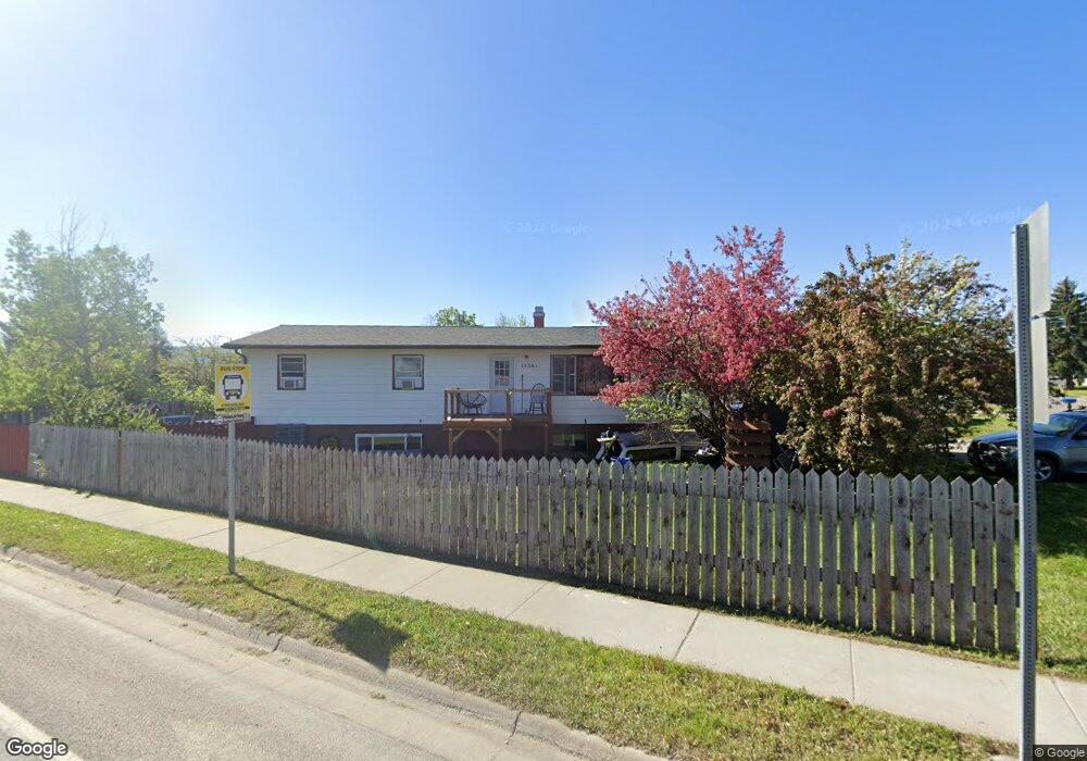
1526 Durston Rd Bozeman, MT 59715
Kirk NeighborhoodEstimated Value: $599,465 - $997,000
6
Beds
2
Baths
1,250
Sq Ft
$615/Sq Ft
Est. Value
About This Home
This home is located at 1526 Durston Rd, Bozeman, MT 59715 and is currently estimated at $768,366, approximately $614 per square foot. 1526 Durston Rd is a home located in Gallatin County with nearby schools including Lincoln Titus Elementary School, Whittier School, and Van Cortlandtville School.
Ownership History
Date
Name
Owned For
Owner Type
Purchase Details
Closed on
Oct 28, 2020
Sold by
Janus Benjamin Daniel
Bought by
Janus Benjamin Daniel and Janus Joseph James
Current Estimated Value
Home Financials for this Owner
Home Financials are based on the most recent Mortgage that was taken out on this home.
Original Mortgage
$460,113
Outstanding Balance
$409,246
Interest Rate
2.9%
Mortgage Type
FHA
Estimated Equity
$359,120
Purchase Details
Closed on
Sep 28, 2020
Sold by
Dvs 1526 Llc
Bought by
Janus Benjamin Daniel
Home Financials for this Owner
Home Financials are based on the most recent Mortgage that was taken out on this home.
Original Mortgage
$460,113
Outstanding Balance
$409,246
Interest Rate
2.9%
Mortgage Type
FHA
Estimated Equity
$359,120
Purchase Details
Closed on
Jul 14, 2005
Sold by
Shyne Daniel A and Shyne Victoria Petersen
Bought by
Dvs1526 Llc
Create a Home Valuation Report for This Property
The Home Valuation Report is an in-depth analysis detailing your home's value as well as a comparison with similar homes in the area
Home Values in the Area
Average Home Value in this Area
Purchase History
| Date | Buyer | Sale Price | Title Company |
|---|---|---|---|
| Janus Benjamin Daniel | -- | Montana Title & Escrow | |
| Janus Benjamin Daniel | -- | Montana Title & Escrow | |
| Dvs1526 Llc | -- | None Available |
Source: Public Records
Mortgage History
| Date | Status | Borrower | Loan Amount |
|---|---|---|---|
| Open | Janus Benjamin Daniel | $460,113 |
Source: Public Records
Tax History Compared to Growth
Tax History
| Year | Tax Paid | Tax Assessment Tax Assessment Total Assessment is a certain percentage of the fair market value that is determined by local assessors to be the total taxable value of land and additions on the property. | Land | Improvement |
|---|---|---|---|---|
| 2025 | $2,644 | $598,300 | $0 | $0 |
| 2024 | $3,911 | $587,600 | $0 | $0 |
| 2023 | $3,785 | $587,600 | $0 | $0 |
| 2022 | $2,528 | $329,700 | $0 | $0 |
| 2021 | $2,790 | $329,700 | $0 | $0 |
| 2020 | $2,667 | $311,900 | $0 | $0 |
| 2019 | $2,728 | $311,900 | $0 | $0 |
| 2018 | $2,492 | $264,000 | $0 | $0 |
| 2017 | $2,462 | $264,000 | $0 | $0 |
| 2016 | $2,351 | $249,000 | $0 | $0 |
| 2015 | $2,353 | $249,000 | $0 | $0 |
| 2014 | $2,267 | $141,142 | $0 | $0 |
Source: Public Records
Map
Nearby Homes
- 818 Matheson Way
- 854 Matheson Way
- 403 N 18th Ave
- 304 N 16th Ave
- 402 & 404 N 19th Ave
- 907 N 17th Ave
- 1460 Juniper St
- 1406 Juniper St
- 318 & 320 N 19th
- 1608 W Beall St Unit C
- 1610 W Beall St Unit C
- TBD N 19th Ave
- 1036 N 15th Ave
- 1033 N 14th Ave
- 152 Laager Loop
- 420 N 22nd Ave
- 1283 Crabapple Dr
- 526 N 10th Ave
- 928 Mountain Ash Ave
- 510 N 23rd Ave
- 514 N 16th Ave
- 1605 Durston Rd Unit 44
- 1605 Durston Rd
- 1605 Durston Rd Unit 51
- 1605 Durston Rd Unit 49
- 510 N 16th Ave
- 519 N 15th Ave
- 1604 Durston Rd
- 515 N 15th Ave
- 517 N 16th Ave
- 511 N 15th Ave
- 506 N 16th Ave
- 611 N 15th Ave
- 1519 Durston Rd
- 509 N 16th Ave
- 639 N 15th Ave
- 509 N 16th Ave
- 507 N 15th Ave
- 502 N 16th Ave
- 505 N 16th Ave