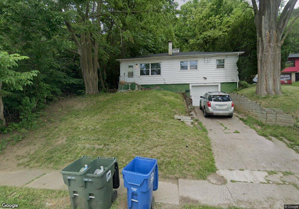
1526 W 10th St Davenport, IA 52804
Riverview Terrace NeighborhoodEstimated Value: $94,000 - $114,000
3
Beds
2
Baths
980
Sq Ft
$107/Sq Ft
Est. Value
About This Home
This home is located at 1526 W 10th St, Davenport, IA 52804 and is currently estimated at $104,670, approximately $106 per square foot. 1526 W 10th St is a home located in Scott County with nearby schools including Walnut Hill Elementary School, South Christian Elementary School, and Christian County Middle School.
Ownership History
Date
Name
Owned For
Owner Type
Purchase Details
Closed on
Mar 29, 2023
Sold by
Gleize Teri L and Gleise Terri L
Bought by
Gleize Terri L and Plett Darrin C
Current Estimated Value
Purchase Details
Closed on
Sep 1, 2006
Sold by
Gleize Terri L and Plett Darrin C
Bought by
Mott Doug and Mott Shane
Home Financials for this Owner
Home Financials are based on the most recent Mortgage that was taken out on this home.
Original Mortgage
$64,650
Interest Rate
9%
Mortgage Type
Seller Take Back
Create a Home Valuation Report for This Property
The Home Valuation Report is an in-depth analysis detailing your home's value as well as a comparison with similar homes in the area
Home Values in the Area
Average Home Value in this Area
Purchase History
| Date | Buyer | Sale Price | Title Company |
|---|---|---|---|
| Gleize Terri L | -- | None Listed On Document | |
| Mott Doug | $65,000 | None Available |
Source: Public Records
Mortgage History
| Date | Status | Borrower | Loan Amount |
|---|---|---|---|
| Previous Owner | Mott Doug | $64,650 |
Source: Public Records
Tax History Compared to Growth
Tax History
| Year | Tax Paid | Tax Assessment Tax Assessment Total Assessment is a certain percentage of the fair market value that is determined by local assessors to be the total taxable value of land and additions on the property. | Land | Improvement |
|---|---|---|---|---|
| 2025 | $1,428 | $88,740 | $13,630 | $75,110 |
| 2024 | $1,394 | $79,900 | $13,630 | $66,270 |
| 2023 | $1,602 | $79,900 | $13,630 | $66,270 |
| 2022 | $1,610 | $74,990 | $13,630 | $61,360 |
| 2021 | $1,610 | $74,990 | $13,630 | $61,360 |
| 2020 | $1,588 | $73,070 | $13,630 | $59,440 |
| 2019 | $1,524 | $67,960 | $13,630 | $54,330 |
| 2018 | $1,492 | $67,960 | $13,630 | $54,330 |
| 2017 | $1,546 | $67,960 | $13,630 | $54,330 |
| 2016 | $1,488 | $67,960 | $0 | $0 |
| 2015 | $1,488 | $53,940 | $0 | $0 |
| 2014 | $1,198 | $53,940 | $0 | $0 |
| 2013 | $1,178 | $0 | $0 | $0 |
| 2012 | -- | $67,870 | $15,950 | $51,920 |
Source: Public Records
Map
Nearby Homes
- 1604 W 9th St
- 1446 Clay St
- 1414 W 9th St
- 1701 W 8th St
- 1824 W 8th St
- 1445 W 7th St
- 1309 Clay St
- 1505 W 14th St
- 1854 W 8th St
- 1335 W 13th St
- 4735 W 12th St
- 1321 W 13th St
- 1419 N Division St
- 1207 N Marquette St
- 817 N Marquette St
- 1410 W 4th St
- 1119 W 8th St
- 1111 W 8th St
- 1604 N Division St
- 1538 W 3rd St
- 1518 W 10th St
- 1523 W 10th St
- 1527 W 10th St
- 1515 W 10th St
- 1533 W 10th St
- 1509 W 10th St
- 1537 W 10th St
- 1539 Clay St
- 1503 W 10th St
- 1603 W 10th St Unit 2
- 1603 W 10th St Unit 1
- 922 Washington St
- 920 Washington St
- 1535 Clay St
- 1611 W 10th St
- 1533 Clay St
- 1617 W 10th St
- 1464 W 10th St
- 1519 Clay St
- 1522 W 9th St