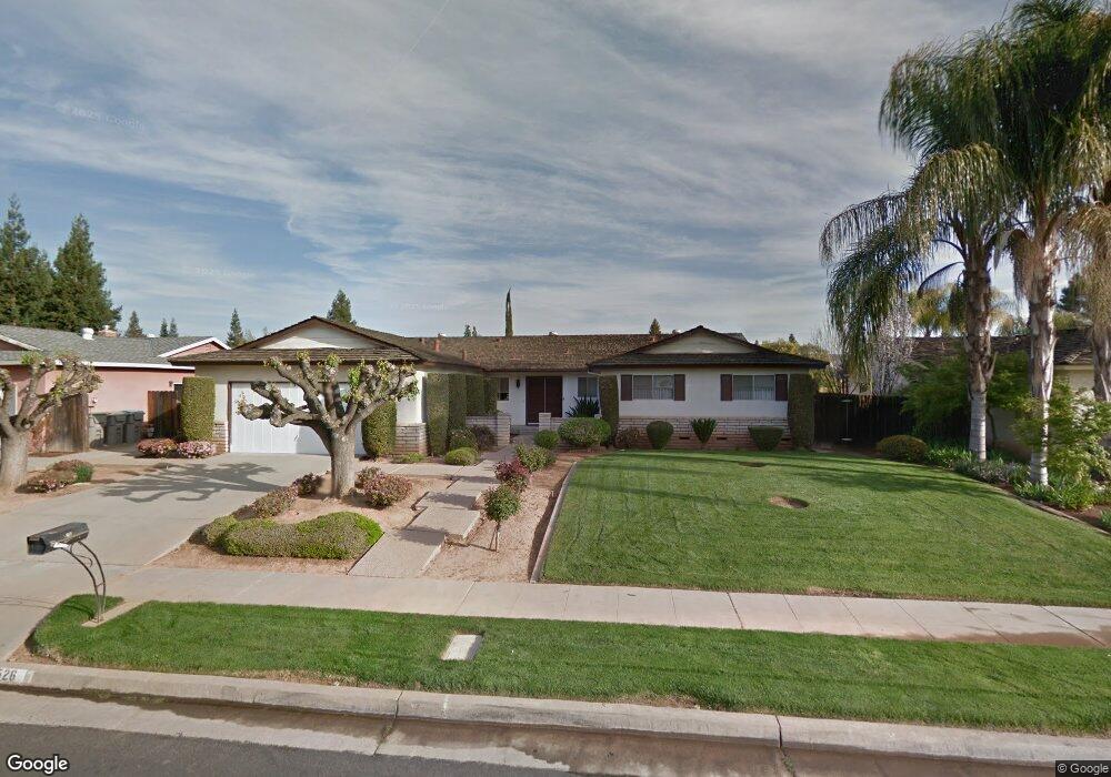
1526 W Paul Ave Fresno, CA 93711
Bullard NeighborhoodEstimated Value: $565,000 - $629,000
4
Beds
3
Baths
2,677
Sq Ft
$221/Sq Ft
Est. Value
About This Home
This home is located at 1526 W Paul Ave, Fresno, CA 93711 and is currently estimated at $590,591, approximately $220 per square foot. 1526 W Paul Ave is a home located in Fresno County with nearby schools including Starr Elementary School, Tenaya Middle School, and Bullard High School.
Ownership History
Date
Name
Owned For
Owner Type
Purchase Details
Closed on
Feb 12, 2025
Sold by
Darakjian Hrant and Darakjian Kelly
Bought by
Hunter Adam and Hunter Rachel
Current Estimated Value
Home Financials for this Owner
Home Financials are based on the most recent Mortgage that was taken out on this home.
Original Mortgage
$417,175
Outstanding Balance
$414,696
Interest Rate
6.91%
Mortgage Type
FHA
Estimated Equity
$175,895
Purchase Details
Closed on
Apr 25, 2024
Sold by
Darakjian Kelly Lee
Bought by
Hrant Darakjian And Kelly Lee Darakjian Decla and Darakjian
Purchase Details
Closed on
May 25, 2020
Sold by
Darakijian Kelly Lee and The Ara Boghosian Declaration
Bought by
Darakjian Kelly Lee and Boghosian Glenn Scott
Purchase Details
Closed on
Aug 18, 2011
Sold by
Boghosian Ara
Bought by
Boghosian Ara
Create a Home Valuation Report for This Property
The Home Valuation Report is an in-depth analysis detailing your home's value as well as a comparison with similar homes in the area
Home Values in the Area
Average Home Value in this Area
Purchase History
| Date | Buyer | Sale Price | Title Company |
|---|---|---|---|
| Hunter Adam | $580,000 | Chicago Title | |
| Hrant Darakjian And Kelly Lee Darakjian Decla | -- | None Listed On Document | |
| Darakjian Kelly Lee | -- | None Available | |
| Boghosian Ara | -- | None Available |
Source: Public Records
Mortgage History
| Date | Status | Borrower | Loan Amount |
|---|---|---|---|
| Open | Hunter Adam | $417,175 |
Source: Public Records
Tax History Compared to Growth
Tax History
| Year | Tax Paid | Tax Assessment Tax Assessment Total Assessment is a certain percentage of the fair market value that is determined by local assessors to be the total taxable value of land and additions on the property. | Land | Improvement |
|---|---|---|---|---|
| 2025 | $1,790 | $145,716 | $27,915 | $117,801 |
| 2023 | $1,790 | $140,060 | $26,832 | $113,228 |
| 2022 | $1,732 | $137,314 | $26,306 | $111,008 |
| 2021 | $1,685 | $134,623 | $25,791 | $108,832 |
| 2020 | $1,678 | $133,244 | $25,527 | $107,717 |
| 2019 | $1,613 | $130,632 | $25,027 | $105,605 |
| 2018 | $1,578 | $128,072 | $24,537 | $103,535 |
| 2017 | $1,551 | $125,561 | $24,056 | $101,505 |
| 2016 | $1,416 | $123,100 | $23,585 | $99,515 |
| 2015 | $1,393 | $121,252 | $23,231 | $98,021 |
| 2014 | $1,363 | $118,877 | $22,776 | $96,101 |
Source: Public Records
Map
Nearby Homes
- 6569 N Teilman Ave
- 6447 N Vagedes Ave
- 6671 N Channing Way
- 6753 N Durant Ave
- 1654 W Vartikian Ave
- 7047 N Teilman Ave Unit 101
- 7047 N Teilman Ave Unit 102
- 6658 N Thorne Ave
- 1590 W Escalon Ave
- 1387 W Sample Ave
- 6594 N Farris Ave
- 1611 W Escalon Ave
- 6518 N Dolores Ave
- 6737 N Harrison Ave
- 7166 N Fruit Ave Unit 160
- 7166 N Fruit Ave Unit 132
- 7166 N Fruit Ave Unit 133
- 7178 N Fruit Ave Unit 108
- 7166 N Fruit Ave Unit 127
- 6743 N Dolores Ave
- 1516 W Paul Ave
- 1540 W Paul Ave
- 1527 W Palo Alto Ave
- 1541 W Palo Alto Ave
- 1517 W Palo Alto Ave
- 1502 W Paul Ave
- 1552 W Paul Ave
- 1525 W Paul Ave
- 1515 W Paul Ave
- 1539 W Paul Ave
- 1553 W Palo Alto Ave
- 1503 W Palo Alto Ave
- 1501 W Paul Ave
- 1551 W Paul Ave
- 1484 W Paul Ave
- 1568 W Paul Ave
- 1485 W Palo Alto Ave
- 1567 W Palo Alto Ave
- 1524 W Menlo Ave
- 1528 W Palo Alto Ave