Estimated Value: $640,484 - $865,000
3
Beds
2
Baths
2,509
Sq Ft
$319/Sq Ft
Est. Value
About This Home
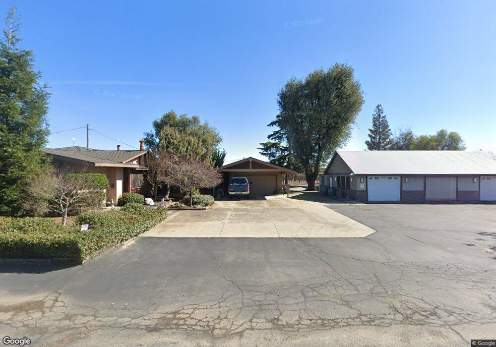
This home is located at 15260 N Locust Tree Rd, Lodi, CA 95240 and is currently estimated at $801,371, approximately $319 per square foot. 15260 N Locust Tree Rd is a home located in San Joaquin County with nearby schools including Victor Elementary School, Houston School, and Lodi High School.
Ownership History
Date
Name
Owned For
Owner Type
Purchase Details
Closed on
Apr 1, 2021
Sold by
Nies Lary Ralph and Nies Lenore Melody
Bought by
Nies Family Trust and Nies
Current Estimated Value
Purchase Details
Closed on
Feb 10, 2021
Sold by
Nies Larry Ralph and Nies Lenore Melody
Bought by
Nies Kurtis Anthony and Nies Scott Christopher
Purchase Details
Closed on
Mar 15, 2004
Sold by
Schroeder Agnes
Bought by
Nies Larry R and Nies Lenore M
Purchase Details
Closed on
Jun 16, 1995
Sold by
Nies Larry R
Bought by
Nies Larry Ralph and Nies Lenore Melody
Create a Home Valuation Report for This Property
The Home Valuation Report is an in-depth analysis detailing your home's value as well as a comparison with similar homes in the area
Purchase History
| Date | Buyer | Sale Price | Title Company |
|---|---|---|---|
| Nies Family Trust | -- | None Listed On Document | |
| Nies Kurtis Anthony | -- | None Listed On Document | |
| Nies Larry Ralph | -- | None Listed On Document | |
| Nies Larry R | $2,000 | -- | |
| Nies Larry Ralph | -- | -- |
Source: Public Records
Tax History
| Year | Tax Paid | Tax Assessment Tax Assessment Total Assessment is a certain percentage of the fair market value that is determined by local assessors to be the total taxable value of land and additions on the property. | Land | Improvement |
|---|---|---|---|---|
| 2025 | $2,020 | $171,603 | $14,582 | $157,021 |
| 2024 | $1,968 | $168,240 | $14,297 | $153,943 |
| 2023 | $1,947 | $164,942 | $14,017 | $150,925 |
| 2022 | $1,831 | $161,709 | $13,743 | $147,966 |
| 2021 | $1,859 | $158,539 | $13,474 | $145,065 |
| 2020 | $1,814 | $156,914 | $13,336 | $143,578 |
| 2019 | $1,779 | $153,838 | $13,075 | $140,763 |
| 2018 | $1,754 | $150,822 | $12,819 | $138,003 |
| 2017 | $1,716 | $147,866 | $12,568 | $135,298 |
| 2016 | $1,616 | $144,968 | $12,321 | $132,647 |
| 2014 | $1,577 | $139,995 | $11,899 | $128,096 |
Source: Public Records
Map
Nearby Homes
- 17036 N Locust Tree Rd
- 15910 N Locust Tree Rd
- 17010 N Locust Tree Rd
- 12116 Alpine Rd
- 15296 N Highway 88
- 10400 E Harney Ln
- 16464 Fox Rd
- 7782 E Harney Ln
- 13400 Hibbard Rd
- 14235 N Vintage Rd
- 11900 E Brandt Rd
- 15918 N Jack Tone Rd
- 15155 N Curry Ave
- 13299 N Curry Ave
- 11791 N Alpine Rd
- 11850 Live Oak Rd
- 12872 N Jack Tone Rd
- 5954 E Hogan Ln
- 18450 N Highway 88
- 18450 N Highway 88 Unit 17
- 15190 N Locust Tree Rd
- 15089 N Locust Tree Rd
- 14320 N Locust Tree Rd
- 16141 N Locust Tree Rd
- 9995 Newfield Rd
- 15491 N Locust Tree Rd
- 15600 N Locust Tree Rd
- 9830 E Kettleman Ln
- 14975 N Locust Tree Rd
- 9594 E Kettleman Ln
- 10301 Newfield Rd
- 15651 N Locust Tree Rd
- 9490 E Kettleman Ln
- 10155 E Kettleman Ln
- 14880 N Locust Tree Rd
- 9369 E Kettleman Ln
- 15405 N Locust Tree Rd
- 15745 N Locust Tree Rd
- 14800 N Locust Tree Rd
- 15822 N Locust Tree Rd
Your Personal Tour Guide
Ask me questions while you tour the home.