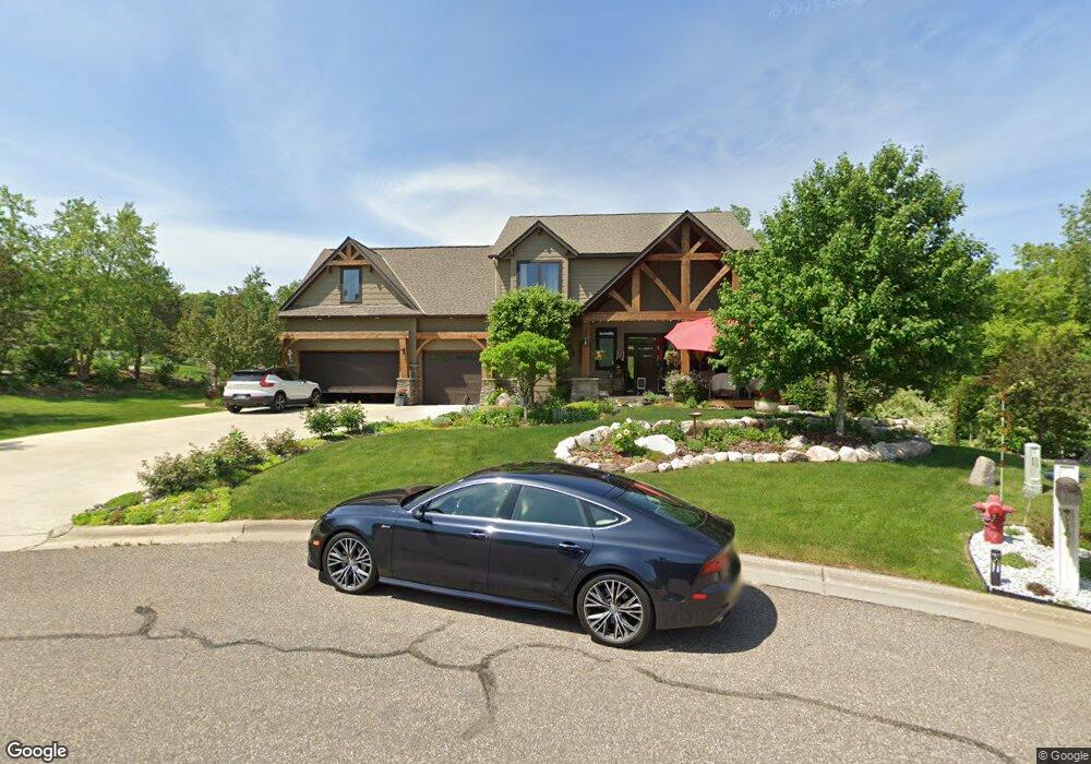
15270 15270 Branch Cir Burnsville, MN 55337
Estimated Value: $723,000 - $815,000
4
Beds
3
Baths
2,779
Sq Ft
$279/Sq Ft
Est. Value
About This Home
This home is located at 15270 15270 Branch Cir, Burnsville, MN 55337 and is currently estimated at $774,874, approximately $278 per square foot. 15270 15270 Branch Cir is a home located in Dakota County with nearby schools including Impact Academy at Orchard Lake Elementary School, Kenwood Trail Middle School, and Lakeville South High School.
Ownership History
Date
Name
Owned For
Owner Type
Purchase Details
Closed on
Nov 22, 2011
Sold by
Forest Park Heights Llc
Bought by
Balfanz Katri K
Current Estimated Value
Home Financials for this Owner
Home Financials are based on the most recent Mortgage that was taken out on this home.
Original Mortgage
$120,510
Outstanding Balance
$82,414
Interest Rate
4.08%
Mortgage Type
New Conventional
Estimated Equity
$692,460
Create a Home Valuation Report for This Property
The Home Valuation Report is an in-depth analysis detailing your home's value as well as a comparison with similar homes in the area
Home Values in the Area
Average Home Value in this Area
Purchase History
| Date | Buyer | Sale Price | Title Company |
|---|---|---|---|
| Balfanz Katri K | $133,900 | Premier Title |
Source: Public Records
Mortgage History
| Date | Status | Borrower | Loan Amount |
|---|---|---|---|
| Open | Balfanz Katri K | $120,510 |
Source: Public Records
Tax History Compared to Growth
Tax History
| Year | Tax Paid | Tax Assessment Tax Assessment Total Assessment is a certain percentage of the fair market value that is determined by local assessors to be the total taxable value of land and additions on the property. | Land | Improvement |
|---|---|---|---|---|
| 2024 | $9,372 | $704,600 | $234,300 | $470,300 |
| 2023 | $9,372 | $723,500 | $268,300 | $455,200 |
| 2022 | $8,848 | $740,100 | $267,700 | $472,400 |
| 2021 | $8,846 | $659,600 | $232,700 | $426,900 |
| 2020 | $9,104 | $648,600 | $221,700 | $426,900 |
| 2019 | $8,333 | $637,400 | $211,100 | $426,300 |
| 2018 | $7,783 | $604,500 | $191,900 | $412,600 |
| 2017 | $7,173 | $564,500 | $191,400 | $373,100 |
| 2016 | $7,853 | $515,600 | $174,100 | $341,500 |
| 2015 | $6,800 | $538,300 | $169,000 | $369,300 |
| 2014 | -- | $499,300 | $165,900 | $333,400 |
| 2013 | -- | $343,061 | $149,358 | $193,703 |
Source: Public Records
Map
Nearby Homes
- 155xx Loop Rd S
- 2300 Wildwood Ct
- 2204 Wildwood Ct
- 14750 W Bursnville Pkwy Unit 145
- 14750 W Bursnville Pkwy Unit 115
- 14750 W Bursnville Pkwy Unit 289
- 14908 Judicial Rd
- 4281 W 150th St
- 4291 W 150th St
- 4116 N River Run
- 14920 Sharon Ln
- XXXX Judicial Rd
- 4725 Linden Cove Ln
- 4729 Linden Cove Ln
- 4759 Linden Cove Ln
- 4155 Joppa Cir
- 14900 Viewcrest Ln
- 4869 Linden Cove Ln
- 1833 Southcross Dr W Unit 2201
- 2017 Southcross Dr W Unit 703
- 15270 Branch Cir
- 15262 Branch Cir
- 15259 Branch Cir
- 3312 Valley View Dr
- 3261 Valley View Dr
- 3315 Valley View Dr
- 15267 Branch Cir
- 15259 15259 Branch Cir
- 3289 Valley View Dr
- 3289 Valley View Dr
- 3229 Valley View Dr
- 3229 3229 Valley View-Drive-
- 3229 3229 Valley View Dr
- 3338 Valley View Dr
- 3341 Valley View Dr
- 3341 Valley View Dr
- 3370 Valley View Dr
- 15264 Pin Oak Ct
- 15256 Pin Oak Ct
- 3367 Valley View Dr