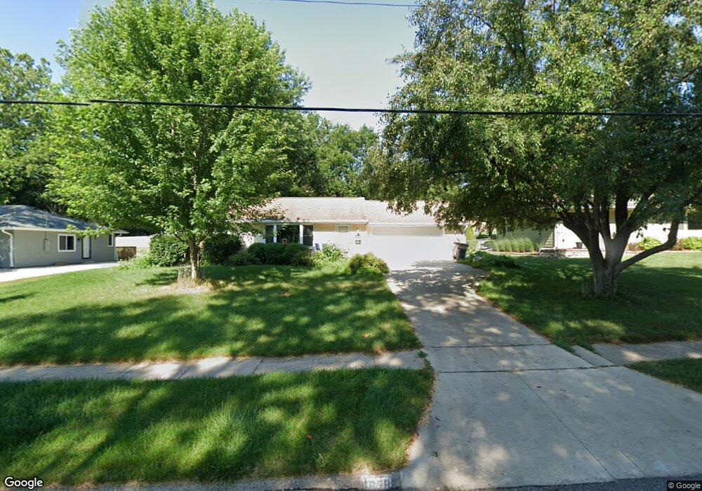
1528 19th St West Des Moines, IA 50265
Estimated Value: $266,000 - $326,000
3
Beds
2
Baths
1,312
Sq Ft
$219/Sq Ft
Est. Value
About This Home
This home is located at 1528 19th St, West Des Moines, IA 50265 and is currently estimated at $287,538, approximately $219 per square foot. 1528 19th St is a home located in Polk County with nearby schools including Indian Hills Junior High School, Valley Southwoods Freshman High School, and Valley High School.
Ownership History
Date
Name
Owned For
Owner Type
Purchase Details
Closed on
Dec 30, 1999
Sold by
Bigsby Glen Edgar and Bigsby Claudia Sue
Bought by
Kramer Jeffrey W and Kramer Carolyn E
Current Estimated Value
Home Financials for this Owner
Home Financials are based on the most recent Mortgage that was taken out on this home.
Original Mortgage
$118,027
Outstanding Balance
$37,032
Interest Rate
7.89%
Mortgage Type
FHA
Estimated Equity
$250,506
Purchase Details
Closed on
Jan 15, 1997
Sold by
Bigsby Judith Ann
Bought by
Bigsby Glenn Edgar
Create a Home Valuation Report for This Property
The Home Valuation Report is an in-depth analysis detailing your home's value as well as a comparison with similar homes in the area
Home Values in the Area
Average Home Value in this Area
Purchase History
| Date | Buyer | Sale Price | Title Company |
|---|---|---|---|
| Kramer Jeffrey W | $118,500 | -- | |
| Bigsby Glenn Edgar | -- | -- |
Source: Public Records
Mortgage History
| Date | Status | Borrower | Loan Amount |
|---|---|---|---|
| Open | Kramer Jeffrey W | $118,027 |
Source: Public Records
Tax History Compared to Growth
Tax History
| Year | Tax Paid | Tax Assessment Tax Assessment Total Assessment is a certain percentage of the fair market value that is determined by local assessors to be the total taxable value of land and additions on the property. | Land | Improvement |
|---|---|---|---|---|
| 2025 | $3,254 | $242,900 | $71,500 | $171,400 |
| 2024 | $3,254 | $215,700 | $62,700 | $153,000 |
| 2023 | $3,228 | $215,700 | $62,700 | $153,000 |
| 2022 | $3,188 | $176,000 | $52,600 | $123,400 |
| 2021 | $2,962 | $176,000 | $52,600 | $123,400 |
| 2020 | $2,914 | $156,300 | $47,300 | $109,000 |
| 2019 | $2,758 | $156,300 | $47,300 | $109,000 |
| 2018 | $2,762 | $143,200 | $42,500 | $100,700 |
| 2017 | $2,376 | $143,200 | $42,500 | $100,700 |
| 2016 | $2,320 | $120,900 | $39,400 | $81,500 |
| 2015 | $2,320 | $120,900 | $39,400 | $81,500 |
| 2014 | $2,234 | $119,100 | $38,100 | $81,000 |
Source: Public Records
Map
Nearby Homes
- 1625 19th St
- 1827 Pleasant St
- 1705 Buffalo Rd
- 2408 Pleasant St
- 542 Bella St
- 1230 16th St
- 1114 22nd St
- 3927 Westgate Pkwy
- 4052 NW 175th St
- 3945 Westgate Pkwy
- 3963 Westgate Pkwy
- 1006 22nd St
- 1474 NW 90th St
- 1028 28th St
- 17686 Hammontree Dr
- 2100 Meadow Brook Dr Unit 103
- 1233 72nd St
- 8833 Luin Dr
- 842 23rd St
- 1808 80th St