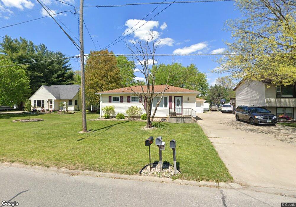
1528 Huntington Rd Waterloo, IA 50701
Estimated Value: $142,000 - $178,000
2
Beds
1
Bath
814
Sq Ft
$193/Sq Ft
Est. Value
About This Home
This home is located at 1528 Huntington Rd, Waterloo, IA 50701 and is currently estimated at $157,215, approximately $193 per square foot. 1528 Huntington Rd is a home located in Black Hawk County with nearby schools including Becker Elementary School, Central Middle School, and West High School.
Ownership History
Date
Name
Owned For
Owner Type
Purchase Details
Closed on
May 20, 2016
Sold by
Wilson Dustin D and Wilson Kelsey
Bought by
Nefzger Lynn M
Current Estimated Value
Purchase Details
Closed on
Dec 21, 2012
Sold by
Bw Properties Llc
Bought by
Wilson Dustin Fd
Home Financials for this Owner
Home Financials are based on the most recent Mortgage that was taken out on this home.
Original Mortgage
$85,424
Interest Rate
3.75%
Mortgage Type
FHA
Purchase Details
Closed on
Jan 4, 2012
Sold by
Yearling Candi J and Buehner Candi Jo
Bought by
Everbank
Create a Home Valuation Report for This Property
The Home Valuation Report is an in-depth analysis detailing your home's value as well as a comparison with similar homes in the area
Home Values in the Area
Average Home Value in this Area
Purchase History
| Date | Buyer | Sale Price | Title Company |
|---|---|---|---|
| Nefzger Lynn M | -- | Attorney | |
| Wilson Dustin Fd | $87,000 | None Available | |
| Everbank | $58,959 | None Available |
Source: Public Records
Mortgage History
| Date | Status | Borrower | Loan Amount |
|---|---|---|---|
| Previous Owner | Wilson Dustin Fd | $85,424 |
Source: Public Records
Tax History Compared to Growth
Tax History
| Year | Tax Paid | Tax Assessment Tax Assessment Total Assessment is a certain percentage of the fair market value that is determined by local assessors to be the total taxable value of land and additions on the property. | Land | Improvement |
|---|---|---|---|---|
| 2025 | $2,558 | $143,150 | $21,450 | $121,700 |
| 2024 | $2,558 | $128,180 | $21,450 | $106,730 |
| 2023 | $2,164 | $128,180 | $21,450 | $106,730 |
| 2022 | $2,106 | $107,430 | $21,450 | $85,980 |
| 2021 | $2,164 | $107,430 | $21,450 | $85,980 |
| 2020 | $2,124 | $104,130 | $18,150 | $85,980 |
| 2019 | $2,124 | $104,130 | $18,150 | $85,980 |
| 2018 | $2,322 | $104,130 | $18,150 | $85,980 |
| 2017 | $2,170 | $104,130 | $18,150 | $85,980 |
| 2016 | $1,946 | $94,490 | $18,150 | $76,340 |
| 2015 | $1,946 | $94,490 | $18,150 | $76,340 |
| 2014 | $1,984 | $94,490 | $18,150 | $76,340 |
Source: Public Records
Map
Nearby Homes
- 1726 Huntington Rd
- 1221 Downing Ave
- 1114 Eleanor Dr
- 1107 Downing Ave
- 2621 University Ave
- 1269 Scott Ave
- 1742 Sager Ave
- 1275 Deloris Dr
- 2320 University Ave
- 915 Alabar Ave
- 819 Hanna Blvd
- 241 Carrington Ave
- 1016 Evergreen Ave
- 1129 Wallgate Ave
- 102 Bergen Dr
- 104 Bergen Dr
- 724 Kirkwood Ave
- 3816 Monterey Dr
- 131 Axlewood Dr
- 124 Axlewood Dr
- 1522 Huntington Rd
- 1604 Huntington Rd
- 1518 Huntington Rd
- 1615 Huntington Rd
- 1619 Huntington Rd
- 1531 Huntington Rd
- 1529 Huntington Rd
- 1514 Huntington Rd
- 1626 Huntington Rd
- 1525 Huntington Rd
- 1535 Huntington Rd
- 1519 Huntington Rd
- 1504 Huntington Rd
- 1511 Huntington Rd
- 1632 Huntington Rd
- 1629 Huntington Rd
- 1625 Huntington Rd
- 1464 Huntington Rd
- 1507 Huntington Rd
- 1638 Huntington Rd