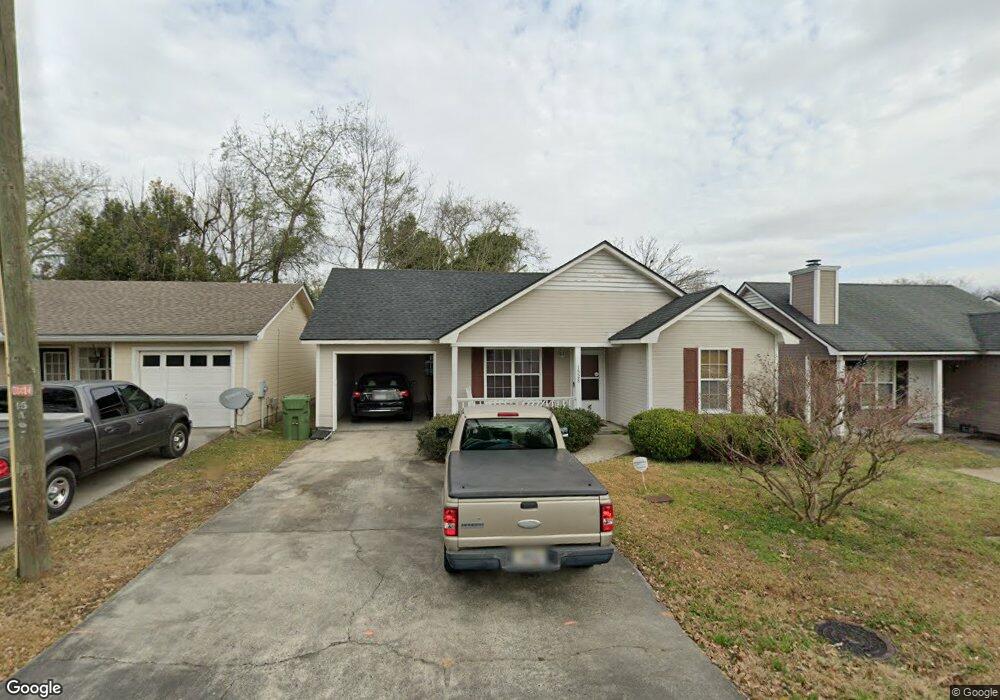
1528 Myrtle St Valdosta, GA 31601
Estimated Value: $144,420 - $163,000
--
Bed
2
Baths
1,299
Sq Ft
$119/Sq Ft
Est. Value
About This Home
This home is located at 1528 Myrtle St, Valdosta, GA 31601 and is currently estimated at $154,605, approximately $119 per square foot. 1528 Myrtle St is a home located in Lowndes County with nearby schools including Westside Elementary School, Hahira Middle School, and Lowndes High School.
Ownership History
Date
Name
Owned For
Owner Type
Purchase Details
Closed on
Jun 10, 1999
Sold by
Townsend Don Michael
Bought by
Holsendolph Cornelius
Current Estimated Value
Purchase Details
Closed on
Dec 23, 1992
Bought by
Townsend Don Michael
Purchase Details
Closed on
Aug 14, 1992
Bought by
T L G Inc
Purchase Details
Closed on
Jan 17, 1992
Bought by
Chase Ted and Chase Linda C
Purchase Details
Closed on
Jul 2, 1991
Bought by
Liberty Savings Bank Fsb
Purchase Details
Closed on
Feb 6, 1990
Bought by
Homes By Cox Corp
Create a Home Valuation Report for This Property
The Home Valuation Report is an in-depth analysis detailing your home's value as well as a comparison with similar homes in the area
Home Values in the Area
Average Home Value in this Area
Purchase History
| Date | Buyer | Sale Price | Title Company |
|---|---|---|---|
| Holsendolph Cornelius | $79,500 | -- | |
| Townsend Don Michael | $58,400 | -- | |
| T L G Inc | $12,500 | -- | |
| Chase Ted | -- | -- | |
| Chase Ted | $27,000 | -- | |
| Liberty Savings Bank Fsb | $50,700 | -- | |
| Homes By Cox Corp | $68,500 | -- |
Source: Public Records
Tax History Compared to Growth
Tax History
| Year | Tax Paid | Tax Assessment Tax Assessment Total Assessment is a certain percentage of the fair market value that is determined by local assessors to be the total taxable value of land and additions on the property. | Land | Improvement |
|---|---|---|---|---|
| 2024 | $1,584 | $47,814 | $12,000 | $35,814 |
| 2023 | $1,544 | $47,814 | $12,000 | $35,814 |
| 2022 | $1,088 | $37,240 | $12,000 | $25,240 |
| 2021 | $1,117 | $37,240 | $12,000 | $25,240 |
| 2020 | $979 | $37,240 | $12,000 | $25,240 |
| 2019 | $986 | $37,240 | $12,000 | $25,240 |
| 2018 | $1,000 | $37,240 | $12,000 | $25,240 |
| 2017 | $1,014 | $37,240 | $11,622 | $25,618 |
| 2016 | $1,017 | $37,240 | $11,622 | $25,618 |
| 2015 | -- | $37,240 | $11,622 | $25,618 |
| 2014 | $1,024 | $38,451 | $12,000 | $26,451 |
Source: Public Records
Map
Nearby Homes
- 1911 Baytree Place
- 1337 Edgewood Dr
- 1331B Edgewood Dr Unit B
- 1331A Edgewood Dr Unit A
- 1533 Woodard St Unit n/a
- 1526 Woodard St
- 1522 Woodard St
- 1811 Canterbury Dr
- 1792 Wayland Park Dr
- 1793 Wayland Park Dr
- 1205 Mcree Dr
- 1197 Jo Ree St
- 1196 Mcarthur Dr
- 1196 Mcarthur Dr Unit all
- 817 W Cranford Ave
- 2106 Jerry Jones Dr
- 1314 Mcree Dr
- 2105 Jerry Jones Dr
- 1003 Ridgewood Dr
- 503 Roberts St
- 1526 Myrtle St
- 1530 Myrtle St
- 1524 Myrtle St
- 1532 Myrtle St
- 1404 Strickland Cir
- 1402 Strickland Cir
- 1725 Poplar St
- 1522 Myrtle St
- *** Dean Ln Unit 3unit
- 1600 Victory St
- 1705 Poplar St
- 726 Poplar St
- 0 Poplar St
- 1408 Strickland Cir
- 1735 Poplar St Unit A&B
- 1732 Poplar St Unit 2
- 1531 Myrtle St
- 1601 Spring Meadow Cir
- 1734 Poplar St Unit A&B
- 1603 Spring Meadow Cir