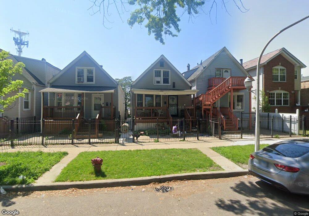
1528 N Keating Ave Chicago, IL 60651
West Humboldt Park NeighborhoodEstimated Value: $268,152 - $400,000
2
Beds
1
Bath
760
Sq Ft
$447/Sq Ft
Est. Value
About This Home
This home is located at 1528 N Keating Ave, Chicago, IL 60651 and is currently estimated at $339,538, approximately $446 per square foot. 1528 N Keating Ave is a home located in Cook County with nearby schools including Lewis Elementary School, Orr Academy High School, and ITW Speer Academy.
Ownership History
Date
Name
Owned For
Owner Type
Purchase Details
Closed on
Jul 27, 2009
Sold by
Anderson Billie
Bought by
Anderson Billie and Jackson Willie
Current Estimated Value
Home Financials for this Owner
Home Financials are based on the most recent Mortgage that was taken out on this home.
Original Mortgage
$70,105
Outstanding Balance
$46,057
Interest Rate
5.36%
Mortgage Type
FHA
Estimated Equity
$293,481
Purchase Details
Closed on
Aug 1, 2007
Sold by
Jackson Willie
Bought by
Anderson Billie
Create a Home Valuation Report for This Property
The Home Valuation Report is an in-depth analysis detailing your home's value as well as a comparison with similar homes in the area
Home Values in the Area
Average Home Value in this Area
Purchase History
| Date | Buyer | Sale Price | Title Company |
|---|---|---|---|
| Anderson Billie | -- | Plymouth Title Guaranty | |
| Anderson Billie | -- | None Available |
Source: Public Records
Mortgage History
| Date | Status | Borrower | Loan Amount |
|---|---|---|---|
| Open | Anderson Billie | $70,105 |
Source: Public Records
Tax History Compared to Growth
Tax History
| Year | Tax Paid | Tax Assessment Tax Assessment Total Assessment is a certain percentage of the fair market value that is determined by local assessors to be the total taxable value of land and additions on the property. | Land | Improvement |
|---|---|---|---|---|
| 2024 | $1,906 | $13,600 | $3,750 | $9,850 |
| 2023 | $973 | $15,000 | $3,000 | $12,000 |
| 2022 | $973 | $15,000 | $3,000 | $12,000 |
| 2021 | $106 | $15,000 | $3,000 | $12,000 |
| 2020 | $106 | $9,840 | $2,925 | $6,915 |
| 2019 | $0 | $10,934 | $2,925 | $8,009 |
| 2018 | $0 | $10,934 | $2,925 | $8,009 |
| 2017 | $58 | $10,574 | $2,550 | $8,024 |
| 2016 | $106 | $10,574 | $2,550 | $8,024 |
| 2015 | $102 | $10,574 | $2,550 | $8,024 |
| 2014 | $101 | $12,197 | $2,400 | $9,797 |
| 2013 | $1,399 | $12,197 | $2,400 | $9,797 |
Source: Public Records
Map
Nearby Homes
- 4820 W Wabansia Ave
- 4718 W Le Moyne St
- 1748 N Keating Ave
- 4826 W Potomac Ave
- 4938 W Crystal St
- 4222 W Division St
- 4946 W Division St
- 1435 N Kolin Ave
- 1522 N Leamington Ave
- 4843 W Haddon Ave
- 1943 N La Crosse Ave
- 4317 W Hirsch St
- 4502 W Thomas St
- 1904 N Kostner Ave
- 1930 N Kenneth Ave
- 4637 W Mclean Ave
- 5021 W Grand Ave
- 1451 N Latrobe Ave
- 1649 N Latrobe Ave
- 2035 N Cicero Ave
- 1530 N Keating Ave
- 1532 N Keating Ave
- 1534 N Keating Ave
- 1534 N Keating Ave
- 1520 N Keating Ave
- 1538 N Keating Ave
- 1516 N Keating Ave
- 1540 N Keating Ave
- 1542 N Keating Ave
- 1525 N Keating Ave
- 1525 N Keating Ave
- 1523 N Keating Ave Unit 1
- 1512 N Keating Ave
- 1521 N Keating Ave
- 1521 N Keating Ave Unit 2
- 1547 N Cicero Ave
- 1527 N Keating Ave
- 1537 N Keating Ave
- 1543 N Keating Ave
- 1543 N Keating Ave