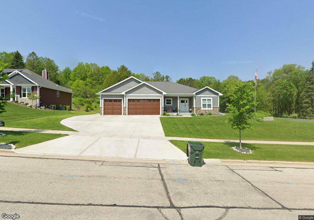
1528 Wolf Dr West Bend, WI 53090
Estimated Value: $443,000 - $582,239
3
Beds
3
Baths
1,917
Sq Ft
$261/Sq Ft
Est. Value
About This Home
This home is located at 1528 Wolf Dr, West Bend, WI 53090 and is currently estimated at $499,810, approximately $260 per square foot. 1528 Wolf Dr is a home with nearby schools including McLane Elementary School, Silverbrook Intermediate School, and East High School.
Ownership History
Date
Name
Owned For
Owner Type
Purchase Details
Closed on
May 11, 2023
Sold by
Tousey Corey D and Tousey Y
Bought by
Tousey Corey D and Tousey Theresa R
Current Estimated Value
Purchase Details
Closed on
Mar 13, 2020
Sold by
Wiesner Investments Llc
Bought by
Tousey Corey D
Home Financials for this Owner
Home Financials are based on the most recent Mortgage that was taken out on this home.
Original Mortgage
$53,100
Interest Rate
3.5%
Mortgage Type
Commercial
Create a Home Valuation Report for This Property
The Home Valuation Report is an in-depth analysis detailing your home's value as well as a comparison with similar homes in the area
Home Values in the Area
Average Home Value in this Area
Purchase History
| Date | Buyer | Sale Price | Title Company |
|---|---|---|---|
| Tousey Corey D | -- | -- | |
| Tousey Corey D | $59,000 | None Available |
Source: Public Records
Mortgage History
| Date | Status | Borrower | Loan Amount |
|---|---|---|---|
| Previous Owner | Tousey Corey D | $53,100 |
Source: Public Records
Tax History Compared to Growth
Tax History
| Year | Tax Paid | Tax Assessment Tax Assessment Total Assessment is a certain percentage of the fair market value that is determined by local assessors to be the total taxable value of land and additions on the property. | Land | Improvement |
|---|---|---|---|---|
| 2024 | $7,262 | $536,800 | $59,800 | $477,000 |
| 2023 | $6,485 | $339,000 | $57,600 | $281,400 |
| 2022 | $6,208 | $339,000 | $57,600 | $281,400 |
| 2021 | $6,114 | $323,300 | $57,600 | $265,700 |
| 2020 | $1,065 | $57,600 | $57,600 | $0 |
| 2019 | $1,036 | $57,600 | $57,600 | $0 |
| 2018 | $1,002 | $57,600 | $57,600 | $0 |
| 2017 | $1,108 | $57,600 | $57,600 | $0 |
| 2016 | $1,118 | $57,600 | $57,600 | $0 |
| 2015 | $1,110 | $57,600 | $57,600 | $0 |
| 2014 | $1,110 | $57,600 | $57,600 | $0 |
| 2013 | $1,199 | $57,600 | $57,600 | $0 |
Source: Public Records
Map
Nearby Homes
- Lt3-5 Schuster Dr
- Lt3 Schuster Dr
- Lt5 Schuster Dr
- Lt4 Schuster Dr
- 3315 Windsor Place
- 3316 Mediterranean Ave
- 2606 Park Forest Dr
- Lt2 Beaver Dam Rd
- 6837 Reuter Ln
- 805 Canterberry Ct Unit C
- 2124 Willowbrook Dr
- 2214 Willowbrook Dr
- 3404 Caleb Ct
- 2110 Hollow Cir
- 2346 W Washington St
- 2820 Valley Ave
- 3439 County Highway D
- 4000 W Washington St
- 4262 N Woodcrest Ridge Dr
- Lt1 Dandelion Ln