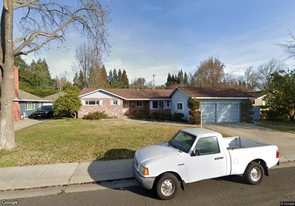
1529 Burnside Way Stockton, CA 95207
Parkwoods NeighborhoodEstimated Value: $434,000 - $549,000
3
Beds
2
Baths
1,664
Sq Ft
$301/Sq Ft
Est. Value
About This Home
This home is located at 1529 Burnside Way, Stockton, CA 95207 and is currently estimated at $501,173, approximately $301 per square foot. 1529 Burnside Way is a home located in San Joaquin County with nearby schools including Lincoln Elementary School, Sierra Middle School, and Lincoln High School.
Ownership History
Date
Name
Owned For
Owner Type
Purchase Details
Closed on
May 22, 2024
Sold by
Humphreys William Burgess and Humphreys Kelleen Ann
Bought by
William Burgess Humphreys And Kelleen Ann Hum and Humphreys
Current Estimated Value
Purchase Details
Closed on
Sep 3, 2004
Sold by
Halverson William J
Bought by
Humphreys William Burgess and Humphreys Kelleen Ann
Purchase Details
Closed on
Mar 12, 1996
Sold by
Halverson Nancy Anella
Bought by
Halverson William J and Halverson Nancy Anella
Create a Home Valuation Report for This Property
The Home Valuation Report is an in-depth analysis detailing your home's value as well as a comparison with similar homes in the area
Home Values in the Area
Average Home Value in this Area
Purchase History
| Date | Buyer | Sale Price | Title Company |
|---|---|---|---|
| William Burgess Humphreys And Kelleen Ann Hum | -- | None Listed On Document | |
| Humphreys William Burgess | $349,000 | Old Republic Title Co | |
| Halverson William J | -- | -- |
Source: Public Records
Tax History Compared to Growth
Tax History
| Year | Tax Paid | Tax Assessment Tax Assessment Total Assessment is a certain percentage of the fair market value that is determined by local assessors to be the total taxable value of land and additions on the property. | Land | Improvement |
|---|---|---|---|---|
| 2025 | $5,456 | $486,443 | $146,350 | $340,093 |
| 2024 | $5,451 | $476,906 | $143,481 | $333,425 |
| 2023 | $5,411 | $467,556 | $140,668 | $326,888 |
| 2022 | $5,268 | $458,389 | $137,910 | $320,479 |
| 2021 | $5,197 | $449,402 | $135,206 | $314,196 |
| 2020 | $4,701 | $401,000 | $90,000 | $311,000 |
| 2019 | $4,716 | $401,000 | $90,000 | $311,000 |
| 2018 | $4,200 | $355,000 | $107,000 | $248,000 |
| 2017 | $4,192 | $355,000 | $107,000 | $248,000 |
| 2016 | $3,896 | $326,000 | $98,000 | $228,000 |
| 2015 | $3,454 | $286,000 | $86,000 | $200,000 |
| 2014 | $2,685 | $218,000 | $65,000 | $153,000 |
Source: Public Records
Map
Nearby Homes
- 1607 Stanton Way
- 1152 Stanton Way
- 7516 Brentwood Dr
- 1906 Meadow Ave
- 1720 Mcclellan Way
- 1214 Mcclellan Way
- 2025 W Lincoln Rd
- 1005 W Benjamin Holt Dr
- 2140 Pennington Ct
- 7307 Woodside Dr
- 1703 Polk Way
- 2039 W Benjamin Holt Dr
- 8011 N Pershing Ave
- 1132 Douglas Rd
- 7512 Heather Dr
- 1489 W Swain Rd
- 7709 Heather Dr
- 1633 Porter Way
- 1629 Porter Way
- 7622 Oakcreek Dr
- 1547 Burnside Way
- 1519 Burnside Way Unit 23
- 1528 W Lincoln Rd
- 7011 Leesburg Place
- 1563 Burnside Way
- 1548 W Lincoln Rd
- 1532 Burnside Way
- 1542 Burnside Way
- 1522 Burnside Way
- 1510 W Lincoln Rd Unit 23
- 1552 Burnside Way
- 6981 Leesburg Place
- 1562 Burnside Way
- 1605 Burnside Way
- 1564 W Lincoln Rd
- 1533 Greeley Way
- 1543 Greeley Way
- 1523 Greeley Way
- 1553 Greeley Way
- 7014 Leesburg Place Unit 23