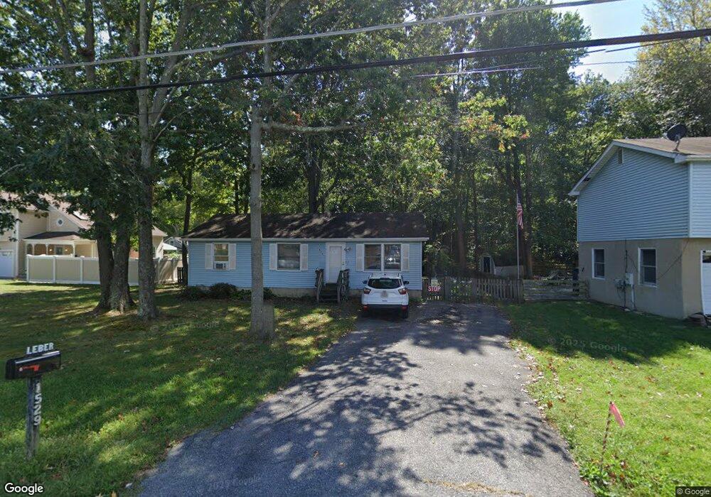
1529 Cedarhurst Rd Shady Side, MD 20764
Estimated Value: $318,000 - $332,000
--
Bed
1
Bath
960
Sq Ft
$338/Sq Ft
Est. Value
About This Home
This home is located at 1529 Cedarhurst Rd, Shady Side, MD 20764 and is currently estimated at $324,697, approximately $338 per square foot. 1529 Cedarhurst Rd is a home located in Anne Arundel County with nearby schools including Shady Side Elementary School, Southern Middle School, and Southern High School.
Ownership History
Date
Name
Owned For
Owner Type
Purchase Details
Closed on
Aug 10, 2004
Sold by
Bedard Donald A
Bought by
Leber John L and Leber Marie L
Current Estimated Value
Purchase Details
Closed on
Aug 19, 1992
Sold by
Hardesty Alex A
Bought by
Bedard Donald A
Home Financials for this Owner
Home Financials are based on the most recent Mortgage that was taken out on this home.
Original Mortgage
$103,150
Interest Rate
7.96%
Purchase Details
Closed on
Nov 20, 1987
Sold by
Kidwell Wayne A
Bought by
Hardesty Alex A
Home Financials for this Owner
Home Financials are based on the most recent Mortgage that was taken out on this home.
Original Mortgage
$79,900
Interest Rate
10.6%
Create a Home Valuation Report for This Property
The Home Valuation Report is an in-depth analysis detailing your home's value as well as a comparison with similar homes in the area
Home Values in the Area
Average Home Value in this Area
Purchase History
| Date | Buyer | Sale Price | Title Company |
|---|---|---|---|
| Leber John L | $206,000 | -- | |
| Bedard Donald A | $101,900 | -- | |
| Hardesty Alex A | $78,300 | -- |
Source: Public Records
Mortgage History
| Date | Status | Borrower | Loan Amount |
|---|---|---|---|
| Previous Owner | Bedard Donald A | $103,150 | |
| Previous Owner | Hardesty Alex A | $79,900 |
Source: Public Records
Tax History Compared to Growth
Tax History
| Year | Tax Paid | Tax Assessment Tax Assessment Total Assessment is a certain percentage of the fair market value that is determined by local assessors to be the total taxable value of land and additions on the property. | Land | Improvement |
|---|---|---|---|---|
| 2025 | $2,880 | $258,900 | -- | -- |
| 2024 | $2,880 | $246,500 | $0 | $0 |
| 2023 | $2,774 | $234,100 | $138,900 | $95,200 |
| 2022 | $2,619 | $230,900 | $0 | $0 |
| 2021 | $5,162 | $227,700 | $0 | $0 |
| 2020 | $2,501 | $224,500 | $138,900 | $85,600 |
| 2019 | $2,502 | $215,567 | $0 | $0 |
| 2018 | $2,095 | $206,633 | $0 | $0 |
| 2017 | $2,563 | $197,700 | $0 | $0 |
| 2016 | -- | $191,433 | $0 | $0 |
| 2015 | -- | $185,167 | $0 | $0 |
| 2014 | -- | $178,900 | $0 | $0 |
Source: Public Records
Map
Nearby Homes
- 1208 Oak Ave
- 1213 Oak Ave
- 1220 Grove Ave
- 1461 Cedarhurst Rd
- 0 Haile Pkwy Unit MDAA2127474
- 1445 & 1447 Haile Pkwy
- 1436 Haile Pkwy
- 1512 Lincoln Rd
- 1428 Haile Pkwy
- 1408 & 1410 Haile Pkwy
- 0 Shady Side Rd Unit MDAA2113156
- 0 Shady Side Rd Unit MDAA2113166
- 5211 Al Jones Dr
- 4950 W End Ave
- 5235 Al Jones Dr
- 6070 Shady Side Rd
- 5250 Al Jones Dr
- 6118 Shady Side Rd
- 6152 Shady Side Rd
- 4949 Idlewilde Rd
- 1533 Cedarhurst Rd
- 1527 Cedarhurst Rd
- 1535 Cedarhurst Rd
- 1530 Cedarhurst Rd
- 1161 Maple Ave
- 5212 Spring Ave
- 1173 Bayview Ave
- 1173 Bay View Ave
- 5214 Spring Ave
- 5222 Spring Ave
- 1171 Oak Ave
- 1175 Oak Ave
- 1169 Oak Ave
- 1172 Bayview Ave
- 1177 Bayview Ave
- 1179 Oak Ave
- 1167 Oak Ave
- 5207 Lake Ave
- 1165 Oak Ave
- 1158 Cedar Ave