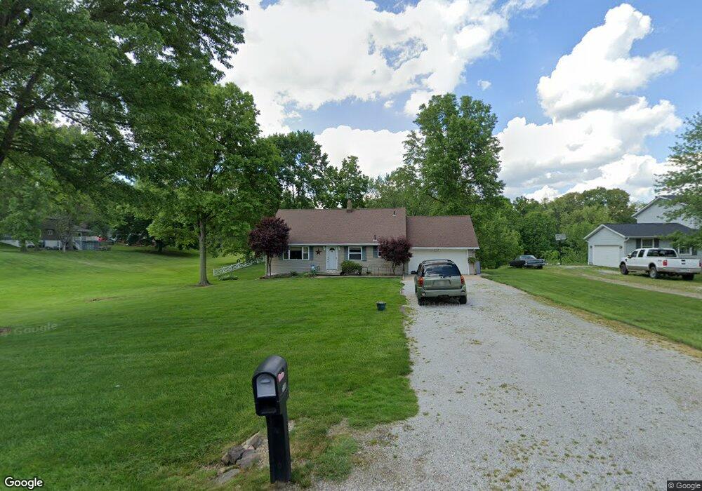
153 Lester Rd New Franklin, OH 44319
Estimated Value: $211,000 - $294,000
5
Beds
2
Baths
1,120
Sq Ft
$226/Sq Ft
Est. Value
About This Home
This home is located at 153 Lester Rd, New Franklin, OH 44319 and is currently estimated at $253,486, approximately $226 per square foot. 153 Lester Rd is a home located in Summit County.
Ownership History
Date
Name
Owned For
Owner Type
Purchase Details
Closed on
Mar 27, 2001
Sold by
Syx Doris E
Bought by
Syx Timothy Wayne and Syx Darlene Lynn
Current Estimated Value
Create a Home Valuation Report for This Property
The Home Valuation Report is an in-depth analysis detailing your home's value as well as a comparison with similar homes in the area
Home Values in the Area
Average Home Value in this Area
Purchase History
| Date | Buyer | Sale Price | Title Company |
|---|---|---|---|
| Syx Timothy Wayne | -- | -- |
Source: Public Records
Tax History Compared to Growth
Tax History
| Year | Tax Paid | Tax Assessment Tax Assessment Total Assessment is a certain percentage of the fair market value that is determined by local assessors to be the total taxable value of land and additions on the property. | Land | Improvement |
|---|---|---|---|---|
| 2025 | $3,480 | $69,559 | $20,909 | $48,650 |
| 2024 | $3,480 | $69,559 | $20,909 | $48,650 |
| 2023 | $3,480 | $69,559 | $20,909 | $48,650 |
| 2022 | $3,168 | $49,333 | $14,830 | $34,503 |
| 2021 | $3,179 | $49,333 | $14,830 | $34,503 |
| 2020 | $3,124 | $49,330 | $14,830 | $34,500 |
| 2019 | $3,209 | $45,410 | $12,050 | $33,360 |
| 2018 | $2,769 | $45,410 | $12,050 | $33,360 |
| 2017 | $2,693 | $45,410 | $12,050 | $33,360 |
| 2016 | $2,661 | $39,990 | $12,050 | $27,940 |
| 2015 | $2,693 | $39,990 | $12,050 | $27,940 |
| 2014 | $2,672 | $39,990 | $12,050 | $27,940 |
| 2013 | $2,670 | $40,200 | $12,050 | $28,150 |
Source: Public Records
Map
Nearby Homes
- 451 Yager Rd
- 6407 Southview Dr
- 5776 Harter Home Dr
- 427 Center Rd
- 899 Loway Dr
- 715 Highland Park Dr
- 0 W Comet Rd Unit 5079117
- 781 Leeman Dr
- 6090 Manchester Rd Unit 6096
- 7060 Manchester Rd
- S/L 14,15 Shakes Hotel Dr
- 1062 Stump Rd
- 4831 Christman Rd
- 4 Shrakes Hotel Dr
- 6 Shrakes Hotel Dr
- 7 Shrakes Hotel Dr
- 5 Shrakes Hotel Dr
- 4881 S Main St
- 3 Shrakes Hotel Dr
- 860 Killinger Rd