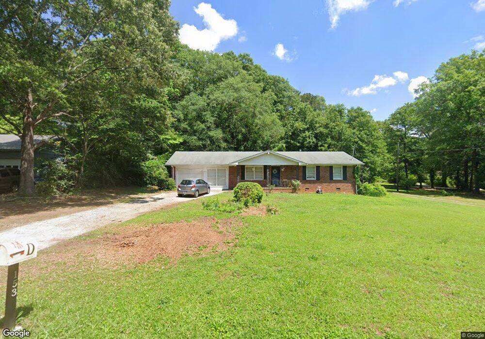
153 McCaskill Dr Jackson, GA 30233
Estimated Value: $222,994 - $273,000
3
Beds
2
Baths
1,696
Sq Ft
$146/Sq Ft
Est. Value
About This Home
This home is located at 153 McCaskill Dr, Jackson, GA 30233 and is currently estimated at $247,499, approximately $145 per square foot. 153 McCaskill Dr is a home located in Butts County with nearby schools including Jackson High School.
Ownership History
Date
Name
Owned For
Owner Type
Purchase Details
Closed on
Jun 4, 2020
Sold by
Executor Thurston Anthony Scott
Bought by
Bryans Emily
Current Estimated Value
Home Financials for this Owner
Home Financials are based on the most recent Mortgage that was taken out on this home.
Original Mortgage
$129,600
Outstanding Balance
$114,116
Interest Rate
3.2%
Mortgage Type
New Conventional
Estimated Equity
$133,383
Purchase Details
Closed on
Nov 25, 2014
Sold by
Parris John Michael
Bought by
Thurston Sandra B
Home Financials for this Owner
Home Financials are based on the most recent Mortgage that was taken out on this home.
Original Mortgage
$90,333
Interest Rate
3.62%
Mortgage Type
FHA
Create a Home Valuation Report for This Property
The Home Valuation Report is an in-depth analysis detailing your home's value as well as a comparison with similar homes in the area
Home Values in the Area
Average Home Value in this Area
Purchase History
| Date | Buyer | Sale Price | Title Company |
|---|---|---|---|
| Bryans Emily | $144,000 | -- | |
| Thurston Sandra B | $92,000 | -- |
Source: Public Records
Mortgage History
| Date | Status | Borrower | Loan Amount |
|---|---|---|---|
| Open | Bryans Emily | $129,600 | |
| Previous Owner | Thurston Sandra B | $90,333 |
Source: Public Records
Tax History
| Year | Tax Paid | Tax Assessment Tax Assessment Total Assessment is a certain percentage of the fair market value that is determined by local assessors to be the total taxable value of land and additions on the property. | Land | Improvement |
|---|---|---|---|---|
| 2025 | $2,165 | $94,340 | $7,600 | $86,740 |
| 2024 | $2,165 | $94,340 | $7,600 | $86,740 |
| 2023 | $2,277 | $92,772 | $7,600 | $85,172 |
| 2022 | $2,889 | $106,457 | $7,600 | $98,857 |
| 2021 | $1,673 | $57,600 | $6,814 | $50,786 |
| 2020 | $1,939 | $64,254 | $7,600 | $56,654 |
| 2019 | $1,351 | $56,334 | $7,600 | $48,734 |
| 2018 | $1,144 | $47,814 | $7,600 | $40,214 |
| 2017 | $840 | $37,424 | $7,600 | $29,824 |
| 2016 | $863 | $37,424 | $7,600 | $29,824 |
| 2015 | $836 | $37,424 | $7,600 | $29,824 |
| 2014 | $1,184 | $35,462 | $7,600 | $27,862 |
Source: Public Records
Map
Nearby Homes
- 908 Nelson St
- 1375 Highway 42 S
- 544 Franklin St
- 347 Ww Carr Ave
- 321 Kirts Ridge
- 14 Weaver St
- 124 Harper St
- 330 James Moore Cir
- 193 Brownlee Rd
- 1262 E Highway 16
- 415 White Pine Dr
- 376 Covington St
- 0 Highway 36 E Unit 25704971
- 0 E Highway 36 Unit 10693968
- 0 E Highway 36 Unit 10652570
- 0 E Hwy 36 Unit 10611807
- 480 Hickory Ridge Rd
- 514 Covington St
- 286 White Elm Ln Unit LOT 184
- 317 W College St
- 133 McCaskill Dr
- 960 Nelson St
- 930 Nelson St
- 974 Nelson St
- 202 McCaskill Dr
- 1020 Nelson St
- 160 Correll Dr
- 265 McCaskill Dr
- 250 McCaskill Dr
- 943 Nelson St
- 1064 Nelson St
- 985 Nelson St
- 1019 Nelson St
- 876 Nelson St
- 861 Freeman St
- 947 Freeman St
- 919 Nelson St
- 1037 Nelson St
- 299 McCaskill Dr
- 889 Freeman St
Your Personal Tour Guide
Ask me questions while you tour the home.