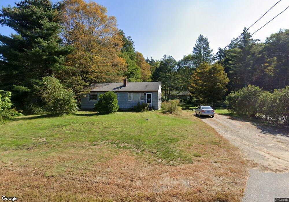
153 Monson Rd Stafford Springs, CT 06076
Stafford NeighborhoodEstimated Value: $261,000 - $307,000
3
Beds
1
Bath
960
Sq Ft
$291/Sq Ft
Est. Value
About This Home
This home is located at 153 Monson Rd, Stafford Springs, CT 06076 and is currently estimated at $279,128, approximately $290 per square foot. 153 Monson Rd is a home located in Tolland County with nearby schools including Stafford Elementary School, Stafford Middle School, and Stafford High School.
Ownership History
Date
Name
Owned For
Owner Type
Purchase Details
Closed on
Oct 18, 2004
Sold by
Armelin Paul
Bought by
Cunningham Neal and Cunningham Deirdre
Current Estimated Value
Home Financials for this Owner
Home Financials are based on the most recent Mortgage that was taken out on this home.
Original Mortgage
$166,100
Outstanding Balance
$82,426
Interest Rate
5.8%
Estimated Equity
$196,702
Purchase Details
Closed on
Feb 28, 2000
Sold by
Foster Lance and Foster Dana
Bought by
Armelin Paul
Home Financials for this Owner
Home Financials are based on the most recent Mortgage that was taken out on this home.
Original Mortgage
$109,800
Interest Rate
8.15%
Create a Home Valuation Report for This Property
The Home Valuation Report is an in-depth analysis detailing your home's value as well as a comparison with similar homes in the area
Home Values in the Area
Average Home Value in this Area
Purchase History
| Date | Buyer | Sale Price | Title Company |
|---|---|---|---|
| Cunningham Neal | $167,500 | -- | |
| Armelin Paul | $109,900 | -- |
Source: Public Records
Mortgage History
| Date | Status | Borrower | Loan Amount |
|---|---|---|---|
| Open | Armelin Paul | $166,100 | |
| Previous Owner | Armelin Paul | $109,800 | |
| Previous Owner | Armelin Paul | $108,000 |
Source: Public Records
Tax History Compared to Growth
Tax History
| Year | Tax Paid | Tax Assessment Tax Assessment Total Assessment is a certain percentage of the fair market value that is determined by local assessors to be the total taxable value of land and additions on the property. | Land | Improvement |
|---|---|---|---|---|
| 2025 | $5,678 | $101,010 | $27,930 | $73,080 |
| 2024 | $3,898 | $101,010 | $27,930 | $73,080 |
| 2023 | $3,713 | $101,010 | $27,930 | $73,080 |
| 2022 | $3,614 | $101,010 | $27,930 | $73,080 |
| 2021 | $3,528 | $101,010 | $27,930 | $73,080 |
| 2020 | $3,391 | $97,090 | $31,080 | $66,010 |
| 2019 | $3,457 | $98,980 | $31,080 | $67,900 |
| 2018 | $3,391 | $98,980 | $31,080 | $67,900 |
| 2017 | $3,358 | $98,980 | $31,080 | $67,900 |
| 2016 | $3,317 | $98,980 | $31,080 | $67,900 |
| 2015 | $3,445 | $103,250 | $31,080 | $72,170 |
| 2014 | $3,410 | $103,250 | $31,080 | $72,170 |
Source: Public Records
Map
Nearby Homes
- 10 Laurel Ln
- 15 Deepwood Dr
- 81 Monson Rd
- 2 Pinewood Ln
- 12 Hillcrest Dr
- 4 Pinewood Ln
- 8 Gale Rd
- 97 Orcuttville Rd
- 200 Orcuttville Rd
- 14 Valley View Dr
- 105 Leonard Rd
- 4 Leonard Rd
- 19 Potter Rd
- 192 Leonard Rd
- 0 Stony Ln
- 201 Diamond Ledge Rd
- 0 Rockledge Rd Unit 24131563
- 336 East St
- 115 W Stafford Rd
- 80 W Stafford Rd
- 155 Monson Rd
- 155 Monson Rd Unit C
- 155 Monson Rd Unit B
- 150 Monson Rd
- 151 Monson Rd
- 161 Monson Rd
- 6 Avery Dr
- 2 Avery Dr
- 10 Avery Dr
- 12 Avery Dr
- 160 Monson Rd
- 162 Monson Rd
- 124 Sunset Ridge Rd Unit B
- 124 Sunset Ridge Rd
- 124 Sunset Ridge Rd Unit A
- 116 Sunset Ridge Rd
- 0 Diamond Ledge Rd
- 143 Monson Rd
- 166 Monson Rd
- 165 Monson Rd