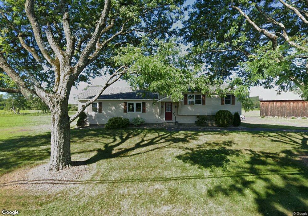
153 N Hatfield Rd North Hatfield, MA 01066
Estimated Value: $490,768 - $521,000
16
Beds
2
Baths
1,702
Sq Ft
$297/Sq Ft
Est. Value
About This Home
This home is located at 153 N Hatfield Rd, North Hatfield, MA 01066 and is currently estimated at $505,884, approximately $297 per square foot. 153 N Hatfield Rd is a home with nearby schools including Hatfield Elementary School and Smith Academy.
Ownership History
Date
Name
Owned For
Owner Type
Purchase Details
Closed on
Nov 27, 2024
Sold by
Thayer Richard F and Thayer James W
Bought by
Thayer Realty Llc
Current Estimated Value
Purchase Details
Closed on
Nov 17, 2024
Sold by
Inter Vivos T and Thayer
Bought by
Thayer Richard F and Thayer James W
Purchase Details
Closed on
Nov 20, 2023
Sold by
Thayer Realty Llc
Bought by
Inter Vivos T and Thayer
Purchase Details
Closed on
Jan 12, 2018
Sold by
Walaszek Roger A and Thayer Walter R
Bought by
Thayer Realty Llc
Create a Home Valuation Report for This Property
The Home Valuation Report is an in-depth analysis detailing your home's value as well as a comparison with similar homes in the area
Home Values in the Area
Average Home Value in this Area
Purchase History
| Date | Buyer | Sale Price | Title Company |
|---|---|---|---|
| Thayer Realty Llc | -- | None Available | |
| Thayer Realty Llc | -- | None Available | |
| Thayer Richard F | $312,851 | None Available | |
| Inter Vivos T | -- | None Available | |
| Inter Vivos T | -- | None Available | |
| Thayer Realty Llc | $275,000 | -- | |
| Thayer Realty Llc | $275,000 | -- |
Source: Public Records
Tax History
| Year | Tax Paid | Tax Assessment Tax Assessment Total Assessment is a certain percentage of the fair market value that is determined by local assessors to be the total taxable value of land and additions on the property. | Land | Improvement |
|---|---|---|---|---|
| 2025 | $5,748 | $415,300 | $152,300 | $263,000 |
| 2024 | $5,313 | $347,000 | $132,700 | $214,300 |
| 2023 | $4,400 | $326,400 | $126,200 | $200,200 |
| 2022 | $4,134 | $302,400 | $119,700 | $182,700 |
| 2021 | $4,136 | $291,500 | $108,800 | $182,700 |
| 2020 | $3,944 | $291,500 | $108,800 | $182,700 |
| 2019 | $3,846 | $276,900 | $106,600 | $170,300 |
| 2018 | $3,664 | $269,800 | $106,600 | $163,200 |
| 2017 | $3,551 | $268,600 | $106,600 | $162,000 |
| 2016 | $3,540 | $268,600 | $106,600 | $162,000 |
| 2015 | $3,440 | $261,200 | $95,700 | $165,500 |
| 2014 | $3,325 | $262,400 | $95,700 | $166,700 |
Source: Public Records
Map
Nearby Homes
- 151 Pantry Rd
- 59 N Hatfield Rd
- 0 Straits Rd
- 149 Prospect St
- 71 Chestnut St
- 58 Main St Unit 4
- 58 Main St Unit 3
- 18 Elm St
- 0 North St Unit 73407299
- 8 Aloha Dr
- 3 Frost Ln
- 43 Laurel Park Unit 43
- 6 Shattuck Rd
- 14 Hawley Rd
- 32 Stonewall Dr
- Lot 3 Roosevelt St
- 15 S Plain Rd
- 27 River Dr
- 11 West St
- 121 Rocky Hill Rd
- 157 N Hatfield Rd
- 156 N Hatfield Rd
- 161 N Hatfield Rd
- 161 N Hatfield Rd
- 165 N Hatfield Rd
- 160 N Hatfield Rd
- 104 Mountain Rd
- 108 Mountain Rd
- 165 N Hatfield Rd
- 164 N Hatfield Rd
- 169 N Hatfield Rd
- 166 N Hatfield Rd
- 166 N Hatfield Rd
- 280 West St
- 172 N Hatfield Rd
- 123 N Hatfield Rd
- 123 N Hatfield Rd
- 273 West St
- 158 N Hatfield Rd
- 178 N Hatfield Rd
Your Personal Tour Guide
Ask me questions while you tour the home.