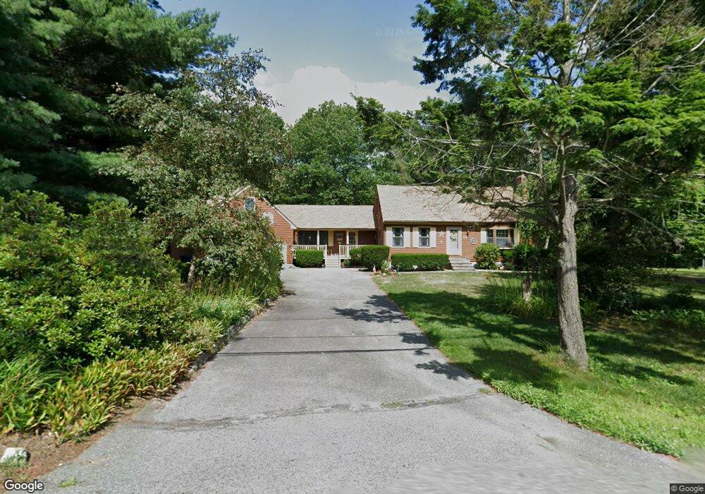
153 Parker Rd Dracut, MA 01826
Estimated Value: $559,000 - $730,000
2
Beds
2
Baths
1,796
Sq Ft
$369/Sq Ft
Est. Value
About This Home
This home is located at 153 Parker Rd, Dracut, MA 01826 and is currently estimated at $662,283, approximately $368 per square foot. 153 Parker Rd is a home located in Middlesex County with nearby schools including Joseph A. Campbell Elementary School, Richardson Middle School, and Dracut Senior High School.
Ownership History
Date
Name
Owned For
Owner Type
Purchase Details
Closed on
Jul 18, 2023
Sold by
Grailich Edward and Grailich Patricia A
Bought by
Grailich Ft and Grailich
Current Estimated Value
Purchase Details
Closed on
Jul 14, 1978
Bought by
Grailich Edward and Grailich Patricia
Create a Home Valuation Report for This Property
The Home Valuation Report is an in-depth analysis detailing your home's value as well as a comparison with similar homes in the area
Home Values in the Area
Average Home Value in this Area
Purchase History
| Date | Buyer | Sale Price | Title Company |
|---|---|---|---|
| Grailich Ft | -- | None Available | |
| Grailich Edward | -- | -- |
Source: Public Records
Mortgage History
| Date | Status | Borrower | Loan Amount |
|---|---|---|---|
| Previous Owner | Grailich Edward | $45,000 |
Source: Public Records
Tax History
| Year | Tax Paid | Tax Assessment Tax Assessment Total Assessment is a certain percentage of the fair market value that is determined by local assessors to be the total taxable value of land and additions on the property. | Land | Improvement |
|---|---|---|---|---|
| 2025 | $6,159 | $608,600 | $228,800 | $379,800 |
| 2024 | $5,919 | $566,400 | $218,000 | $348,400 |
| 2023 | $5,705 | $492,700 | $189,600 | $303,100 |
| 2022 | $5,641 | $459,000 | $172,400 | $286,600 |
| 2021 | $8,040 | $420,100 | $156,600 | $263,500 |
| 2020 | $5,281 | $395,600 | $151,900 | $243,700 |
| 2019 | $5,339 | $388,300 | $144,600 | $243,700 |
| 2018 | $4,837 | $342,100 | $144,600 | $197,500 |
| 2017 | $4,641 | $342,100 | $144,600 | $197,500 |
| 2016 | $4,577 | $308,400 | $139,000 | $169,400 |
| 2015 | $4,470 | $299,400 | $139,000 | $160,400 |
| 2014 | $4,234 | $292,200 | $139,000 | $153,200 |
Source: Public Records
Map
Nearby Homes
- 84 Tellier Way
- 31 Varnum Ave
- 821 Merrimack Ave
- 20 Mount Pleasant St
- 12 Hayfield Rd
- 277 Loon Hill Rd
- 785 Broadway Rd
- 2 Francis Dr Unit 213
- 4 Francis Dr Unit 312
- 4 Francis Dr Unit 207
- 2 Francis Dr Unit 301
- 46 Hopkins Cir
- 11 Joseph Ave
- 29 Stoneybrook Cir
- 194 River Rd
- 322 River Rd
- 89 Newbury St
- 10 Lanseigne St
- 206 Burnham Rd
- 315 Broadway Rd Unit 1
- 163 Parker Rd
- 98 Parker Rd
- 143 Parker Rd
- 102 Parker Rd
- 94 Parker Rd
- 134 Cartpath Rd
- 86(Lot 9) Cart Path Rd
- 5 (Lot 24) Cart Path Rd
- 128 Cart Path Rd
- 3 Farm Gate Rd
- 141 Cartpath Rd
- 205 Parker Rd
- 135 Cartpath Rd
- 5 Farm Gate Rd
- 5 Farm Gate Rd Unit lot 11
- 7 Farm Gate Rd
- 110 Parker Rd
- 154 Parker Rd
- 9 Farm Gate Rd Unit lot 9
- 123 Parker Rd
Your Personal Tour Guide
Ask me questions while you tour the home.