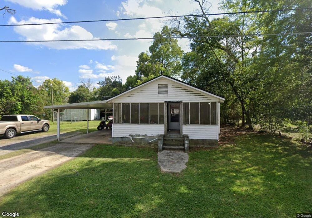
153 Powell St SE Pelham, GA 31779
Estimated Value: $69,480 - $130,000
--
Bed
1
Bath
1,456
Sq Ft
$72/Sq Ft
Est. Value
About This Home
This home is located at 153 Powell St SE, Pelham, GA 31779 and is currently estimated at $104,620, approximately $71 per square foot. 153 Powell St SE is a home located in Mitchell County with nearby schools including Pelham Elementary School, Pelham City Middle School, and Pelham High School.
Ownership History
Date
Name
Owned For
Owner Type
Purchase Details
Closed on
Jun 12, 2014
Sold by
Roberts Diana Brett
Bought by
Roberts Diana Brett and Roberts Darin D
Current Estimated Value
Home Financials for this Owner
Home Financials are based on the most recent Mortgage that was taken out on this home.
Original Mortgage
$20,000
Outstanding Balance
$6,242
Interest Rate
4.23%
Mortgage Type
New Conventional
Estimated Equity
$98,378
Create a Home Valuation Report for This Property
The Home Valuation Report is an in-depth analysis detailing your home's value as well as a comparison with similar homes in the area
Home Values in the Area
Average Home Value in this Area
Purchase History
| Date | Buyer | Sale Price | Title Company |
|---|---|---|---|
| Roberts Diana Brett | -- | -- |
Source: Public Records
Mortgage History
| Date | Status | Borrower | Loan Amount |
|---|---|---|---|
| Open | Roberts Diana Brett | $20,000 |
Source: Public Records
Tax History Compared to Growth
Tax History
| Year | Tax Paid | Tax Assessment Tax Assessment Total Assessment is a certain percentage of the fair market value that is determined by local assessors to be the total taxable value of land and additions on the property. | Land | Improvement |
|---|---|---|---|---|
| 2024 | $931 | $22,560 | $1,400 | $21,160 |
| 2023 | $983 | $22,560 | $1,400 | $21,160 |
| 2022 | $775 | $17,480 | $1,400 | $16,080 |
| 2021 | $665 | $15,840 | $1,400 | $14,440 |
| 2020 | $637 | $15,840 | $1,400 | $14,440 |
| 2019 | $652 | $15,840 | $1,400 | $14,440 |
| 2018 | $716 | $15,840 | $1,400 | $14,440 |
| 2017 | $251 | $14,770 | $1,400 | $13,370 |
| 2016 | $261 | $14,770 | $1,400 | $13,370 |
| 2015 | $261 | $14,770 | $1,400 | $13,370 |
| 2014 | $261 | $14,770 | $1,400 | $13,370 |
| 2013 | $261 | $14,770 | $1,400 | $13,370 |
Source: Public Records
Map
Nearby Homes
- 3** Youngs Mill Rd
- 135 Baggs Ave SE
- 183 Baggs Ave SE
- 375 Baggs Ave SE
- 199 Carroll St NE
- 209 McDonald St SW
- 389 Stewart St SW
- 443 Stewart St SW
- 277 Saunders St SW
- 410 Hollis St SW
- 212 Hand Ave W
- 425 Hollis St SW
- 438 Dogwood Dr NE
- 323 Curry St NE
- 335 Curry St NE
- 210 Castleberry St NW
- 354 Bennett St NW
- 482 Curry St NE
- 547 Cotton Rd NE
- 233 Cannon St NW
- 154 Proctor St SE
- 148 Proctor St SE
- 166 Powell St SE
- 145 Powell St SE
- 272 Powell St SE
- 140 Proctor St SE
- 170 Proctor St SE
- 140 Powell St SE
- 125 Powell St SE
- 143 Proctor St SE
- 124 Proctor St SE
- 137 Proctor St SE
- 126 Powell St SE
- 437 Rawls St SE
- 118 Powell St SE
- 414 W Railroad St S
- 376 W Railroad St S
- 390 W Railroad St S
- 402 W Railroad St S
- 419 W Railroad St S