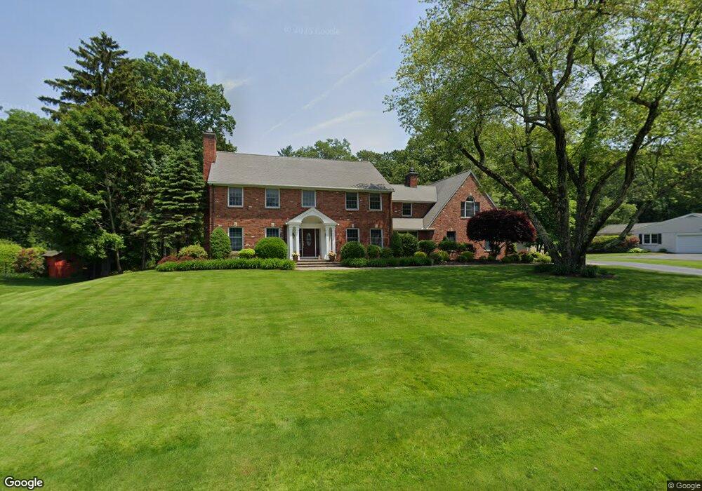
153 Prynnwood Rd Longmeadow, MA 01106
Estimated Value: $984,000 - $1,311,000
5
Beds
6
Baths
4,617
Sq Ft
$250/Sq Ft
Est. Value
About This Home
This home is located at 153 Prynnwood Rd, Longmeadow, MA 01106 and is currently estimated at $1,152,667, approximately $249 per square foot. 153 Prynnwood Rd is a home located in Hampden County with nearby schools including Wolf Swamp Road School, Glenbrook Middle School, and Longmeadow High School.
Ownership History
Date
Name
Owned For
Owner Type
Purchase Details
Closed on
Mar 14, 2025
Sold by
Peck David I and Peck Susan D
Bought by
Peck 2025 T and Peck P
Current Estimated Value
Purchase Details
Closed on
Apr 27, 1990
Sold by
Cooney Peter R
Bought by
Peckovsky David I
Purchase Details
Closed on
Aug 31, 1988
Sold by
Conway Thomas J
Bought by
Cooney Peter R
Create a Home Valuation Report for This Property
The Home Valuation Report is an in-depth analysis detailing your home's value as well as a comparison with similar homes in the area
Home Values in the Area
Average Home Value in this Area
Purchase History
| Date | Buyer | Sale Price | Title Company |
|---|---|---|---|
| Peck 2025 T | -- | None Available | |
| Peck 2025 T | -- | None Available | |
| Peckovsky David I | $500,000 | -- | |
| Peckovsky David I | $500,000 | -- | |
| Cooney Peter R | $530,000 | -- |
Source: Public Records
Mortgage History
| Date | Status | Borrower | Loan Amount |
|---|---|---|---|
| Previous Owner | Cooney Peter R | $385,000 |
Source: Public Records
Tax History Compared to Growth
Tax History
| Year | Tax Paid | Tax Assessment Tax Assessment Total Assessment is a certain percentage of the fair market value that is determined by local assessors to be the total taxable value of land and additions on the property. | Land | Improvement |
|---|---|---|---|---|
| 2025 | $24,501 | $1,160,100 | $237,200 | $922,900 |
| 2024 | $23,991 | $1,160,100 | $237,200 | $922,900 |
| 2023 | $23,195 | $1,012,000 | $186,800 | $825,200 |
| 2022 | $23,507 | $954,000 | $194,900 | $759,100 |
| 2021 | $22,882 | $924,900 | $193,700 | $731,200 |
| 2020 | $22,431 | $926,500 | $209,300 | $717,200 |
| 2019 | $21,146 | $877,800 | $209,300 | $668,500 |
| 2018 | $21,563 | $885,900 | $227,600 | $658,300 |
| 2017 | $20,890 | $885,900 | $227,600 | $658,300 |
| 2016 | $20,245 | $832,100 | $212,900 | $619,200 |
| 2015 | $19,605 | $830,000 | $210,800 | $619,200 |
Source: Public Records
Map
Nearby Homes
- 165 Prynnwood Rd
- 131 Prynnwood Rd
- 181 Prynnwood Rd
- 119 Prynnwood Rd
- 132 Prynnwood Rd
- 148 Knollwood Dr
- 17 Prynne Ridge Rd
- 134 Knollwood Dr
- 114 Prynnwood Rd
- 195 Prynnwood Rd
- 103 Prynnwood Rd
- 24 Prynne Ridge Rd
- 178 Knollwood Dr
- 122 Knollwood Dr
- 196 Prynnwood Rd
- 190 Knollwood Dr
- 45 Prynne Ridge Rd
- 133 Knollwood Dr
- 96 Prynnwood Rd
- 209 Prynnwood Rd