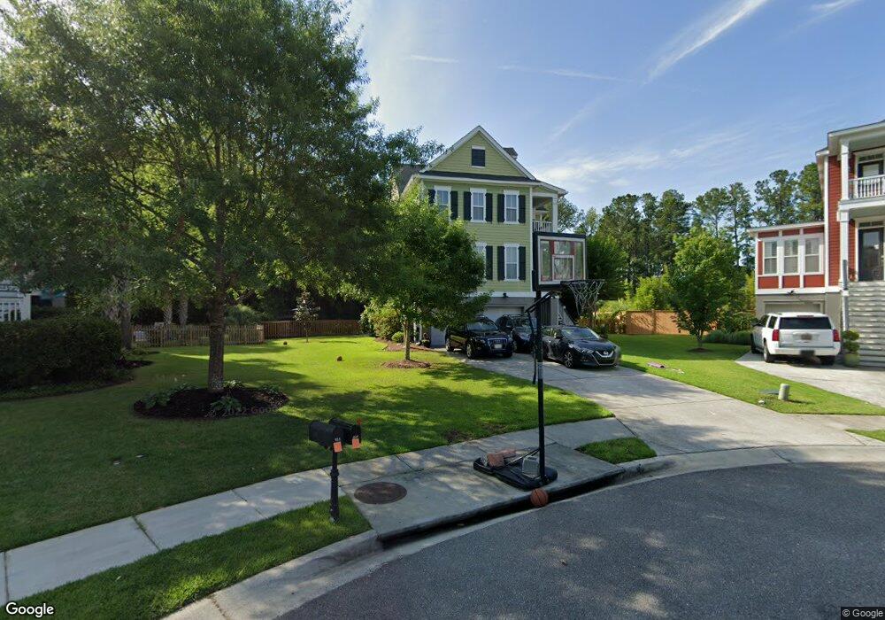
153 Sandshell Dr Charleston, SC 29492
Wando NeighborhoodEstimated Value: $845,263 - $1,215,000
Studio
--
Bath
2,608
Sq Ft
$371/Sq Ft
Est. Value
About This Home
This home is located at 153 Sandshell Dr, Charleston, SC 29492 and is currently estimated at $967,066, approximately $370 per square foot. 153 Sandshell Dr is a home located in Berkeley County with nearby schools including Daniel Island School and Bishop England High School.
Ownership History
Date
Name
Owned For
Owner Type
Purchase Details
Closed on
Jun 22, 2016
Sold by
Sniderman Lydia C and Sniderman Peter A
Bought by
Brown William David and Brown Ashley Blair
Current Estimated Value
Home Financials for this Owner
Home Financials are based on the most recent Mortgage that was taken out on this home.
Original Mortgage
$350,000
Outstanding Balance
$278,561
Interest Rate
3.57%
Mortgage Type
New Conventional
Estimated Equity
$688,505
Purchase Details
Closed on
Apr 27, 2007
Sold by
Centex Homes
Bought by
Sniderman Lydia C and Sniderman Peter A
Home Financials for this Owner
Home Financials are based on the most recent Mortgage that was taken out on this home.
Original Mortgage
$394,500
Interest Rate
6.12%
Mortgage Type
Unknown
Create a Home Valuation Report for This Property
The Home Valuation Report is an in-depth analysis detailing your home's value as well as a comparison with similar homes in the area
Home Values in the Area
Average Home Value in this Area
Purchase History
| Date | Buyer | Sale Price | Title Company |
|---|---|---|---|
| Brown William David | $480,000 | None Available | |
| Sniderman Lydia C | $493,189 | None Available |
Source: Public Records
Mortgage History
| Date | Status | Borrower | Loan Amount |
|---|---|---|---|
| Open | Brown William David | $350,000 | |
| Previous Owner | Sniderman Lydia C | $394,500 |
Source: Public Records
Tax History
| Year | Tax Paid | Tax Assessment Tax Assessment Total Assessment is a certain percentage of the fair market value that is determined by local assessors to be the total taxable value of land and additions on the property. | Land | Improvement |
|---|---|---|---|---|
| 2025 | $2,408 | $588,915 | $125,268 | $463,647 |
| 2024 | $2,326 | $23,557 | $5,011 | $18,546 |
| 2023 | $2,326 | $23,557 | $5,011 | $18,546 |
| 2022 | $2,339 | $20,484 | $5,068 | $15,416 |
| 2021 | $2,404 | $20,490 | $5,068 | $15,416 |
| 2020 | $2,437 | $20,484 | $5,068 | $15,416 |
| 2019 | $2,419 | $20,484 | $5,068 | $15,416 |
| 2018 | $2,430 | $19,988 | $5,068 | $14,920 |
| 2017 | $8,460 | $19,988 | $5,068 | $14,920 |
| 2016 | $1,875 | $29,980 | $7,600 | $22,380 |
| 2015 | $1,715 | $15,650 | $3,800 | $11,850 |
| 2014 | $1,690 | $15,650 | $3,800 | $11,850 |
| 2013 | -- | $15,650 | $3,800 | $11,850 |
Source: Public Records
Map
Nearby Homes
- 122 Collins Hill Ln
- 118 Collins Hill Ln
- 331 Megans Bay Ln
- 1054 Saint Thomas Island Dr
- 214 Clouter Creek Dr
- 309 Megans Bay Ln
- 303 Megans Bay Ln
- 0 Saint Thomas Island Dr
- 0 Saint Thomas Island Dr Unit 2
- 0 Saint Thomas Island Dr Unit 1
- 0 Harvest Time Place
- 178 Beresford Creek St
- 0 Sportsman Island Dr Unit 25025614
- 861 Dunham St
- 113 Lucia St
- 542 Amalie Farms Dr
- 00 Clements Ferry Rd
- 102 Bellinger St
- 287 Beresford Creek St
- 926 Cochran St
- 155 Sandshell Dr
- 151 Sandshell Dr
- 157 Sandshell Dr
- 149 Sandshell Dr
- 147 Sandshell Dr
- 145 Sandshell Dr
- 104 Feldman Ct
- 154 Sandshell Dr
- 148 Sandshell Dr
- 143 Sandshell Dr
- 6 Feldman Ct
- 5 Feldman Ct
- 0 Feldman Ct Unit 2500771
- 2 Feldman Ct
- 0 Feldman Ct Unit 1003225
- 0 Feldman Ct Unit 1100550
- 0 Feldman Ct Unit 1305418
- 0 Feldman Ct Unit 1329088
- 0 Feldman Ct Unit 15003711
- 0 Feldman Ct Unit 15025742
Your Personal Tour Guide
Ask me questions while you tour the home.