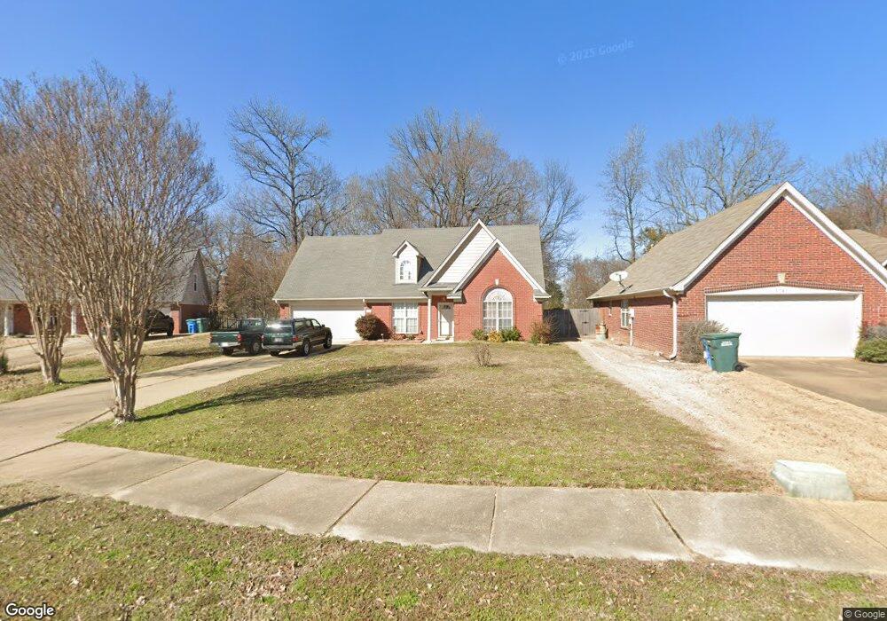
1530 Brentwood Trace Southaven, MS 38671
Estimated Value: $279,000 - $293,000
3
Beds
3
Baths
1,998
Sq Ft
$144/Sq Ft
Est. Value
About This Home
This home is located at 1530 Brentwood Trace, Southaven, MS 38671 and is currently estimated at $286,951, approximately $143 per square foot. 1530 Brentwood Trace is a home located in DeSoto County with nearby schools including Greenbrook Elementary School, Southaven Intermediate School, and Southaven Middle School.
Ownership History
Date
Name
Owned For
Owner Type
Purchase Details
Closed on
Oct 31, 2016
Sold by
Sykes Norma J
Bought by
Sykes Ronald E
Current Estimated Value
Purchase Details
Closed on
Jul 10, 2008
Sold by
Federal National Mortgage Association
Bought by
Sykes Norma J
Home Financials for this Owner
Home Financials are based on the most recent Mortgage that was taken out on this home.
Original Mortgage
$114,000
Interest Rate
6.31%
Mortgage Type
Purchase Money Mortgage
Create a Home Valuation Report for This Property
The Home Valuation Report is an in-depth analysis detailing your home's value as well as a comparison with similar homes in the area
Home Values in the Area
Average Home Value in this Area
Purchase History
| Date | Buyer | Sale Price | Title Company |
|---|---|---|---|
| Sykes Ronald E | -- | Attorney | |
| Sykes Norma J | -- | First American Title Ins Co |
Source: Public Records
Mortgage History
| Date | Status | Borrower | Loan Amount |
|---|---|---|---|
| Previous Owner | Sykes Norma J | $114,000 |
Source: Public Records
Tax History Compared to Growth
Tax History
| Year | Tax Paid | Tax Assessment Tax Assessment Total Assessment is a certain percentage of the fair market value that is determined by local assessors to be the total taxable value of land and additions on the property. | Land | Improvement |
|---|---|---|---|---|
| 2024 | $1,608 | $13,125 | $2,000 | $11,125 |
| 2023 | $1,608 | $13,125 | $0 | $0 |
| 2022 | $1,563 | $13,093 | $2,000 | $11,093 |
| 2021 | $1,563 | $13,093 | $2,000 | $11,093 |
| 2020 | $1,432 | $12,167 | $2,000 | $10,167 |
| 2019 | $1,432 | $12,167 | $2,000 | $10,167 |
| 2017 | $1,406 | $21,852 | $11,926 | $9,926 |
| 2016 | $638 | $11,926 | $2,000 | $9,926 |
| 2015 | $1,699 | $21,852 | $11,926 | $9,926 |
| 2014 | $638 | $11,926 | $0 | $0 |
| 2013 | $1,484 | $11,926 | $0 | $0 |
Source: Public Records
Map
Nearby Homes
- 1854 Brentwood Trace
- 1359 Greencliff Dr
- 1573 Reece Dr S
- 7745 Callie Dr
- 1420 Arcastle Loop N
- 7785 Parkridge Dr
- 1563 Cambria Dr
- Plan 1503 at Central Park
- Plan 1665 at Central Park
- Plan 1820-2 at Central Park
- Plan 1700 at Central Park
- Plan 1635-C at Central Park
- 1663 Cambria Dr
- 1683 Cambria Dr
- 7414 Tack Cove
- 1443 Hemlock Dr
- 1562 Cambria Dr
- 7122 Pipe Dream Cove
- 1652 Cambria Dr
- 7555 Winners Cir E
- 1546 Brentwood Trace
- 1520 Brentwood Trace
- 1558 Brentwood Trace
- 7493 Fox Trace
- 1545 Brentwood Trace
- 7481 Fox Trace
- 1572 Brentwood Trace
- 1572 Brentwood Trace
- 1555 Brentwood Trace
- 7467 Fox Trace
- 7506 Roundtable Dr
- 7490 Roundtable Dr
- 7452 Fox Trace
- 1571 Brentwood Trace
- 1586 Brentwood Trace
- 7476 Roundtable Dr
- 7453 Fox Trace
- 7464 Roundtable Dr
- 1583 Brentwood Trace
- 7440 Fox Trace