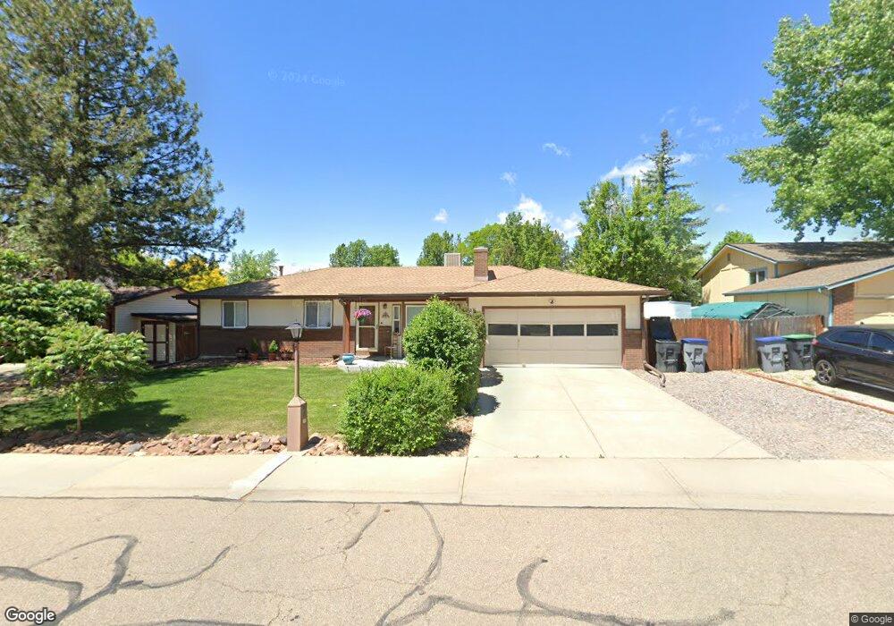
1530 Denison Cir Longmont, CO 80503
Longmont Estates NeighborhoodEstimated Value: $478,000 - $546,000
4
Beds
3
Baths
2,165
Sq Ft
$234/Sq Ft
Est. Value
About This Home
This home is located at 1530 Denison Cir, Longmont, CO 80503 and is currently estimated at $507,171, approximately $234 per square foot. 1530 Denison Cir is a home located in Boulder County with nearby schools including Longmont Estates Elementary School, Westview Middle School, and Silver Creek High School.
Ownership History
Date
Name
Owned For
Owner Type
Purchase Details
Closed on
Aug 20, 2024
Sold by
Waage Kristine
Bought by
Waage Family Trust
Current Estimated Value
Purchase Details
Closed on
Oct 26, 2001
Sold by
Andrews Michael A and Andrews Gloria K
Bought by
Waage Kristine R
Home Financials for this Owner
Home Financials are based on the most recent Mortgage that was taken out on this home.
Original Mortgage
$198,000
Interest Rate
6.77%
Purchase Details
Closed on
Dec 2, 1999
Sold by
Andrews Jane A
Bought by
Andrews Michael A
Home Financials for this Owner
Home Financials are based on the most recent Mortgage that was taken out on this home.
Original Mortgage
$127,500
Interest Rate
7.93%
Purchase Details
Closed on
Apr 11, 1990
Bought by
Waage Kristine
Purchase Details
Closed on
Jun 18, 1980
Bought by
Waage Kristine
Purchase Details
Closed on
Feb 28, 1980
Bought by
Waage Kristine
Create a Home Valuation Report for This Property
The Home Valuation Report is an in-depth analysis detailing your home's value as well as a comparison with similar homes in the area
Home Values in the Area
Average Home Value in this Area
Purchase History
| Date | Buyer | Sale Price | Title Company |
|---|---|---|---|
| Waage Family Trust | -- | None Listed On Document | |
| Waage Kristine R | $220,000 | First American Heritage Titl | |
| Andrews Michael A | $170,000 | Land Title | |
| Waage Kristine | $90,000 | -- | |
| Waage Kristine | $69,000 | -- | |
| Waage Kristine | $42,200 | -- |
Source: Public Records
Mortgage History
| Date | Status | Borrower | Loan Amount |
|---|---|---|---|
| Previous Owner | Waage Kristine R | $198,000 | |
| Previous Owner | Andrews Michael A | $127,500 | |
| Closed | Andrews Michael A | $34,000 |
Source: Public Records
Tax History Compared to Growth
Tax History
| Year | Tax Paid | Tax Assessment Tax Assessment Total Assessment is a certain percentage of the fair market value that is determined by local assessors to be the total taxable value of land and additions on the property. | Land | Improvement |
|---|---|---|---|---|
| 2025 | $2,979 | $31,888 | $8,525 | $23,363 |
| 2024 | $2,979 | $31,888 | $8,525 | $23,363 |
| 2023 | $2,939 | $31,148 | $9,507 | $25,326 |
| 2022 | $2,635 | $26,632 | $7,325 | $19,307 |
| 2021 | $2,670 | $27,399 | $7,536 | $19,863 |
| 2020 | $2,321 | $23,889 | $6,078 | $17,811 |
| 2019 | $2,284 | $23,889 | $6,078 | $17,811 |
| 2018 | $2,021 | $21,276 | $6,120 | $15,156 |
| 2017 | $1,993 | $23,522 | $6,766 | $16,756 |
| 2016 | $1,750 | $18,308 | $8,199 | $10,109 |
| 2015 | $1,668 | $15,682 | $4,060 | $11,622 |
| 2014 | $1,465 | $15,682 | $4,060 | $11,622 |
Source: Public Records
Map
Nearby Homes
- 1451 Elmhurst Dr
- 1448 Elmhurst Ct
- 1460 Belmont Dr
- 1506 Fisk Ct
- 2325 15th Ave
- 2623 Elmhurst Cir
- 2871 Humboldt Cir
- 1379 Charles Dr Unit 7
- 1379 Charles Dr Unit 4
- 1379 Charles Dr Unit 5
- 1379 Charles Dr Unit 3
- 2888 Humboldt Cir
- 1835 Cambridge Dr
- 1406 Hover St
- 2810 Humboldt Cir
- 1350 Stuart St
- 1429 Auburn Ct
- 28 University Dr
- 1262 Lanyon Ln
- 1345 Northwestern Rd
- 1536 Denison Cir
- 1524 Denison Cir
- 1528 Elmhurst Dr
- 1524 Elmhurst Dr
- 1542 Denison Cir
- 1518 Denison Cir
- 1537 Denison Cir
- 1525 Denison Cir
- 1518 Elmhurst Dr
- 1534 Elmhurst Dr
- 1543 Denison Cir
- 1620 Denison Cir
- 1519 Denison Cir
- 1626 Denison Cir
- 1512 Denison Cir
- 1604 Denison Cir
- 1512 Elmhurst Dr
- 1540 Elmhurst Dr
- 1531 Cambridge Dr
- 1549 Denison Cir