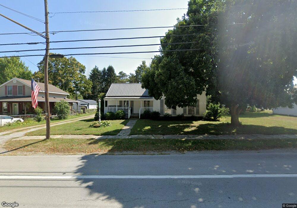
15306 State Route 113 Wakeman, OH 44889
Estimated Value: $194,000 - $363,000
3
Beds
2
Baths
1,897
Sq Ft
$145/Sq Ft
Est. Value
About This Home
This home is located at 15306 State Route 113, Wakeman, OH 44889 and is currently estimated at $275,333, approximately $145 per square foot. 15306 State Route 113 is a home located in Erie County with nearby schools including Firelands Elementary School, Firelands Middle School, and Firelands High School.
Ownership History
Date
Name
Owned For
Owner Type
Purchase Details
Closed on
Sep 22, 2015
Sold by
Palmer Charles W
Bought by
Cecil Alfred L and Cecil Dzidra
Current Estimated Value
Purchase Details
Closed on
Nov 19, 2001
Sold by
Schieve Guy W
Bought by
Palmer Charles W and Palmer Judy L
Home Financials for this Owner
Home Financials are based on the most recent Mortgage that was taken out on this home.
Original Mortgage
$73,000
Interest Rate
6.69%
Mortgage Type
New Conventional
Purchase Details
Closed on
Jan 20, 1999
Sold by
Cramer Howard
Bought by
Schieve Guy and Schieve Debra
Home Financials for this Owner
Home Financials are based on the most recent Mortgage that was taken out on this home.
Original Mortgage
$64,000
Interest Rate
6.76%
Mortgage Type
New Conventional
Create a Home Valuation Report for This Property
The Home Valuation Report is an in-depth analysis detailing your home's value as well as a comparison with similar homes in the area
Home Values in the Area
Average Home Value in this Area
Purchase History
| Date | Buyer | Sale Price | Title Company |
|---|---|---|---|
| Cecil Alfred L | $45,000 | Attorney | |
| Palmer Charles W | $92,000 | -- | |
| Schieve Guy | $80,000 | -- |
Source: Public Records
Mortgage History
| Date | Status | Borrower | Loan Amount |
|---|---|---|---|
| Previous Owner | Palmer Charles W | $73,000 | |
| Previous Owner | Schieve Guy | $64,000 |
Source: Public Records
Tax History Compared to Growth
Tax History
| Year | Tax Paid | Tax Assessment Tax Assessment Total Assessment is a certain percentage of the fair market value that is determined by local assessors to be the total taxable value of land and additions on the property. | Land | Improvement |
|---|---|---|---|---|
| 2024 | $1,925 | $53,200 | $14,917 | $38,283 |
| 2023 | $1,925 | $43,837 | $13,562 | $30,275 |
| 2022 | $1,853 | $43,830 | $13,559 | $30,271 |
| 2021 | $1,838 | $43,830 | $13,560 | $30,270 |
| 2020 | $1,770 | $42,120 | $13,560 | $28,560 |
| 2019 | $1,838 | $42,120 | $13,560 | $28,560 |
| 2018 | $1,889 | $42,120 | $13,560 | $28,560 |
| 2017 | $1,866 | $43,990 | $18,530 | $25,460 |
| 2016 | $1,878 | $43,990 | $18,530 | $25,460 |
| 2015 | $1,892 | $43,990 | $18,530 | $25,460 |
| 2014 | $1,943 | $43,780 | $18,530 | $25,250 |
| 2013 | $1,928 | $43,780 | $18,530 | $25,250 |
Source: Public Records
Map
Nearby Homes
- 15319 State Route 113
- 7218 State Route 60
- 13514 State Route 113
- 9113 Dean Rd
- 9708 Harrison Rd
- 15617 Sperry Rd
- V/L Baird Rd
- 13111 Harmon Rd
- 13917 Mason Rd
- 11909 Joppa Rd
- V/L Darrow Rd
- Lot B Gifford Rd
- 9839 Gifford Rd
- 50963 Becker Rd
- 51232 N Ridge Rd
- 13612 Thompson Rd
- 11135 Baumhart Rd
- 0 Baumhart Rd
- 12214 Thompson Rd
- 13310 Baumhart Rd
- 15308 State Route 113
- 15310 State Route 113
- 15218 State Route 113
- 15218 Ohio 113
- 15218 State Route 113
- 11015 2nd St
- 15319 State Rd 113
- 11008 Chapel St
- 11008 Chapel St
- 11012 Chapel St
- 15316 State Route 113
- 15307 State Route 113
- 11005 Chapel St
- 15318 State Route 113
- 15318 State Route 113
- 15402 State Route 113
- 15317 Ohio 113
- 11020 2nd St
- 11020 2nd St
- 15201 State Route 113