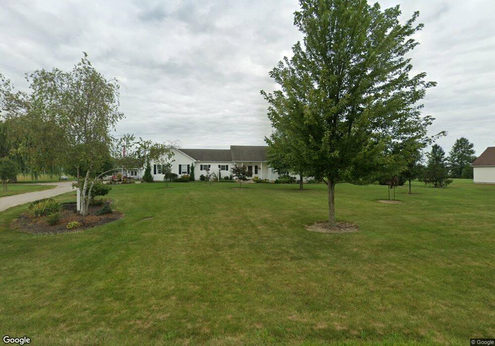
15308 Rhonda Ln Lagrange, OH 44050
Estimated Value: $338,000 - $413,000
3
Beds
2
Baths
1,600
Sq Ft
$236/Sq Ft
Est. Value
About This Home
This home is located at 15308 Rhonda Ln, Lagrange, OH 44050 and is currently estimated at $377,822, approximately $236 per square foot. 15308 Rhonda Ln is a home located in Lorain County with nearby schools including Keystone Elementary School, Keystone Middle School, and Keystone High School.
Ownership History
Date
Name
Owned For
Owner Type
Purchase Details
Closed on
Jan 28, 2003
Sold by
David Development Inc and Smith Rhonda
Bought by
Zemgulis Francis J and Zemgulis Barbara A
Current Estimated Value
Home Financials for this Owner
Home Financials are based on the most recent Mortgage that was taken out on this home.
Original Mortgage
$40,900
Interest Rate
7.5%
Create a Home Valuation Report for This Property
The Home Valuation Report is an in-depth analysis detailing your home's value as well as a comparison with similar homes in the area
Home Values in the Area
Average Home Value in this Area
Purchase History
| Date | Buyer | Sale Price | Title Company |
|---|---|---|---|
| Zemgulis Francis J | $56,900 | Lorain County Title Co Inc |
Source: Public Records
Mortgage History
| Date | Status | Borrower | Loan Amount |
|---|---|---|---|
| Previous Owner | Zemgulis Francis J | $40,900 |
Source: Public Records
Tax History Compared to Growth
Tax History
| Year | Tax Paid | Tax Assessment Tax Assessment Total Assessment is a certain percentage of the fair market value that is determined by local assessors to be the total taxable value of land and additions on the property. | Land | Improvement |
|---|---|---|---|---|
| 2024 | $3,725 | $100,496 | $32,046 | $68,450 |
| 2023 | $3,708 | $84,721 | $25,368 | $59,353 |
| 2022 | $3,700 | $84,721 | $25,368 | $59,353 |
| 2021 | $3,696 | $84,721 | $25,368 | $59,353 |
| 2020 | $3,377 | $70,600 | $21,140 | $49,460 |
| 2019 | $3,355 | $70,600 | $21,140 | $49,460 |
| 2018 | $3,273 | $70,600 | $21,140 | $49,460 |
| 2017 | $2,828 | $58,720 | $17,150 | $41,570 |
| 2016 | $2,867 | $58,720 | $17,150 | $41,570 |
| 2015 | $2,862 | $58,720 | $17,150 | $41,570 |
| 2014 | $2,504 | $58,720 | $17,150 | $41,570 |
| 2013 | $2,429 | $58,720 | $17,150 | $41,570 |
Source: Public Records
Map
Nearby Homes
- 756 N Center St
- 41635 Parsons Rd
- 171 Keywood Blvd
- 128 Harvest Ct
- 40725 Biggs Rd
- 829 Robinson Dr
- 831 Robinson Dr
- 822 Robinson Dr
- 433 N Center St
- 808 Buckingham Dr
- 548 William St
- 800 Buckingham Dr
- 516 Appomattox Ct
- 630 Rundle St
- 607 Rundle St
- 194 Railroad St
- 110 Railroad St
- 0 Dill Ct Unit 5072837
- 40175 Banks Rd
- 40185 Banks Rd
- 15272 Rhonda Ln
- 15299 Rhonda Ln
- 41573 Rachael Dr
- 41535 Rachael Dr
- 15291 Rhonda Ln
- 41611 Rachael Dr
- 41649 Rachael Dr
- 15255 Rhonda Ln
- 15217 Rhonda Ln
- 41576 Rachael Dr
- 41687 Rachael Dr
- 15179 Rhonda Ln
- 41538 Rachael Dr
- 41614 Rachael Dr
- 41652 Rachael Dr
- 41500 Rachael Dr
- 41725 Rachael Dr
- 41690 Rachael Dr
- 15653 Whitehead Rd
- 15505 Whitehead Rd