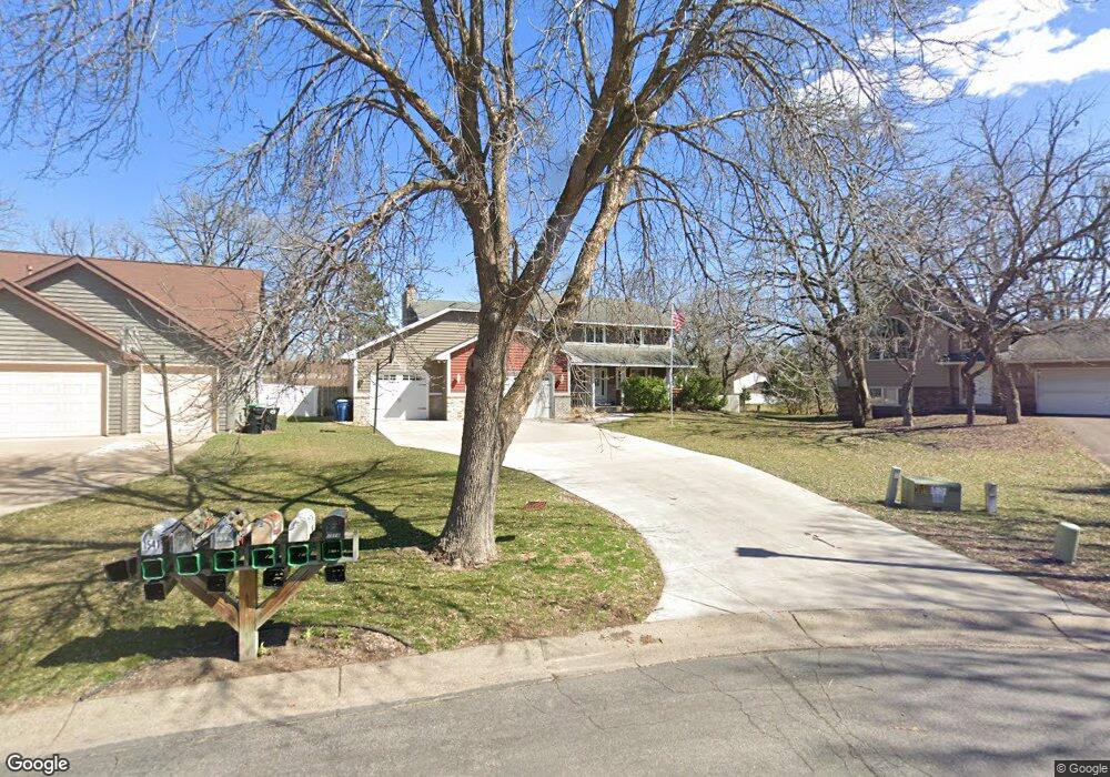
1531 122nd Cir NW Coon Rapids, MN 55448
Estimated Value: $452,708 - $525,000
5
Beds
4
Baths
2,406
Sq Ft
$206/Sq Ft
Est. Value
About This Home
This home is located at 1531 122nd Cir NW, Coon Rapids, MN 55448 and is currently estimated at $496,677, approximately $206 per square foot. 1531 122nd Cir NW is a home located in Anoka County with nearby schools including Lucile Bruner Elementary School, Sand Creek Elementary School, and Laughlin Junior/Senior High School.
Ownership History
Date
Name
Owned For
Owner Type
Purchase Details
Closed on
Jul 7, 2020
Sold by
Hp Minnesota I Llc
Bought by
Hpa Borrower 2016 Ml Llc
Current Estimated Value
Purchase Details
Closed on
Aug 29, 2019
Sold by
Al Obaidi Ahmed
Bought by
Hp Minnesota I Llc
Purchase Details
Closed on
Aug 31, 2018
Sold by
Sorenson Ronald D
Bought by
Al Obaidi Ahmed
Home Financials for this Owner
Home Financials are based on the most recent Mortgage that was taken out on this home.
Original Mortgage
$331,900
Interest Rate
4.5%
Mortgage Type
New Conventional
Purchase Details
Closed on
Aug 4, 2016
Sold by
Murphy Brian T and Murphy Amanda M
Bought by
Sorenson Ronald D
Home Financials for this Owner
Home Financials are based on the most recent Mortgage that was taken out on this home.
Original Mortgage
$253,520
Interest Rate
3.48%
Mortgage Type
New Conventional
Create a Home Valuation Report for This Property
The Home Valuation Report is an in-depth analysis detailing your home's value as well as a comparison with similar homes in the area
Home Values in the Area
Average Home Value in this Area
Purchase History
| Date | Buyer | Sale Price | Title Company |
|---|---|---|---|
| Hpa Borrower 2016 Ml Llc | -- | Stewart Title | |
| Hp Minnesota I Llc | $359,900 | Burnet Title | |
| Al Obaidi Ahmed | $359,900 | Liberty Title Inc | |
| Sorenson Ronald D | $316,900 | Lendserv National Title |
Source: Public Records
Mortgage History
| Date | Status | Borrower | Loan Amount |
|---|---|---|---|
| Previous Owner | Al Obaidi Ahmed | $331,900 | |
| Previous Owner | Sorenson Ronald D | $253,520 |
Source: Public Records
Tax History Compared to Growth
Tax History
| Year | Tax Paid | Tax Assessment Tax Assessment Total Assessment is a certain percentage of the fair market value that is determined by local assessors to be the total taxable value of land and additions on the property. | Land | Improvement |
|---|---|---|---|---|
| 2025 | $7,488 | $452,600 | $80,000 | $372,600 |
| 2024 | $7,488 | $448,100 | $87,000 | $361,100 |
| 2023 | $4,525 | $459,700 | $80,000 | $379,700 |
| 2022 | $4,122 | $456,300 | $68,000 | $388,300 |
| 2021 | $3,974 | $366,000 | $67,000 | $299,000 |
| 2020 | $3,916 | $344,000 | $65,000 | $279,000 |
| 2019 | $3,854 | $330,100 | $57,000 | $273,100 |
| 2018 | $3,744 | $315,900 | $0 | $0 |
| 2017 | $3,337 | $298,100 | $0 | $0 |
| 2016 | $3,639 | $278,900 | $0 | $0 |
| 2015 | $3,394 | $278,900 | $46,000 | $232,900 |
| 2014 | -- | $243,200 | $37,000 | $206,200 |
Source: Public Records
Map
Nearby Homes
- 12463 Drake St NW
- 1625 124th Ave NW
- 1727 121st Ln NW
- 12010 Eagle St NW
- 12365 Jay St NW
- 1449 119th Ln NW
- 1593 126th Ln NW
- 1450 126th Ln NW
- 12554 Grouse St NW
- 11852 Yellow Pine St NW
- 12488 Unity St NW
- 12796 Bluebird St NW
- 11923 Wintergreen St NW
- 2068 124th Ln NW
- 1234 128th Cir NW
- 1930 127th Cir NW
- 1520 129th Ave NW
- 1660 Northdale Blvd NW
- 899 123rd Ln NW
- 2147 125th Ln NW
- 1541 122nd Cir NW
- 1521 122nd Cir NW
- 12270 Drake St NW
- 12268 Drake St NW
- 1518 122nd Cir NW
- 1551 122nd Cir NW
- 12266 Drake St NW
- 12272 Drake St NW
- 12276 12276 Drake St NW
- 12270 Eagle St NW
- 12264 Drake St NW
- 12266 Eagle St NW
- 12258 Eagle St NW
- 12276 Drake St NW
- 12262 Drake St NW
- 12284 Drake St NW
- 12262 Eagle St NW
- 12254 Eagle St NW
- 12280 Drake St NW
- 12284 12284 Drake-Street-nw