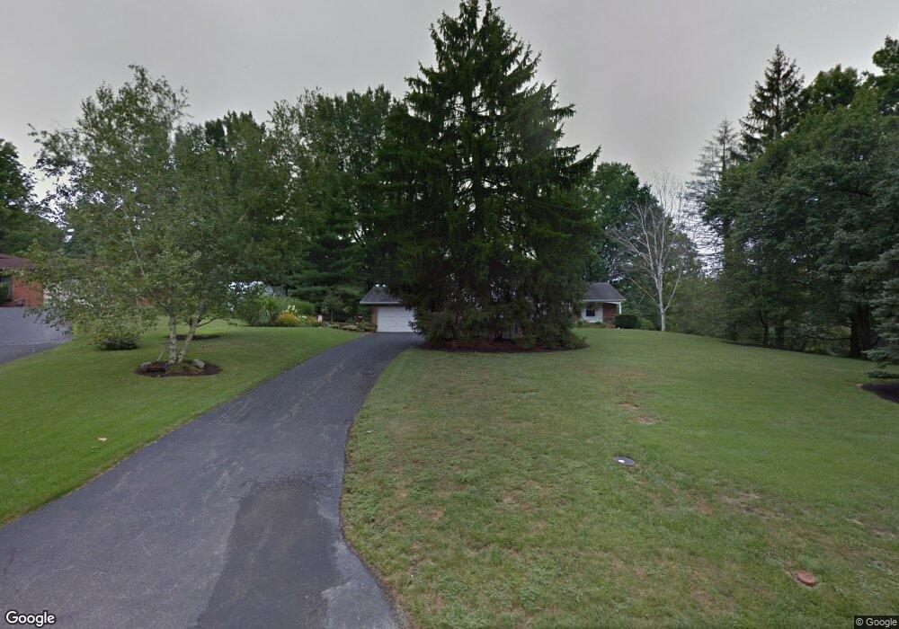
1531 Covered Bridge Rd Cincinnati, OH 45231
Winton Lake NeighborhoodEstimated Value: $286,861 - $351,000
3
Beds
3
Baths
1,970
Sq Ft
$158/Sq Ft
Est. Value
About This Home
This home is located at 1531 Covered Bridge Rd, Cincinnati, OH 45231 and is currently estimated at $311,215, approximately $157 per square foot. 1531 Covered Bridge Rd is a home located in Hamilton County with nearby schools including Mt Healthy High School and Central Montessori Academy.
Ownership History
Date
Name
Owned For
Owner Type
Purchase Details
Closed on
Apr 16, 2013
Sold by
Foertsch Daniel R and Foertsch Jenny S
Bought by
Foertsch Jenny S
Current Estimated Value
Purchase Details
Closed on
Jan 16, 2006
Sold by
Foertsch Daniel R and Foertsch Jenny S
Bought by
Foertsch Daniel R
Purchase Details
Closed on
Nov 15, 2002
Sold by
Foertsch Daniel R
Bought by
Foertsch Daniel R
Purchase Details
Closed on
Dec 22, 1998
Sold by
Foertsch Jean K and Foertsch Albert R
Bought by
Foertsch Daniel R
Home Financials for this Owner
Home Financials are based on the most recent Mortgage that was taken out on this home.
Original Mortgage
$98,000
Interest Rate
6.83%
Mortgage Type
Unknown
Purchase Details
Closed on
Aug 3, 1995
Sold by
Lemich George L and Lemich Martha A
Bought by
Foertsch Jean K
Create a Home Valuation Report for This Property
The Home Valuation Report is an in-depth analysis detailing your home's value as well as a comparison with similar homes in the area
Home Values in the Area
Average Home Value in this Area
Purchase History
| Date | Buyer | Sale Price | Title Company |
|---|---|---|---|
| Foertsch Jenny S | -- | Attorney | |
| Foertsch Daniel R | -- | Attorney | |
| Foertsch Daniel R | -- | None Available | |
| Foertsch Daniel R | -- | -- | |
| Foertsch Daniel R | $117,000 | -- | |
| Foertsch Jean K | -- | -- |
Source: Public Records
Mortgage History
| Date | Status | Borrower | Loan Amount |
|---|---|---|---|
| Closed | Foertsch Daniel R | $98,000 |
Source: Public Records
Tax History Compared to Growth
Tax History
| Year | Tax Paid | Tax Assessment Tax Assessment Total Assessment is a certain percentage of the fair market value that is determined by local assessors to be the total taxable value of land and additions on the property. | Land | Improvement |
|---|---|---|---|---|
| 2024 | $4,472 | $77,616 | $23,135 | $54,481 |
| 2023 | $4,248 | $77,616 | $23,135 | $54,481 |
| 2022 | $4,540 | $59,756 | $22,572 | $37,184 |
| 2021 | $4,418 | $59,756 | $22,572 | $37,184 |
| 2020 | $4,484 | $59,756 | $22,572 | $37,184 |
| 2019 | $3,932 | $48,979 | $18,501 | $30,478 |
| 2018 | $3,954 | $48,979 | $18,501 | $30,478 |
| 2017 | $3,752 | $48,979 | $18,501 | $30,478 |
| 2016 | $3,755 | $48,311 | $21,588 | $26,723 |
| 2015 | $3,784 | $48,311 | $21,588 | $26,723 |
| 2014 | $3,766 | $48,311 | $21,588 | $26,723 |
| 2013 | $3,881 | $50,856 | $22,726 | $28,130 |
Source: Public Records
Map
Nearby Homes
- 1503 Covered Bridge Rd
- 9731 Culpepper Ct
- 1805 Miles Rd
- 1559 Meredith Dr
- 1579 Meredith Dr
- 10040 Daly Rd
- 1050 Meredith Dr
- 1662 Springdale Rd
- 10467 Mill Rd
- 1917 Springdale Rd
- 10493 Mill Rd
- 10525 Mill Rd
- 9648 Fallshill Cir
- 9320 Rambler Place
- 1509 Adams Rd
- 1559 Adams Rd
- 65 Bayham Dr
- 5 Briarwood Ln
- 2 Brompton Ln
- 2204 Woodacre Dr
- 1523 Covered Bridge Rd
- 1545 Covered Bridge Rd
- 1517 Covered Bridge Rd
- 1532 Covered Bridge Rd
- 1558 Covered Bridge Rd
- 1522 Covered Bridge Rd
- 1514 Covered Bridge Rd
- 1562 Covered Bridge Rd
- 1505 Covered Bridge Rd
- 1555 Covered Bridge Rd
- 1506 Covered Bridge Rd
- 1564 Covered Bridge Rd
- 1500 Covered Bridge Rd
- 1500 Covered Bridge Rd
- 1500 Covered Bridge Rd
- 1568 Covered Bridge Rd
- 1575 Covered Bridge Rd
- 1544 Covered Bridge Rd
- 1501 Covered Bridge Rd
- 1501 Covered Bridge Rd