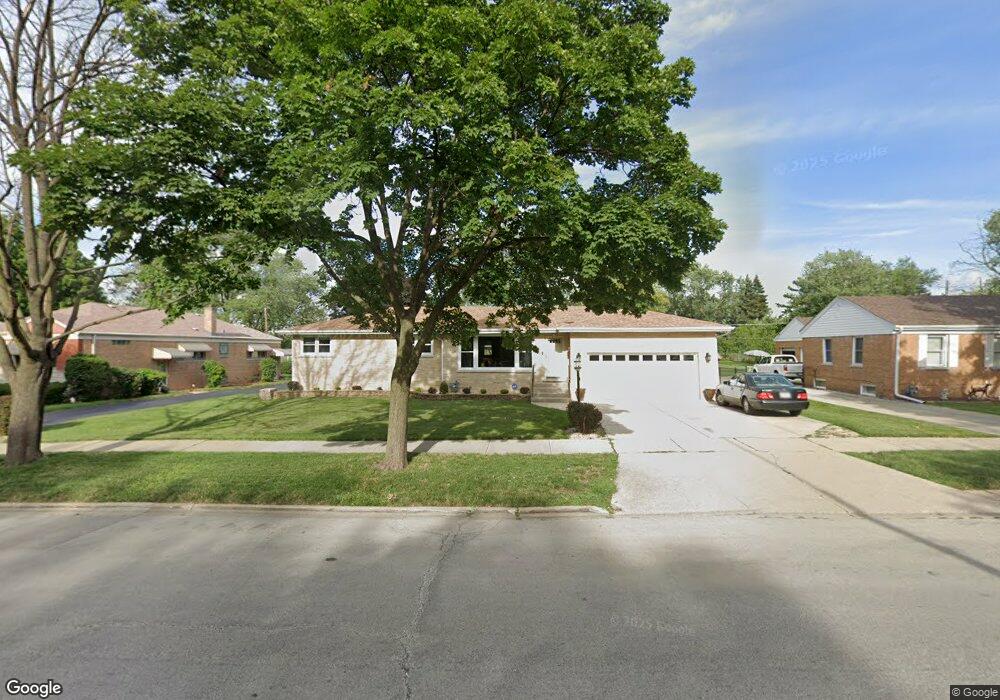
1531 N Taft Ave Berkeley, IL 60163
Estimated Value: $294,506 - $354,000
3
Beds
2
Baths
1,564
Sq Ft
$206/Sq Ft
Est. Value
About This Home
This home is located at 1531 N Taft Ave, Berkeley, IL 60163 and is currently estimated at $322,127, approximately $205 per square foot. 1531 N Taft Ave is a home located in Cook County with nearby schools including Macarthur Intermediate School, Sunnyside Elementary School, and Proviso West High School.
Ownership History
Date
Name
Owned For
Owner Type
Purchase Details
Closed on
Oct 27, 2011
Sold by
Coleman Konota
Bought by
Oneal Lenwood and Oneal Ida
Current Estimated Value
Create a Home Valuation Report for This Property
The Home Valuation Report is an in-depth analysis detailing your home's value as well as a comparison with similar homes in the area
Home Values in the Area
Average Home Value in this Area
Purchase History
| Date | Buyer | Sale Price | Title Company |
|---|---|---|---|
| Oneal Lenwood | $125,000 | Cti |
Source: Public Records
Tax History
| Year | Tax Paid | Tax Assessment Tax Assessment Total Assessment is a certain percentage of the fair market value that is determined by local assessors to be the total taxable value of land and additions on the property. | Land | Improvement |
|---|---|---|---|---|
| 2025 | $7,052 | $25,000 | $3,960 | $21,040 |
| 2024 | $7,052 | $25,000 | $3,960 | $21,040 |
| 2023 | $5,353 | $25,000 | $3,960 | $21,040 |
| 2022 | $5,353 | $18,340 | $2,700 | $15,640 |
| 2021 | $5,407 | $18,340 | $2,700 | $15,640 |
| 2020 | $6,293 | $18,340 | $2,700 | $15,640 |
| 2019 | $5,936 | $17,435 | $2,520 | $14,915 |
| 2018 | $5,817 | $17,435 | $2,520 | $14,915 |
| 2017 | $5,585 | $17,435 | $2,520 | $14,915 |
| 2016 | $5,410 | $15,862 | $2,340 | $13,522 |
| 2015 | $5,343 | $15,862 | $2,340 | $13,522 |
| 2014 | $5,268 | $15,862 | $2,340 | $13,522 |
| 2013 | $5,511 | $17,680 | $2,340 | $15,340 |
Source: Public Records
Map
Nearby Homes
- 1447 N Ashbel Ave
- 1428 1/2 N Ashbel Ave
- 5706 Saint Charles Rd
- 5700 Saint Charles Rd
- 1529 N Hillside Ave
- 4938 W Randolph St
- 4904 W Hawthorne Ave
- 5949 School St
- 1038 Arthur Ave
- 504 N Irving Ave
- 515 S Parkview Ave
- 593 S Edgewood Ave
- 605 N Wolf Rd Unit B9
- 768 N Rohde Ave
- 520 N Wolf Rd Unit 203
- 1463 Speechley Blvd
- 330 E Saint Charles Rd
- 250 N Irving Ave
- 2050 Atwood Ave
- 226 N Lind Ave
- 1537 N Taft Ave
- 1527 N Taft Ave
- 1523 N Taft Ave
- 1541 N Taft Ave
- 1519 N Taft Ave
- 1524 N Taft Ave
- 1520 N Taft Ave
- 1515 N Taft Ave
- 1536 King Dr
- 1516 N Taft Ave
- 1538 King Dr
- 1542 N Taft Ave
- 1551 N Taft Ave
- 1511 N Taft Ave
- 1512 N Taft Ave
- 1540 N Taft Ave
- 1508 N Taft Ave
- 1525 Herbert Ave
- 1529 Herbert Ave
- 1507 N Taft Ave
Your Personal Tour Guide
Ask me questions while you tour the home.