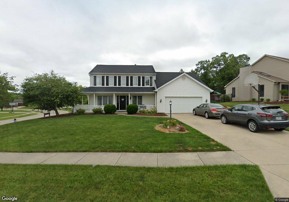
1532 Seabrook Dr Fort Wayne, IN 46845
Estimated Value: $318,000 - $334,751
4
Beds
3
Baths
2,115
Sq Ft
$154/Sq Ft
Est. Value
About This Home
This home is located at 1532 Seabrook Dr, Fort Wayne, IN 46845 and is currently estimated at $325,688, approximately $153 per square foot. 1532 Seabrook Dr is a home located in Allen County with nearby schools including Eel River Elementary School, Carroll Middle School, and Carroll High School.
Ownership History
Date
Name
Owned For
Owner Type
Purchase Details
Closed on
May 31, 2006
Sold by
Dunn Christopher S and Dunn Holly R
Bought by
Eiler Brent M
Current Estimated Value
Home Financials for this Owner
Home Financials are based on the most recent Mortgage that was taken out on this home.
Original Mortgage
$160,000
Outstanding Balance
$94,330
Interest Rate
6.62%
Mortgage Type
Fannie Mae Freddie Mac
Estimated Equity
$231,358
Purchase Details
Closed on
Feb 9, 2001
Sold by
Tobalski James G and Kujawa Tobalski Jenifer L
Bought by
Dunn Christopher S and Dunn Holly R
Create a Home Valuation Report for This Property
The Home Valuation Report is an in-depth analysis detailing your home's value as well as a comparison with similar homes in the area
Home Values in the Area
Average Home Value in this Area
Purchase History
| Date | Buyer | Sale Price | Title Company |
|---|---|---|---|
| Eiler Brent M | -- | Lawyers Title | |
| Dunn Christopher S | -- | Three Rivers Title Company I |
Source: Public Records
Mortgage History
| Date | Status | Borrower | Loan Amount |
|---|---|---|---|
| Open | Eiler Brent M | $160,000 | |
| Closed | Dunn Christopher S | $0 |
Source: Public Records
Tax History Compared to Growth
Tax History
| Year | Tax Paid | Tax Assessment Tax Assessment Total Assessment is a certain percentage of the fair market value that is determined by local assessors to be the total taxable value of land and additions on the property. | Land | Improvement |
|---|---|---|---|---|
| 2024 | $3,242 | $320,800 | $24,300 | $296,500 |
| 2022 | $2,877 | $277,200 | $24,300 | $252,900 |
| 2021 | $2,412 | $231,400 | $24,300 | $207,100 |
| 2020 | $2,362 | $219,500 | $24,300 | $195,200 |
| 2019 | $2,191 | $203,400 | $24,300 | $179,100 |
| 2018 | $2,023 | $196,600 | $24,300 | $172,300 |
| 2017 | $1,766 | $175,100 | $24,300 | $150,800 |
| 2016 | $1,672 | $165,700 | $24,300 | $141,400 |
| 2014 | $1,594 | $159,400 | $24,300 | $135,100 |
| 2013 | $1,503 | $150,300 | $24,300 | $126,000 |
Source: Public Records
Map
Nearby Homes
- 11020 Windsor Woods Blvd
- 1421 Holly Ridge Run
- 1228 Holly Ridge Run
- 10717 Wild Ridge Place
- 1923 Sweet Cider Rd
- 1326 Bluff Pointe Way
- 2028 Weather Wood Place
- 10614 Alderwood Ln
- 704 Oaktree Ct
- 2316 Sweet Cider Rd
- 2308 Broken Oak Rd
- 12012 Kimball Run
- 1410 Billy Dr
- 9804 Oak Trail Rd
- 1607 Billy Dr
- 2529 Sweet Cider Rd
- 12202 Shearwater Run
- 9611 Lima Rd
- 10428 Maple Springs Cove
- 10638 Lantern Bay Cove
- 1520 Seabrook Dr
- 1531 Colebrook Ct
- 11115 Windsor Woods Blvd
- 11029 Windsor Woods Blvd
- 1525 Seabrook Dr
- 11105 Bushnell Ct
- 11113 Bushnell Ct
- 11023 Windsor Woods Blvd
- 11207 Windsor Woods Blvd
- 1515 Colebrook Ct
- 11121 Bushnell Ct
- 11027 Bushnell Ct
- 11017 Windsor Woods Blvd
- 11008 Windsor Woods Blvd
- 11129 Bushnell Ct
- 1526 Calvert Ct
- 11212 Windsor Woods Blvd
- 11015 Bushnell Ct
- 1514 Colebrook Ct
- 1522 Colebrook Ct