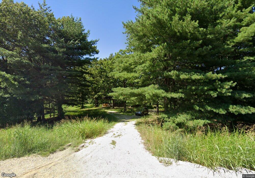
15325 Saint Robert Outer Rd Saint Robert, MO 65584
Estimated Value: $150,000 - $203,766
2
Beds
2
Baths
1,217
Sq Ft
$150/Sq Ft
Est. Value
About This Home
This home is located at 15325 Saint Robert Outer Rd, Saint Robert, MO 65584 and is currently estimated at $182,192, approximately $149 per square foot. 15325 Saint Robert Outer Rd is a home located in Pulaski County with nearby schools including Freedom Elementary School, Waynesville East Elementary School, and Waynesville Sixth Grade Center.
Ownership History
Date
Name
Owned For
Owner Type
Purchase Details
Closed on
Oct 1, 2009
Bought by
Gasconade River Properties Llc
Current Estimated Value
Purchase Details
Closed on
Jul 28, 2008
Sold by
Ells Timothy A and Ells Jennifer
Bought by
Secretary Of Veterans Affairs
Purchase Details
Closed on
Dec 15, 2006
Sold by
Mcgregor Wallace Neil
Bought by
Ells Timothy A and Ells Jennifer
Home Financials for this Owner
Home Financials are based on the most recent Mortgage that was taken out on this home.
Original Mortgage
$86,827
Interest Rate
6.27%
Mortgage Type
VA
Create a Home Valuation Report for This Property
The Home Valuation Report is an in-depth analysis detailing your home's value as well as a comparison with similar homes in the area
Home Values in the Area
Average Home Value in this Area
Purchase History
| Date | Buyer | Sale Price | Title Company |
|---|---|---|---|
| Gasconade River Properties Llc | -- | -- | |
| Secretary Of Veterans Affairs | $68,741 | None Available | |
| Ells Timothy A | -- | None Available |
Source: Public Records
Mortgage History
| Date | Status | Borrower | Loan Amount |
|---|---|---|---|
| Previous Owner | Ells Timothy A | $86,827 |
Source: Public Records
Tax History
| Year | Tax Paid | Tax Assessment Tax Assessment Total Assessment is a certain percentage of the fair market value that is determined by local assessors to be the total taxable value of land and additions on the property. | Land | Improvement |
|---|---|---|---|---|
| 2025 | $641 | $16,491 | $3,420 | $13,071 |
| 2024 | $641 | $14,733 | $2,850 | $11,883 |
| 2023 | $626 | $14,733 | $2,850 | $11,883 |
| 2022 | $578 | $14,733 | $2,850 | $11,883 |
| 2021 | $499 | $12,865 | $2,850 | $10,015 |
| 2020 | $491 | $15,116 | $0 | $0 |
| 2019 | $491 | $12,388 | $0 | $0 |
| 2018 | $491 | $12,388 | $0 | $0 |
| 2017 | $490 | $15,116 | $0 | $0 |
| 2016 | $466 | $12,390 | $0 | $0 |
| 2015 | -- | $12,390 | $0 | $0 |
| 2014 | $463 | $12,390 | $0 | $0 |
Source: Public Records
Map
Nearby Homes
- 22930 Hardy Ln
- 22780 Halberd Dr
- 103 Ridgeview Dr
- 15120 Hackney Dr
- 15020 Hackney Dr
- 15025 Hackney Dr
- 103 Cedar Ct
- 105 Oak Ct
- 102 Oak Ct
- 14755 Saint Robert Outer Rd
- 118 Sycamore Dr
- 22585 Harlan Ln
- 23105 Triple Ln
- 000 Texas Rd
- 0 Tbd Address Unit MAR23073110
- 108 Dogwood Cir
- 220 April Dr
- 24025 Turtle Ln
- 15316 Talent Ln
- 13446 Highway Z
- 14875 State Highway Z
- 25780 State Highway Z
- 0Lot 7 State Highway Z
- 0xxx State Highway Z
- 22975 Hardy Ln
- 76 Ridgeview Dr
- 0Lot 8 Ridgeview Dr
- 0XXX Ridgeview Dr
- 22940 Hardy Ln
- 22890 Hackle Dr
- 0 Hardy Ln
- 22890 Hardy Ln
- 0 Unit 21059082
- 0 Lot 1 Woodridge Plat #1 Unit 23023191
- 0 Lot 1 Woodridge Plat #1 Unit 21059202
- 100 Ridgeview Dr
- 0 Hopi Ln Unit 18029175
- 155 Hickory Ln
- 0 0 Unit 107138
- 0 Tranquil Ln Unit 13001173
Your Personal Tour Guide
Ask me questions while you tour the home.
