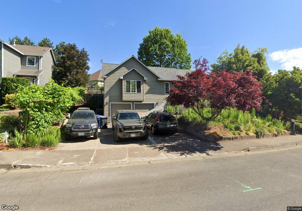
1533 Ammon St NW Salem, OR 97304
West Salem NeighborhoodEstimated Value: $507,830 - $532,000
4
Beds
3
Baths
1,972
Sq Ft
$263/Sq Ft
Est. Value
About This Home
This home is located at 1533 Ammon St NW, Salem, OR 97304 and is currently estimated at $519,458, approximately $263 per square foot. 1533 Ammon St NW is a home located in Polk County with nearby schools including Harritt Elementary School, Walker Middle School, and West Salem High School.
Ownership History
Date
Name
Owned For
Owner Type
Purchase Details
Closed on
Mar 16, 2015
Sold by
Ward Judith Mcquade
Bought by
Chesselet Cash
Current Estimated Value
Home Financials for this Owner
Home Financials are based on the most recent Mortgage that was taken out on this home.
Original Mortgage
$219,450
Outstanding Balance
$167,641
Interest Rate
3.61%
Mortgage Type
New Conventional
Estimated Equity
$351,817
Purchase Details
Closed on
Jun 14, 2012
Sold by
Ward Michael D
Bought by
Ward Judith Mcquade
Purchase Details
Closed on
Sep 19, 2006
Sold by
Neil Jason E and Neil Stella G
Bought by
Ward Michael D and Ward Judith Mcquade
Home Financials for this Owner
Home Financials are based on the most recent Mortgage that was taken out on this home.
Original Mortgage
$100,000
Interest Rate
6.51%
Mortgage Type
Purchase Money Mortgage
Create a Home Valuation Report for This Property
The Home Valuation Report is an in-depth analysis detailing your home's value as well as a comparison with similar homes in the area
Home Values in the Area
Average Home Value in this Area
Purchase History
| Date | Buyer | Sale Price | Title Company |
|---|---|---|---|
| Chesselet Cash | $231,000 | First American | |
| Ward Judith Mcquade | -- | None Available | |
| Ward Michael D | $275,000 | Fidelity Natl Title Co Of Or |
Source: Public Records
Mortgage History
| Date | Status | Borrower | Loan Amount |
|---|---|---|---|
| Open | Chesselet Cash | $219,450 | |
| Previous Owner | Ward Michael D | $100,000 |
Source: Public Records
Tax History Compared to Growth
Tax History
| Year | Tax Paid | Tax Assessment Tax Assessment Total Assessment is a certain percentage of the fair market value that is determined by local assessors to be the total taxable value of land and additions on the property. | Land | Improvement |
|---|---|---|---|---|
| 2025 | $5,160 | $282,040 | $80,220 | $201,820 |
| 2024 | $5,160 | $273,830 | $77,880 | $195,950 |
| 2023 | $5,011 | $265,860 | $75,610 | $190,250 |
| 2022 | $4,850 | $258,120 | $73,410 | $184,710 |
| 2021 | $4,712 | $250,610 | $71,270 | $179,340 |
| 2020 | $4,572 | $243,320 | $69,190 | $174,130 |
| 2019 | $4,413 | $236,240 | $67,170 | $169,070 |
| 2018 | $4,339 | $229,360 | $65,220 | $164,140 |
| 2017 | $3,911 | $222,680 | $63,320 | $159,360 |
| 2016 | $3,817 | $216,200 | $61,470 | $154,730 |
| 2015 | $3,833 | $203,080 | $47,000 | $156,080 |
| 2014 | $3,600 | $201,390 | $47,900 | $153,490 |
Source: Public Records
Map
Nearby Homes
- 1553 Ammon St NW
- 2236 15th Ave NW
- 2114 Mousebird Ave NW
- 2084 Mousebird Ave NW
- 1835 Wakefield Ct NW
- 1417 Orchard Heights Rd NW
- 1236 Redwood St NW
- 1375 Ranier Loop NW
- 1380 Ranier Loop NW
- 2388 Westminster Ave NW
- 1198 Hemlock St NW
- 2438 Whetstone Ct NW
- 1157 Redwood St NW
- 1664 Pelican Ct NW
- 1936 Orchard Heights Rd NW
- 1656 Ashland Ct NW
- 920 Orchardview Ave NW
- 1842 Boulder Ridge Ct NW
- 2110 Woodhaven Ct NW
- 2367 Wilark Dr NW
- 1513 Ammon St NW
- 1632 Royalann Ct NW
- 1503 Ammon St NW
- 1554 Ammon St NW
- 1642 Royalann Ct NW
- 1514 Ammon St NW
- 1493 Ammon St NW
- 1504 Ammon St NW
- 1574 Ammon St NW
- 1622 Royalann Ct NW
- 1652 Royalann Ct NW
- 1498 Cresthill Ave NW
- 1483 Ammon St NW
- 1494 Ammon St NW
- 1594 Ammon St NW
- 1517 Goldcrest Ave NW
- 2165 15th Ave NW
- 1662 Royalann Ct NW
- 1623 Ammon St NW