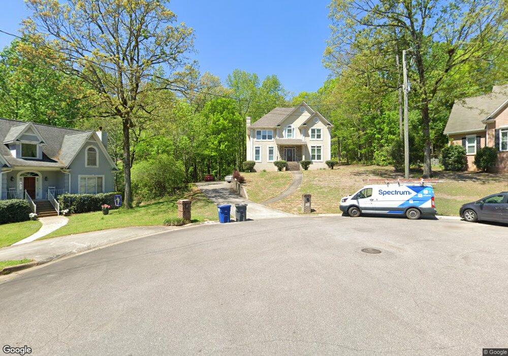
1533 Cypress Cove Cir Hoover, AL 35244
Estimated Value: $428,000 - $472,000
4
Beds
3
Baths
2,648
Sq Ft
$167/Sq Ft
Est. Value
About This Home
This home is located at 1533 Cypress Cove Cir, Hoover, AL 35244 and is currently estimated at $442,895, approximately $167 per square foot. 1533 Cypress Cove Cir is a home located in Jefferson County with nearby schools including South Shades Crest Elementary School, Brock's Gap Intermediate School, and Robert F. Bumpus Middle School.
Ownership History
Date
Name
Owned For
Owner Type
Purchase Details
Closed on
May 8, 2019
Sold by
Cottrell Ray
Bought by
E21 Llc and C/O Law Albertelli
Current Estimated Value
Purchase Details
Closed on
Feb 13, 2002
Sold by
Harrah C Dana and Harrah Mary S
Bought by
Cottrell Ray and Cottrell Chrysanthia R
Home Financials for this Owner
Home Financials are based on the most recent Mortgage that was taken out on this home.
Original Mortgage
$216,900
Interest Rate
6.81%
Purchase Details
Closed on
Sep 30, 1997
Sold by
Clowers Charles L and Clowers Sara E
Bought by
Harrah C Dana and Harrah Mary S
Home Financials for this Owner
Home Financials are based on the most recent Mortgage that was taken out on this home.
Original Mortgage
$180,000
Interest Rate
7.46%
Create a Home Valuation Report for This Property
The Home Valuation Report is an in-depth analysis detailing your home's value as well as a comparison with similar homes in the area
Home Values in the Area
Average Home Value in this Area
Purchase History
| Date | Buyer | Sale Price | Title Company |
|---|---|---|---|
| E21 Llc | $158,000 | -- | |
| Cottrell Ray | $241,000 | -- | |
| Harrah C Dana | $225,000 | -- |
Source: Public Records
Mortgage History
| Date | Status | Borrower | Loan Amount |
|---|---|---|---|
| Previous Owner | Cottrell Ray | $216,900 | |
| Previous Owner | Harrah C Dana | $180,000 |
Source: Public Records
Tax History Compared to Growth
Tax History
| Year | Tax Paid | Tax Assessment Tax Assessment Total Assessment is a certain percentage of the fair market value that is determined by local assessors to be the total taxable value of land and additions on the property. | Land | Improvement |
|---|---|---|---|---|
| 2024 | $2,752 | $38,640 | -- | -- |
| 2022 | $2,564 | $36,040 | $8,000 | $28,040 |
| 2021 | $2,201 | $31,030 | $8,000 | $23,030 |
| 2020 | $2,164 | $30,400 | $8,000 | $22,400 |
| 2019 | $2,154 | $30,400 | $0 | $0 |
| 2018 | $1,909 | $27,020 | $0 | $0 |
| 2017 | $1,909 | $27,020 | $0 | $0 |
| 2016 | $1,909 | $27,020 | $0 | $0 |
| 2015 | $1,909 | $27,020 | $0 | $0 |
| 2014 | $1,885 | $26,620 | $0 | $0 |
| 2013 | $1,885 | $26,620 | $0 | $0 |
Source: Public Records
Map
Nearby Homes
- 1521 Cypress Cove Cir
- 413 Russet Hill Rd
- 1916 Strawberry Ln
- 1912 High Ridge Cir
- 5911 Peachwood Cir
- 1860 Russet Hill Cir
- 600 Southdale Ln
- 5527 Lake Cyrus Ln
- 205 Russet Woods Dr
- 5524 Lake Cyrus Ln
- 600 Crest View Cir
- 2412 Fluker Dr
- 404 Russet Hollow Rd
- 510 Russet Valley Cir
- 5569 Park Side Cir
- 230 Russet Woods Dr
- 127 Top O Tree Ln
- 5536 Park Side Cir
- 6213 Russet Landing Cir
- 2105 Russet Meadows Ln
- 1532 Cypress Cove Cir
- 1994 Cypress Cove Cir
- 2016 Crosscrest Dr
- 1525 Cypress Cove Cir
- 1809 Strawberry Ln
- 2012 Crosscrest Dr
- 2020 Crosscrest Dr
- 1528 Cypress Cove Cir
- 2008 Crosscrest Dr
- 1813 Strawberry Ln
- 1524 Cypress Cove Cir
- 2024 Crosscrest Dr
- 1817 Strawberry Ln
- 452 Russet Hill Rd
- 2004 Crosscrest Dr
- 2015 Crosscrest Dr
- 2028 Crosscrest Dr
- 1520 Cypress Cove Cir
- 456 Russet Hill Rd
- 1519 Cypress Cove Cir