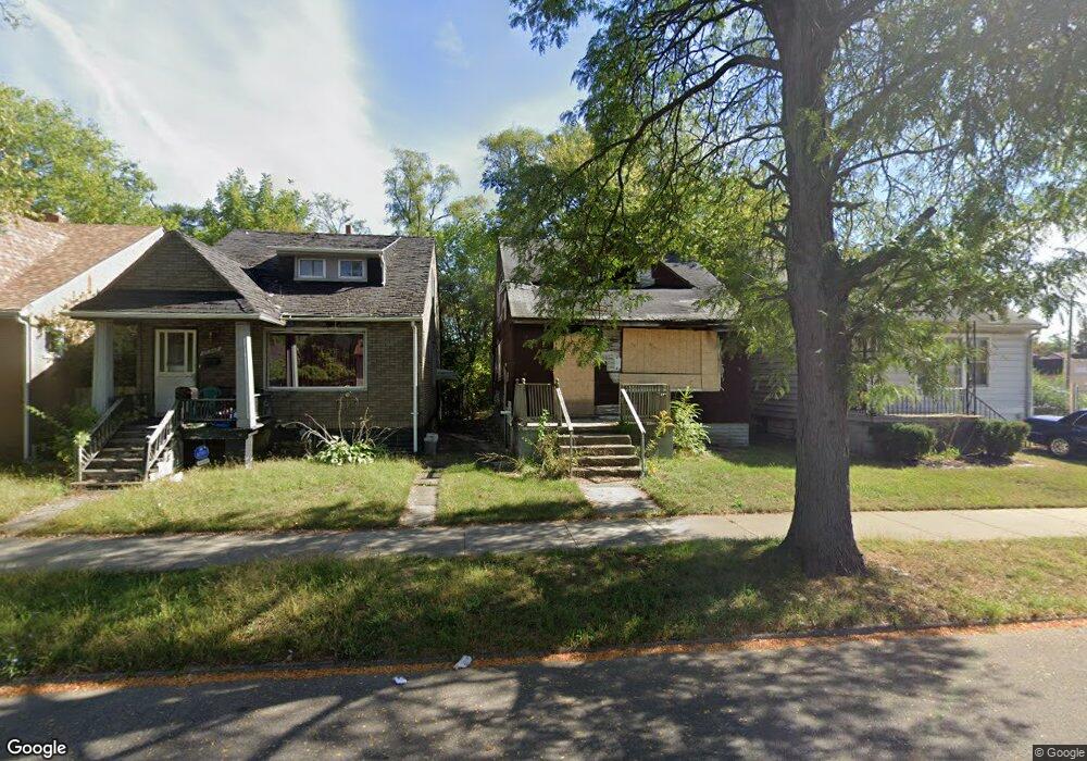
15336 Stansbury St Detroit, MI 48227
Bethune Community NeighborhoodEstimated Value: $69,045 - $97,000
3
Beds
1
Bath
836
Sq Ft
$95/Sq Ft
Est. Value
About This Home
This home is located at 15336 Stansbury St, Detroit, MI 48227 and is currently estimated at $79,011, approximately $94 per square foot. 15336 Stansbury St is a home located in Wayne County with nearby schools including John R. King Academic And Performing Arts Academy, Young Coleman A. Elementary School, and Charles L. Spain Elementary-Middle School.
Ownership History
Date
Name
Owned For
Owner Type
Purchase Details
Closed on
Jul 24, 2023
Sold by
Detroit Land Bank Authority
Bought by
Neal Michael
Current Estimated Value
Purchase Details
Closed on
Jan 12, 2017
Sold by
Sabree Eric R
Bought by
The Detroit Land Bank Authority
Purchase Details
Closed on
Nov 16, 2012
Sold by
Wayne County Treasurer
Bought by
Home Source Detroit Ii Llc
Purchase Details
Closed on
Jun 11, 2008
Sold by
Prentis Management Co
Bought by
New Hope Community Development Corp
Create a Home Valuation Report for This Property
The Home Valuation Report is an in-depth analysis detailing your home's value as well as a comparison with similar homes in the area
Home Values in the Area
Average Home Value in this Area
Purchase History
| Date | Buyer | Sale Price | Title Company |
|---|---|---|---|
| Neal Michael | $1,800 | None Listed On Document | |
| The Detroit Land Bank Authority | -- | None Available | |
| Home Source Detroit Ii Llc | $500 | None Available | |
| New Hope Community Development Corp | -- | Seaver Title |
Source: Public Records
Tax History Compared to Growth
Tax History
| Year | Tax Paid | Tax Assessment Tax Assessment Total Assessment is a certain percentage of the fair market value that is determined by local assessors to be the total taxable value of land and additions on the property. | Land | Improvement |
|---|---|---|---|---|
| 2025 | -- | $22,700 | $0 | $0 |
| 2024 | -- | $0 | $0 | $0 |
| 2023 | $0 | $0 | $0 | $0 |
| 2022 | $0 | $0 | $0 | $0 |
| 2021 | $0 | $0 | $0 | $0 |
| 2020 | $1,735 | $0 | $0 | $0 |
| 2019 | $1,735 | $0 | $0 | $0 |
| 2018 | $0 | $5,800 | $0 | $0 |
| 2017 | $110 | $5,800 | $0 | $0 |
| 2016 | $881 | $8,500 | $0 | $0 |
| 2015 | $850 | $8,500 | $0 | $0 |
| 2013 | $1,200 | $12,000 | $0 | $0 |
| 2010 | -- | $21,862 | $530 | $21,332 |
Source: Public Records
Map
Nearby Homes
- 15354 Stansbury St
- 15110 Cruse St
- 15431 Cruse St
- 15486 Lesure St
- 15019 Stansbury St
- 15375 Freeland St
- 15102 Freeland St
- 15475 Ardmore St
- 15036 Tracey St
- 15344 Hartwell St
- 15724 Lesure St
- 15061 Hartwell St
- 15703 Ardmore St
- 15039 Freeland St
- 15031 Freeland St
- 14938 Tracey St
- 15766 Cruse St
- 14904 Stansbury Ave
- 15767 Cruse St
- 15780 Stansbury St
- 15342 Stansbury St
- 15330 Stansbury St
- 15324 Stansbury St
- 15348 Stansbury St
- 15358 Stansbury St
- 13840 Fenkell Ave
- 15364 Stansbury St
- 15337 Stansbury St
- 15343 Stansbury St
- 15361 Lesure St
- 15325 Stansbury St
- 15349 Stansbury St
- 15368 Stansbury St
- 15371 Lesure St
- 15367 Lesure St
- 15361 Stansbury St
- 14010 Fenkell St
- 15367 Stansbury St
- 15377 Lesure St
- 15374 Stansbury St