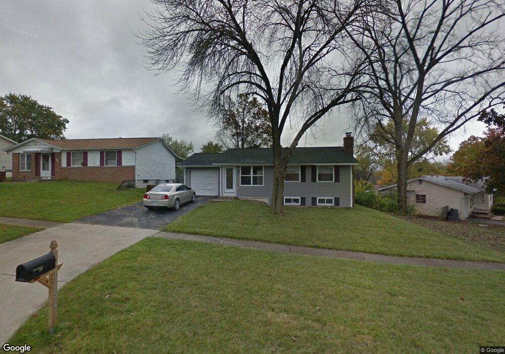
1534 River Bend Rd Columbus, OH 43223
Riverbend NeighborhoodEstimated Value: $185,561 - $213,000
2
Beds
2
Baths
768
Sq Ft
$260/Sq Ft
Est. Value
About This Home
This home is located at 1534 River Bend Rd, Columbus, OH 43223 and is currently estimated at $199,390, approximately $259 per square foot. 1534 River Bend Rd is a home located in Franklin County with nearby schools including James A Harmon Elementary School, Franklin Woods Intermediate School, and Finland Middle School.
Ownership History
Date
Name
Owned For
Owner Type
Purchase Details
Closed on
Jun 15, 2004
Sold by
Burns Mary L
Bought by
Burns Robert E
Current Estimated Value
Purchase Details
Closed on
Feb 19, 1999
Sold by
Nicklas Darla J
Bought by
Burns Robert E and Burns Mary L
Home Financials for this Owner
Home Financials are based on the most recent Mortgage that was taken out on this home.
Original Mortgage
$87,155
Outstanding Balance
$19,049
Interest Rate
6.88%
Mortgage Type
FHA
Estimated Equity
$180,341
Purchase Details
Closed on
May 29, 1997
Sold by
Farrell Jean and Farrell Hugh
Bought by
Nicklas Darla J
Home Financials for this Owner
Home Financials are based on the most recent Mortgage that was taken out on this home.
Original Mortgage
$73,926
Interest Rate
8.27%
Mortgage Type
FHA
Purchase Details
Closed on
Dec 20, 1988
Create a Home Valuation Report for This Property
The Home Valuation Report is an in-depth analysis detailing your home's value as well as a comparison with similar homes in the area
Home Values in the Area
Average Home Value in this Area
Purchase History
| Date | Buyer | Sale Price | Title Company |
|---|---|---|---|
| Burns Robert E | -- | -- | |
| Burns Robert E | $87,200 | -- | |
| Nicklas Darla J | $74,000 | Celtic Title Agency Inc | |
| -- | -- | -- |
Source: Public Records
Mortgage History
| Date | Status | Borrower | Loan Amount |
|---|---|---|---|
| Open | Burns Robert E | $87,155 | |
| Closed | Nicklas Darla J | $73,926 |
Source: Public Records
Tax History
| Year | Tax Paid | Tax Assessment Tax Assessment Total Assessment is a certain percentage of the fair market value that is determined by local assessors to be the total taxable value of land and additions on the property. | Land | Improvement |
|---|---|---|---|---|
| 2025 | $3,279 | $60,270 | $16,800 | $43,470 |
| 2024 | $3,279 | $60,270 | $16,800 | $43,470 |
| 2023 | $2,159 | $60,270 | $16,800 | $43,470 |
| 2022 | $1,889 | $38,710 | $10,150 | $28,560 |
| 2021 | $1,927 | $38,710 | $10,150 | $28,560 |
| 2020 | $1,916 | $38,710 | $10,150 | $28,560 |
| 2019 | $1,775 | $31,640 | $8,470 | $23,170 |
| 2018 | $1,638 | $31,640 | $8,470 | $23,170 |
| 2017 | $1,634 | $31,640 | $8,470 | $23,170 |
| 2016 | $1,510 | $24,960 | $4,900 | $20,060 |
| 2015 | $1,510 | $24,960 | $4,900 | $20,060 |
| 2014 | $1,512 | $24,960 | $4,900 | $20,060 |
| 2013 | $833 | $27,720 | $5,425 | $22,295 |
Source: Public Records
Map
Nearby Homes
- 1638 Tall Meadows Dr
- 3116 Musket Ridge Dr
- 1605 Greenville Rd
- 2937 Rundell Dr
- 2800 Alkire Rd
- 3407 Western Hill Rd
- 2870 Chesfield Dr
- 2856 Chesfield Dr
- 1657 Ripplebrook Rd
- 2112 Sondra Ln
- 1335 Hafton Woods Dr
- 1360 Hafton Woods Dr
- 0 Glencreek Rd
- 1147 Parma Ave
- 1722 Hollow Run Dr
- 988 S Roys Ave
- 1490 Demorest Rd
- 3029 Rosedale Ave
- 2600 Plainview Ave
- 3586 Alkire Rd
- 1534 Riverbend Rd
- 1526 Riverbend Rd
- 1546 Riverbend Rd
- 1518 River Bend Rd
- 1518 Riverbend Rd
- 3104 Hill Grove Ave
- 3110 Hill Grove Ave
- 3098 Hill Grove Ave
- 3116 Hill Grove Ave
- 1510 Riverbend Rd
- 1537 River Bend Rd
- 1529 Riverbend Rd
- 1545 River Bend Rd
- 1521 Riverbend Rd
- 1551 Riverbend Rd
- 3092 Hill Grove Ave
- 1537 Riverbend Rd
- 1557 River Bend Rd
- 1557 Riverbend Rd
- 1502 Riverbend Rd
Your Personal Tour Guide
Ask me questions while you tour the home.