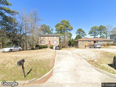
1534 Tarrant Huffman Rd Birmingham, AL 35217
Penfield Park NeighborhoodEstimated Value: $127,000 - $154,000
4
Beds
2
Baths
1,998
Sq Ft
$72/Sq Ft
Est. Value
About This Home
This home is located at 1534 Tarrant Huffman Rd, Birmingham, AL 35217 and is currently estimated at $142,904, approximately $71 per square foot. 1534 Tarrant Huffman Rd is a home located in Jefferson County with nearby schools including Robinson Elementary School, Ossie Ware Mitchell Middle School, and Huffman High School Magnet.
Ownership History
Date
Name
Owned For
Owner Type
Purchase Details
Closed on
Aug 6, 2018
Sold by
Rha 1 Birmingham Llc
Bought by
Fyr Sfr Borrower Llc and C/O Altisource Asset Management Corp
Current Estimated Value
Purchase Details
Closed on
Aug 1, 2014
Sold by
Long Harry Winston
Bought by
Rha 1 Birmingham Llc
Purchase Details
Closed on
Jul 30, 2014
Sold by
King Nicole Long
Bought by
Rha 1 Birmingham Llc
Purchase Details
Closed on
Mar 13, 2002
Sold by
Long Blanche Knight
Bought by
Long Harry Winston and King Nicole Long
Create a Home Valuation Report for This Property
The Home Valuation Report is an in-depth analysis detailing your home's value as well as a comparison with similar homes in the area
Home Values in the Area
Average Home Value in this Area
Purchase History
| Date | Buyer | Sale Price | Title Company |
|---|---|---|---|
| Fyr Sfr Borrower Llc | $32,969,168 | -- | |
| Rha 1 Birmingham Llc | $60,000 | -- | |
| Rha 1 Birmingham Llc | $60,000 | -- | |
| Long Harry Winston | -- | -- |
Source: Public Records
Mortgage History
| Date | Status | Borrower | Loan Amount |
|---|---|---|---|
| Previous Owner | Long Barry Winston | $40,000 |
Source: Public Records
Tax History Compared to Growth
Tax History
| Year | Tax Paid | Tax Assessment Tax Assessment Total Assessment is a certain percentage of the fair market value that is determined by local assessors to be the total taxable value of land and additions on the property. | Land | Improvement |
|---|---|---|---|---|
| 2024 | $1,900 | $26,200 | -- | -- |
| 2022 | $1,414 | $19,500 | $2,120 | $17,380 |
| 2021 | $1,414 | $19,500 | $2,120 | $17,380 |
| 2020 | $1,694 | $19,500 | $2,120 | $17,380 |
| 2019 | $1,694 | $25,280 | $0 | $0 |
| 2018 | $1,768 | $24,380 | $0 | $0 |
| 2017 | $1,768 | $24,380 | $0 | $0 |
| 2016 | $1,768 | $24,380 | $0 | $0 |
| 2015 | $1,768 | $24,380 | $0 | $0 |
| 2014 | $1,666 | $23,960 | $0 | $0 |
| 2013 | $1,666 | $23,960 | $0 | $0 |
Source: Public Records
Map
Nearby Homes
- 9700 Miller Ave
- 1852 Tarrant Huffman Rd Unit 1
- 1874 Tarrant Huffman Rd Unit 37.002
- 9601 Bryant Ave
- 9924 Miller Ave
- 2024 Cedar St
- 1988 Pine St
- 2290 Treadwell Rd Unit 5
- 9853 Westfield Ct
- 1055 El Camino Dr
- 9603 Marshall Ave
- 9750 Virginianna Dr
- 421 Buckner Dr
- 1025 Stoudemire Ave
- 4105 Highland Ave Unit 10.000
- 9605 Marshall Ave Unit 105.000
- 532 Belmar Dr
- 9048 Bel Air Dr
- 1610 Woodrow Dr
- 509 Cheri Ln
- 1534 Tarrant Huffman Rd
- 1536 Tarrant Huffman Rd
- 1532 Tarrant Huffman Rd
- 1544 Tarrant Huffman Rd
- 1524 Tarrant Huffman Rd
- 1533 Davenport Dr
- 1541 Davenport Dr
- 1533 Tarrant Huffman Rd
- 1311 Airport Rd
- 1516 Tarrant Huffman Rd
- 1525 Davenport Dr
- 9318 Airport Rd
- 1517 Davenport Dr
- 9299 Briarmont Dr
- 9296 Briarmont Dr
- 9320 Airport Rd
- 1508 Tarrant Huffman Rd
- 1524 Davenport Dr
- 1509 Davenport Dr
- 9330 Airport Rd