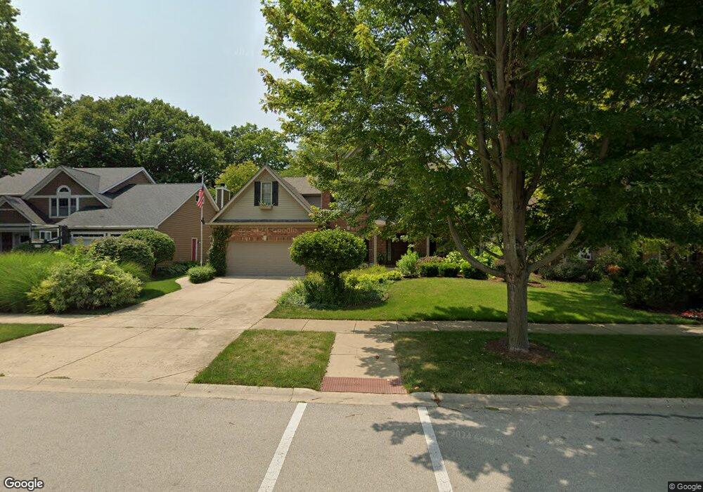
15342 Dan Patch Dr Plainfield, IL 60544
West Plainfield NeighborhoodEstimated Value: $583,992 - $612,000
Studio
1
Bath
2,705
Sq Ft
$219/Sq Ft
Est. Value
About This Home
This home is located at 15342 Dan Patch Dr, Plainfield, IL 60544 and is currently estimated at $593,498, approximately $219 per square foot. 15342 Dan Patch Dr is a home located in Will County with nearby schools including Richard Ira Jones Middle School, Plainfield North High School, and St Mary Immaculate Parish School.
Ownership History
Date
Name
Owned For
Owner Type
Purchase Details
Closed on
Oct 16, 2023
Sold by
Tonkin James
Bought by
Segobiano Scott and Dollinger Casey
Current Estimated Value
Home Financials for this Owner
Home Financials are based on the most recent Mortgage that was taken out on this home.
Original Mortgage
$325,000
Outstanding Balance
$316,085
Interest Rate
6.25%
Mortgage Type
New Conventional
Estimated Equity
$277,413
Purchase Details
Closed on
Aug 28, 2000
Sold by
Fessler Inc
Bought by
Tonkin James and Tonkin Cathie A
Home Financials for this Owner
Home Financials are based on the most recent Mortgage that was taken out on this home.
Original Mortgage
$243,000
Interest Rate
8.15%
Purchase Details
Closed on
Nov 15, 1999
Sold by
The Macom Corp
Bought by
Fessler Inc
Home Financials for this Owner
Home Financials are based on the most recent Mortgage that was taken out on this home.
Original Mortgage
$39,450
Interest Rate
8.25%
Create a Home Valuation Report for This Property
The Home Valuation Report is an in-depth analysis detailing your home's value as well as a comparison with similar homes in the area
Home Values in the Area
Average Home Value in this Area
Purchase History
| Date | Buyer | Sale Price | Title Company |
|---|---|---|---|
| Segobiano Scott | $565,000 | None Listed On Document | |
| Tonkin James | $333,500 | Chicago Title Insurance Co | |
| Fessler Inc | $53,000 | Chicago Title Insurance Co |
Source: Public Records
Mortgage History
| Date | Status | Borrower | Loan Amount |
|---|---|---|---|
| Open | Segobiano Scott | $325,000 | |
| Previous Owner | Tonkin James | $243,000 | |
| Previous Owner | Fessler Inc | $39,450 | |
| Closed | Tonkin James | $36,000 |
Source: Public Records
Tax History
| Year | Tax Paid | Tax Assessment Tax Assessment Total Assessment is a certain percentage of the fair market value that is determined by local assessors to be the total taxable value of land and additions on the property. | Land | Improvement |
|---|---|---|---|---|
| 2024 | $11,355 | $162,017 | $38,027 | $123,990 |
| 2023 | $11,355 | $146,330 | $34,345 | $111,985 |
| 2022 | $9,775 | $131,423 | $30,846 | $100,577 |
| 2021 | $9,206 | $122,825 | $28,828 | $93,997 |
| 2020 | $9,064 | $119,340 | $28,010 | $91,330 |
| 2019 | $9,280 | $120,261 | $26,689 | $93,572 |
| 2018 | $9,289 | $118,161 | $25,076 | $93,085 |
| 2017 | $8,982 | $112,289 | $23,830 | $88,459 |
| 2016 | $8,741 | $107,095 | $22,728 | $84,367 |
| 2015 | $8,221 | $100,323 | $21,291 | $79,032 |
| 2014 | $8,221 | $96,781 | $20,539 | $76,242 |
| 2013 | $8,221 | $96,781 | $20,539 | $76,242 |
Source: Public Records
Map
Nearby Homes
- 24701 Kingston St
- 24642 Lincolnway St
- 24914 W Illini Dr
- 25035 W Soldier Dr
- 14938 S Mccarthy Cir
- 14951 S Dyer Ln
- 14912 S Henebry Ln
- 14920 S Henebry Ln
- 14926 S Henebry Ln
- 14933 S Dyer Ln
- 14956 S Mccarthy Cir
- 14844 S Henebry Ln
- 14908 S Henebry Ln
- 14948 S Mccarthy Cir
- 14940 S Mccarthy Cir
- 15058 S Darr Dr
- 14962 S Henebry Ln
- 14946 S Henebry Ln
- 25058 W Soldier Dr
- 25106 W Soldier Dr
- 15352 Dan Patch Dr
- 15336 Dan Patch Dr
- 15328 Dan Patch Dr
- 15358 Dan Patch Dr
- 15355 Dan Patch Dr Unit 2
- 15335 Dan Patch Dr
- 15320 Dan Patch Dr
- 15400 Dan Patch Dr
- 15327 Dan Patch Dr
- 15365 Dan Patch Dr
- 15314 Dan Patch Dr
- 24729 Kingston St
- 24726 Kingston St Unit 4
- 15408 Dan Patch Dr Unit 2
- 24802 W Illini Dr
- 15317 Dan Patch Dr
- 15409 Dan Patch Dr
- 24806 W Illini Dr
- 15306 Lincolnway Cir
- 24721 Kingston St
Your Personal Tour Guide
Ask me questions while you tour the home.