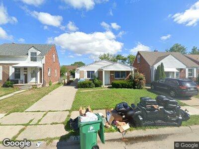
15345 Sprenger Ave Eastpointe, MI 48021
Estimated Value: $152,000 - $190,000
4
Beds
1
Bath
1,166
Sq Ft
$144/Sq Ft
Est. Value
About This Home
This home is located at 15345 Sprenger Ave, Eastpointe, MI 48021 and is currently estimated at $167,443, approximately $143 per square foot. 15345 Sprenger Ave is a home located in Macomb County with nearby schools including Pleasantview Elementary School, Eastpointe Middle School, and Eaton Academy.
Ownership History
Date
Name
Owned For
Owner Type
Purchase Details
Closed on
Aug 26, 2008
Sold by
Shepard Douglas Laurence and Shepard Laurence
Bought by
Fall Ibrahima and Fall Fatou
Current Estimated Value
Home Financials for this Owner
Home Financials are based on the most recent Mortgage that was taken out on this home.
Original Mortgage
$63,838
Interest Rate
6.54%
Mortgage Type
FHA
Purchase Details
Closed on
Jul 29, 1996
Sold by
House A
Bought by
Shepard L
Create a Home Valuation Report for This Property
The Home Valuation Report is an in-depth analysis detailing your home's value as well as a comparison with similar homes in the area
Home Values in the Area
Average Home Value in this Area
Purchase History
| Date | Buyer | Sale Price | Title Company |
|---|---|---|---|
| Fall Ibrahima | $65,000 | None Available | |
| Shepard L | $56,000 | -- |
Source: Public Records
Mortgage History
| Date | Status | Borrower | Loan Amount |
|---|---|---|---|
| Open | Fall Ibrahima | $54,572 | |
| Closed | Fall Ibrahima | $63,838 | |
| Previous Owner | Shepard Laurence | $56,000 |
Source: Public Records
Tax History Compared to Growth
Tax History
| Year | Tax Paid | Tax Assessment Tax Assessment Total Assessment is a certain percentage of the fair market value that is determined by local assessors to be the total taxable value of land and additions on the property. | Land | Improvement |
|---|---|---|---|---|
| 2024 | $2,455 | $66,300 | $0 | $0 |
| 2023 | $2,440 | $60,200 | $0 | $0 |
| 2022 | $1,927 | $51,900 | $0 | $0 |
| 2021 | $1,898 | $45,600 | $0 | $0 |
| 2020 | $1,813 | $39,000 | $0 | $0 |
| 2019 | $1,812 | $34,600 | $0 | $0 |
| 2018 | $2,039 | $29,270 | $0 | $0 |
| 2017 | $1,899 | $28,860 | $2,820 | $26,040 |
| 2016 | $1,818 | $28,860 | $0 | $0 |
| 2015 | $1,247 | $26,850 | $0 | $0 |
| 2013 | -- | $25,730 | $0 | $0 |
Source: Public Records
Map
Nearby Homes
- 15360 Collinson Ave
- 15344 Sprenger Ave
- 15400 Sprenger Ave
- 15162 Sprenger Ave
- 15530 Sprenger Ave
- 21139 Hayes Ave Unit 10
- 15655 Ego Ave
- 15705 Juliana Ave
- 15628 Lincoln Ave
- 15654 Juliana Ave
- 20845 Universal Ave
- 21233 Redmond Ave
- 14732 Ego Ave
- 21119 Redmond Ave
- 14725 Agnes Ave
- 15571 Glander Ave
- 14661 Lydia Ave
- 15709 Carlisle St
- 16033 Ego Ave
- 15709 Collingham Dr
- 15345 Sprenger Ave
- 15337 Sprenger Ave
- 15353 Sprenger Ave
- 15329 Sprenger Ave
- 15361 Sprenger Ave
- 15328 Collinson Ave
- 15369 Sprenger Ave
- 15344 Collinson Ave
- 15321 Sprenger Ave
- 15336 Collinson Ave Unit Bldg-Unit
- 15336 Collinson Ave
- 15377 Sprenger Ave
- 15313 Sprenger Ave
- 15368 Collinson Ave Unit Bldg-Unit
- 15368 Collinson Ave
- 15320 Collinson Ave
- 15360 Sprenger Ave
- 15352 Sprenger Ave
- 15376 Collinson Ave
- 15385 Sprenger Ave