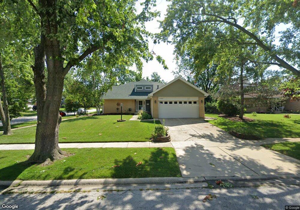
15349 Michaele Dr Oak Forest, IL 60452
Estimated Value: $365,585 - $462,000
4
Beds
3
Baths
2,486
Sq Ft
$164/Sq Ft
Est. Value
About This Home
This home is located at 15349 Michaele Dr, Oak Forest, IL 60452 and is currently estimated at $407,646, approximately $163 per square foot. 15349 Michaele Dr is a home located in Cook County with nearby schools including Lee R Foster Elementary School, Jack Hille Middle School, and Oak Forest High School.
Ownership History
Date
Name
Owned For
Owner Type
Purchase Details
Closed on
Jan 12, 2019
Sold by
Kneisler Pennelope J
Bought by
Pennelope J Kneisler 2019 Living Trust
Current Estimated Value
Purchase Details
Closed on
May 18, 1995
Sold by
Scharf Edith R
Bought by
Kneisler Pennelope J
Home Financials for this Owner
Home Financials are based on the most recent Mortgage that was taken out on this home.
Original Mortgage
$100,000
Interest Rate
8.26%
Create a Home Valuation Report for This Property
The Home Valuation Report is an in-depth analysis detailing your home's value as well as a comparison with similar homes in the area
Home Values in the Area
Average Home Value in this Area
Purchase History
| Date | Buyer | Sale Price | Title Company |
|---|---|---|---|
| Pennelope J Kneisler 2019 Living Trust | -- | Attorney | |
| Kneisler Pennelope J | $139,000 | -- |
Source: Public Records
Mortgage History
| Date | Status | Borrower | Loan Amount |
|---|---|---|---|
| Closed | Kneisler Pennelope J | $100,000 |
Source: Public Records
Tax History Compared to Growth
Tax History
| Year | Tax Paid | Tax Assessment Tax Assessment Total Assessment is a certain percentage of the fair market value that is determined by local assessors to be the total taxable value of land and additions on the property. | Land | Improvement |
|---|---|---|---|---|
| 2024 | $9,386 | $30,000 | $4,590 | $25,410 |
| 2023 | $6,765 | $30,000 | $4,590 | $25,410 |
| 2022 | $6,765 | $22,269 | $4,080 | $18,189 |
| 2021 | $6,664 | $22,269 | $4,080 | $18,189 |
| 2020 | $6,569 | $22,269 | $4,080 | $18,189 |
| 2019 | $6,756 | $22,945 | $3,825 | $19,120 |
| 2018 | $6,638 | $22,945 | $3,825 | $19,120 |
| 2017 | $6,703 | $22,945 | $3,825 | $19,120 |
| 2016 | $5,369 | $17,347 | $3,570 | $13,777 |
| 2015 | $5,905 | $17,347 | $3,570 | $13,777 |
| 2014 | $5,755 | $17,347 | $3,570 | $13,777 |
| 2013 | $6,259 | $20,561 | $3,570 | $16,991 |
Source: Public Records
Map
Nearby Homes
- 5556 Natalie Dr
- 16207 Long Ave
- 5341 Crescent Ln Unit D
- 5340 Crescent Ln Unit C
- 5313 Crescent Green Ln
- 5237 Diamond Dr Unit B
- 5218 Laramie Ct
- 15100 Crescent Green Dr
- 15210 Laramie Ave
- 5726 Lancaster Dr
- 15143 Geoffrey Rd
- 5756 Lancaster Dr
- 5653 Dover Rd
- 5117 154th St
- 15601 Latrobe Ave
- 5735 Dover Rd
- 17301 Lockwood Ave
- 15201 Briar Ln
- 15641 Laramie Ave
- 16352 169 Lot #15 Place
- 15355 Michaele Dr
- 15350 Natalie Dr
- 15361 Michaele Dr
- 15356 Natalie Dr
- 5476 Natalie Dr
- 5482 Natalie Dr
- 15350 Michaele Dr
- 5470 Natalie Dr
- 15362 Natalie Dr
- 15356 Michaele Dr
- 5488 Natalie Dr
- 15367 Michaele Dr
- 15362 Michaele Dr Unit 1103
- 15362 Michaele Dr
- 5464 Natalie Dr
- 5494 Natalie Dr
- 15368 Natalie Dr
- 5458 Natalie Dr
- 15368 Michaele Dr
- 15373 Michaele Dr