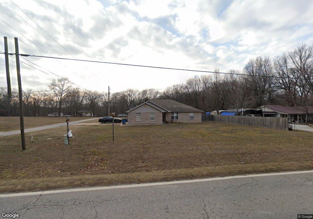
1535 S Curtis Ave Pea Ridge, AR 72751
Estimated Value: $315,000 - $609,000
--
Bed
2
Baths
3,092
Sq Ft
$145/Sq Ft
Est. Value
About This Home
This home is located at 1535 S Curtis Ave, Pea Ridge, AR 72751 and is currently estimated at $447,561, approximately $144 per square foot. 1535 S Curtis Ave is a home located in Benton County with nearby schools including Pea Ridge Intermediate School, Pea Ridge Primary School, and Pea Ridge Middle School.
Ownership History
Date
Name
Owned For
Owner Type
Purchase Details
Closed on
Sep 17, 2024
Sold by
Lois S Richardson Revocable Trust and Richardson Lois S
Bought by
Lois S Richardson Llc
Current Estimated Value
Purchase Details
Closed on
May 12, 2023
Sold by
Richardson Lois S and Richardson Lloyd D
Bought by
Richardson Lois S and Richardson Lloyd D
Purchase Details
Closed on
Feb 6, 1997
Bought by
Richardson
Purchase Details
Closed on
Nov 30, 1993
Bought by
Burrell
Create a Home Valuation Report for This Property
The Home Valuation Report is an in-depth analysis detailing your home's value as well as a comparison with similar homes in the area
Home Values in the Area
Average Home Value in this Area
Purchase History
| Date | Buyer | Sale Price | Title Company |
|---|---|---|---|
| Lois S Richardson Llc | -- | None Listed On Document | |
| Richardson Lois S | -- | None Listed On Document | |
| Richardson | $9,000 | -- | |
| Burrell | $9,000 | -- |
Source: Public Records
Tax History Compared to Growth
Tax History
| Year | Tax Paid | Tax Assessment Tax Assessment Total Assessment is a certain percentage of the fair market value that is determined by local assessors to be the total taxable value of land and additions on the property. | Land | Improvement |
|---|---|---|---|---|
| 2025 | $4,308 | $93,197 | $10,000 | $83,197 |
| 2024 | $4,051 | $93,197 | $10,000 | $83,197 |
| 2023 | $3,683 | $70,090 | $3,800 | $66,290 |
| 2022 | $3,543 | $70,090 | $3,800 | $66,290 |
| 2021 | $3,223 | $70,090 | $3,800 | $66,290 |
| 2020 | $3,027 | $49,780 | $1,500 | $48,280 |
| 2019 | $3,027 | $49,780 | $1,500 | $48,280 |
| 2018 | $3,027 | $49,780 | $1,500 | $48,280 |
| 2017 | $2,565 | $49,780 | $1,500 | $48,280 |
| 2016 | $2,565 | $49,780 | $1,500 | $48,280 |
| 2015 | $2,320 | $40,770 | $3,200 | $37,570 |
| 2014 | $2,320 | $40,770 | $3,200 | $37,570 |
Source: Public Records
Map
Nearby Homes
- 1616 S Curtis Ave
- 1330 S Curtis Ave
- TBD Pace Ln
- 1272 Pace Ln
- 1660 Conrad St
- 1306 Shepherd St
- 1172 Nemett Dr
- 542 Oneida Cir
- 738 Cardin Spur
- 561 Oneida Cir
- 560 Forrest Dr
- 575 Sugar Creek Rd
- 500 Fox Cir
- 215 Hunt St
- 499 S Davis St
- 0 S Davis St
- 21.4 AC Sugar Creek Rd
- 21 AC Sugar Creek Rd
- 0 Sugar Creek Rd
- 5AC Captain Miller Blvd
- 1503 S Curtis Ave
- 1502 S Curtis Ave Unit 49
- 1631 S Curtis Ave
- 1631 S Curtis Ave
- 1588 S Curtis Ave
- 1464 S Curtis Ave
- 1403 S Curtis Ave
- 1689 S Curtis Ave
- 1689 S Curtis Ave
- 1644 S Curtis Ave
- 1644 S Curtis Ave
- 106 Cardin Rd
- 1389 S Curtis Ave
- 110 Cardin Rd
- 1589 Jenks Ct
- 1601 Jenks Ct
- 1.133AC S Curtis Ave
- 1217 Pace Ln
- 1637 Jenks Ct
- 1698 S Curtis Ave