Estimated Value: $263,788 - $329,000
2
Beds
2
Baths
1,425
Sq Ft
$208/Sq Ft
Est. Value
About This Home
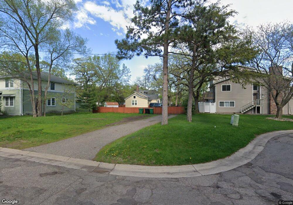
This home is located at 1535 S Ferry St, Anoka, MN 55303 and is currently estimated at $295,947, approximately $207 per square foot. 1535 S Ferry St is a home located in Anoka County with nearby schools including Franklin Elementary School, Anoka Middle School for the Arts - Fred Moor Campus, and Anoka Senior High School.
Ownership History
Date
Name
Owned For
Owner Type
Purchase Details
Closed on
Oct 12, 2018
Sold by
Winberg Julie and Winberg Donald
Bought by
Deuel David J
Current Estimated Value
Home Financials for this Owner
Home Financials are based on the most recent Mortgage that was taken out on this home.
Original Mortgage
$126,500
Outstanding Balance
$110,550
Interest Rate
4.6%
Mortgage Type
New Conventional
Estimated Equity
$185,397
Purchase Details
Closed on
Oct 26, 2006
Sold by
Simo Properties Llc
Bought by
Kaufmann Julie E
Home Financials for this Owner
Home Financials are based on the most recent Mortgage that was taken out on this home.
Original Mortgage
$134,400
Interest Rate
6.38%
Mortgage Type
New Conventional
Purchase Details
Closed on
Feb 2, 2001
Sold by
Peterson Rick D and Peterson Denim L
Bought by
State Of Minnesota Dept Of Transportatio
Create a Home Valuation Report for This Property
The Home Valuation Report is an in-depth analysis detailing your home's value as well as a comparison with similar homes in the area
Home Values in the Area
Average Home Value in this Area
Purchase History
| Date | Buyer | Sale Price | Title Company |
|---|---|---|---|
| Deuel David J | $187,500 | Stewart Title | |
| Kaufmann Julie E | $141,500 | -- | |
| State Of Minnesota Dept Of Transportatio | $11,000 | -- |
Source: Public Records
Mortgage History
| Date | Status | Borrower | Loan Amount |
|---|---|---|---|
| Open | Deuel David J | $126,500 | |
| Previous Owner | Kaufmann Julie E | $134,400 |
Source: Public Records
Tax History Compared to Growth
Tax History
| Year | Tax Paid | Tax Assessment Tax Assessment Total Assessment is a certain percentage of the fair market value that is determined by local assessors to be the total taxable value of land and additions on the property. | Land | Improvement |
|---|---|---|---|---|
| 2025 | $2,468 | $241,800 | $75,000 | $166,800 |
| 2024 | $2,468 | $244,300 | $75,000 | $169,300 |
| 2023 | $2,216 | $253,100 | $75,000 | $178,100 |
| 2022 | $2,051 | $245,800 | $58,000 | $187,800 |
| 2021 | $2,062 | $204,400 | $51,700 | $152,700 |
| 2020 | $1,970 | $200,700 | $58,000 | $142,700 |
| 2019 | $1,502 | $185,800 | $50,000 | $135,800 |
| 2018 | $1,423 | $144,200 | $0 | $0 |
| 2017 | $1,280 | $133,900 | $0 | $0 |
| 2016 | $1,310 | $121,400 | $0 | $0 |
| 2015 | -- | $121,400 | $52,000 | $69,400 |
| 2014 | -- | $98,800 | $37,000 | $61,800 |
Source: Public Records
Map
Nearby Homes
- 1722 River Pointe Place Unit 702
- 1625 3rd Ave
- 504 Douglas St
- 706 Benton St
- 525 Western St
- 535 W River Pkwy
- 307 Sunrise Ln
- 1130 5th Ave
- xxxx Washington St
- 742 Washington St
- 426 Taylor St
- 1032 Fremont St
- 1102 Benton St
- 618 Tyler St
- 834 Brisbin St
- 837 Adams St
- 12941 Saratoga Ln N
- 6xx Pierce St
- 1224 8th Ln
- 845 Bradford Ave
- 1518 Franklin Ln
- 1520 Franklin Ln
- 1540 Franklin Ln
- 1522 Franklin Ln
- 1524 Franklin Ln
- 1510 Franklin Ln
- 1512 Franklin Ln
- 1514 Franklin Ln
- 1516 Franklin Ln
- 1548 Franklin Ln
- 1525 Franklin Ln
- 1533 Franklin Ln
- 1541 Franklin Ln
- 1517 Franklin Ln
- 1506 Franklin Ln
- 1504 Franklin Ln
- 1556 Franklin Ln
- 1501 Franklin Ln
- 1508 Franklin Ln
- 1509 Franklin Ln