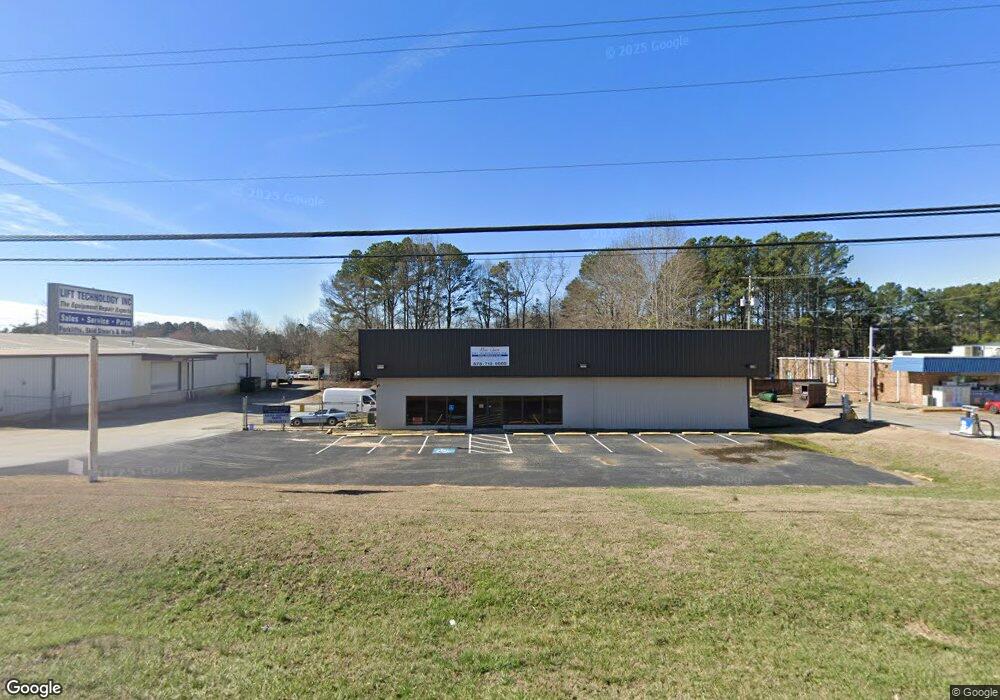
1536 S Broad St Monroe, GA 30655
Estimated Value: $603,238
--
Bed
--
Bath
8,000
Sq Ft
$75/Sq Ft
Est. Value
About This Home
This home is located at 1536 S Broad St, Monroe, GA 30655 and is currently estimated at $603,238, approximately $75 per square foot. 1536 S Broad St is a home located in Walton County with nearby schools including Atha Road Elementary School, Youth Middle School, and Walnut Grove High School.
Ownership History
Date
Name
Owned For
Owner Type
Purchase Details
Closed on
Feb 5, 2020
Sold by
Hutchins Linda
Bought by
Pp Property Management Llc
Current Estimated Value
Home Financials for this Owner
Home Financials are based on the most recent Mortgage that was taken out on this home.
Original Mortgage
$262,500
Outstanding Balance
$207,053
Interest Rate
3.6%
Mortgage Type
Commercial
Estimated Equity
$396,185
Purchase Details
Closed on
Jun 6, 2008
Sold by
Hutchins Wendell M
Bought by
Hutchins Wendell M Family
Purchase Details
Closed on
Mar 30, 1992
Bought by
Phelps Joe
Create a Home Valuation Report for This Property
The Home Valuation Report is an in-depth analysis detailing your home's value as well as a comparison with similar homes in the area
Home Values in the Area
Average Home Value in this Area
Purchase History
| Date | Buyer | Sale Price | Title Company |
|---|---|---|---|
| Pp Property Management Llc | $350,000 | -- | |
| Hutchins Wendell M Family | -- | -- | |
| Phelps Joe | -- | -- |
Source: Public Records
Mortgage History
| Date | Status | Borrower | Loan Amount |
|---|---|---|---|
| Open | Pp Property Management Llc | $262,500 |
Source: Public Records
Tax History Compared to Growth
Tax History
| Year | Tax Paid | Tax Assessment Tax Assessment Total Assessment is a certain percentage of the fair market value that is determined by local assessors to be the total taxable value of land and additions on the property. | Land | Improvement |
|---|---|---|---|---|
| 2024 | $8,581 | $252,096 | $69,000 | $183,096 |
| 2023 | $7,753 | $221,736 | $69,000 | $152,736 |
| 2022 | $4,833 | $129,416 | $19,200 | $110,216 |
| 2021 | $4,827 | $124,896 | $19,200 | $105,696 |
| 2020 | $4,954 | $124,896 | $19,200 | $105,696 |
| 2019 | $3,212 | $80,736 | $19,200 | $61,536 |
| 2018 | $3,180 | $80,736 | $19,200 | $61,536 |
| 2017 | $3,384 | $80,736 | $19,200 | $61,536 |
| 2016 | $3,188 | $77,332 | $19,200 | $58,132 |
| 2015 | $3,245 | $77,332 | $19,200 | $58,132 |
| 2014 | $3,357 | $77,668 | $19,200 | $58,468 |
Source: Public Records
Map
Nearby Homes
- 1328 S Madison Ave
- 208 1/2 Atha St
- 1230 S Madison Ave
- 206 Walker Dr
- 132 Victory Dr
- 1107 S Madison Ave
- 309 Magnolia Ln
- 545 Bridgeport Place
- 126 6th St
- 623 Oakwood Ln
- 143 W 5th St
- 709 S Madison Ave
- 0 Dial Rd Unit 10443881
- 0 Dial Rd Unit 7506285
- 725 Wheel House Ln Unit B
- 808 S Broad St
- 739 Wheel House Ln Unit B
- 739 Wheel House Ln
- 736 Wheel House Ln Unit B
- 736 Wheel House Ln
- 1557 S Broad St
- 1547 S Broad St
- 1446 S Broad St
- 1445 S Broad St
- 433 White Oak Way
- 400 White Oak Way
- 400 White Oak Way
- 424 White Oak Way
- 1439 S Broad St
- 1432 S Broad St
- 1328 S Madison Ave
- 1328 S Madison Ave Unit 374
- 1620 S Broad St
- 1334 S Madison Ave
- 1435 S Broad St
- 1346 S Madison Ave
- 1336 S Madison Ave
- 1431 S Broad St
- 1427 S Broad St
- 115 Vine St