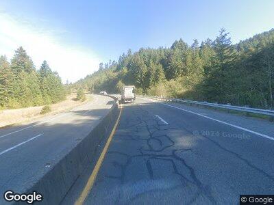
Estimated Value: $215,000 - $429,000
2
Beds
1
Bath
1,368
Sq Ft
$220/Sq Ft
Est. Value
About This Home
This home is located at 153657 Highway 101, Forks, WA 98331 and is currently estimated at $300,994, approximately $220 per square foot. 153657 Highway 101 is a home with nearby schools including Queets-Clearwater Elementary School.
Ownership History
Date
Name
Owned For
Owner Type
Purchase Details
Closed on
Mar 10, 2023
Sold by
Flannery Gregory Robert
Bought by
Gregory And Anne Flannery Living Trust
Current Estimated Value
Purchase Details
Closed on
Mar 9, 2017
Sold by
Rauma Mary Kay
Bought by
Olson Donald R and Olson Betty G
Purchase Details
Closed on
Jan 12, 2016
Sold by
Olson Donald R and Olson Betty G
Bought by
Rauma Mary Kay
Purchase Details
Closed on
Sep 11, 2015
Sold by
Schroeder Robert O and Schroeder Carrie D
Bought by
Olson Donald R and Olson Betty G
Purchase Details
Closed on
Mar 26, 2014
Sold by
Donaldson James A and Donaldson Merrily D
Bought by
Flannery Gregory Robert and Flannery Anne Donaldson
Purchase Details
Closed on
Feb 27, 2007
Sold by
Flannery Anne Donaldson
Bought by
Donaldson James A and Donaldson Merrilyn D
Create a Home Valuation Report for This Property
The Home Valuation Report is an in-depth analysis detailing your home's value as well as a comparison with similar homes in the area
Home Values in the Area
Average Home Value in this Area
Purchase History
| Date | Buyer | Sale Price | Title Company |
|---|---|---|---|
| Gregory And Anne Flannery Living Trust | -- | None Listed On Document | |
| Olson Donald R | -- | None Available | |
| Rauma Mary Kay | $280 | None Available | |
| Olson Donald R | $95,000 | First American Title | |
| Flannery Gregory Robert | $1,415 | First American Title | |
| Donaldson James A | -- | None Available |
Source: Public Records
Tax History Compared to Growth
Tax History
| Year | Tax Paid | Tax Assessment Tax Assessment Total Assessment is a certain percentage of the fair market value that is determined by local assessors to be the total taxable value of land and additions on the property. | Land | Improvement |
|---|---|---|---|---|
| 2023 | $1,359 | $208,342 | $135,300 | $73,042 |
| 2022 | $1,598 | $208,342 | $135,300 | $73,042 |
| 2021 | $1,682 | $190,752 | $124,350 | $66,402 |
| 2020 | $1,554 | $187,432 | $124,350 | $63,082 |
| 2019 | $1,453 | $180,852 | $124,350 | $56,502 |
| 2018 | $1,670 | $180,852 | $124,350 | $56,502 |
| 2017 | $1,499 | $180,852 | $124,350 | $56,502 |
| 2016 | $1,505 | $180,852 | $124,350 | $56,502 |
| 2015 | $1,532 | $180,852 | $124,350 | $56,502 |
| 2014 | -- | $194,140 | $122,540 | $71,600 |
| 2013 | -- | $209,850 | $138,250 | $71,600 |
Source: Public Records
Map
Nearby Homes
- 0 Lot 27 Cape Elizabeth Rd
- 3955 Clearwater Rd
- 2868 Clearwater Rd
- 0 Oil City Rd Unit NWM2361765
- 99994 Dowan Creek Rd
- 99993 Dowan Creek Rd
- 99992 Dowan Creek Rd
- 99991 Dowan Creek Rd
- 107 Dowan Creek Rd
- 3142 Undie Rd
- 0 Moclips Hill Ln
- 50 Moclips Hill Ln
- 11 Lake Dr N
- 4832 Pacific Ave
- 63 Lake Dr N
- 4830 Pacific Ave
- 48340 NW Pacific Blvd
- 2801 Rd
- 4890 Railroad Ave Unit 11 B
- 48410 Pacific Ave
