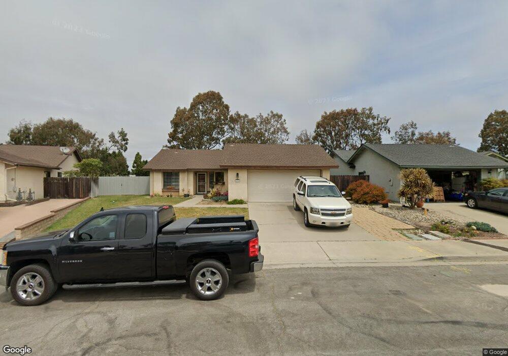
1537 Andrews Ave Lompoc, CA 93436
Estimated Value: $617,335 - $663,000
3
Beds
2
Baths
1,428
Sq Ft
$449/Sq Ft
Est. Value
About This Home
This home is located at 1537 Andrews Ave, Lompoc, CA 93436 and is currently estimated at $640,834, approximately $448 per square foot. 1537 Andrews Ave is a home located in Santa Barbara County with nearby schools including Clarence Ruth Elementary School, Lompoc Valley Middle School, and Lompoc High School.
Ownership History
Date
Name
Owned For
Owner Type
Purchase Details
Closed on
Nov 29, 2022
Sold by
Leiting Joseph A and Leiting Christina W
Bought by
Leiting Family Trust and Leiting
Current Estimated Value
Purchase Details
Closed on
Mar 4, 2021
Sold by
Hawthorne Alexander T and Hawthorne Monica L
Bought by
Leiting Joseph A and Leiting Christina W
Home Financials for this Owner
Home Financials are based on the most recent Mortgage that was taken out on this home.
Original Mortgage
$471,306
Interest Rate
2.73%
Mortgage Type
FHA
Purchase Details
Closed on
May 1, 2007
Sold by
Hill Harold Randall and Hill Judy Kay
Bought by
Hawthorne Alexander T and Hawthorne Monica L
Home Financials for this Owner
Home Financials are based on the most recent Mortgage that was taken out on this home.
Original Mortgage
$413,707
Interest Rate
6.12%
Mortgage Type
VA
Purchase Details
Closed on
Apr 10, 1995
Sold by
Hill Harold R and Hill Judy K
Bought by
Hill Harold Randall and Hill Judy Kay
Home Financials for this Owner
Home Financials are based on the most recent Mortgage that was taken out on this home.
Original Mortgage
$104,000
Interest Rate
8.44%
Create a Home Valuation Report for This Property
The Home Valuation Report is an in-depth analysis detailing your home's value as well as a comparison with similar homes in the area
Home Values in the Area
Average Home Value in this Area
Purchase History
We collect this data history from publicly available records. To have your information removed, we recommend requesting removal directly through your county’s website.
| Date | Buyer | Sale Price | Title Company |
|---|---|---|---|
| Leiting Family Trust | -- | None Listed On Document | |
| Leiting Joseph A | $480,000 | Fidelity National Title Co | |
| Hawthorne Alexander T | $405,000 | Chicago Title Company | |
| Hill Harold Randall | -- | Fidelity National Title |
Source: Public Records
Mortgage History
We collect this data history from publicly available records. To have your information removed, we recommend requesting removal directly through your county’s website.
| Date | Status | Borrower | Loan Amount |
|---|---|---|---|
| Previous Owner | Leiting Joseph A | $471,306 | |
| Previous Owner | Hawthorne Alexander T | $413,707 | |
| Previous Owner | Hill Harold Randall | $104,000 |
Source: Public Records
Tax History
| Year | Tax Paid | Tax Assessment Tax Assessment Total Assessment is a certain percentage of the fair market value that is determined by local assessors to be the total taxable value of land and additions on the property. | Land | Improvement |
|---|---|---|---|---|
| 2025 | $5,574 | $519,565 | $162,364 | $357,201 |
| 2023 | $5,574 | $499,392 | $156,060 | $343,332 |
| 2022 | $5,476 | $489,600 | $153,000 | $336,600 |
| 2021 | $5,537 | $480,000 | $200,000 | $280,000 |
| 2020 | $3,910 | $340,000 | $189,000 | $151,000 |
| 2019 | $3,922 | $340,000 | $189,000 | $151,000 |
| 2018 | $3,751 | $324,000 | $180,000 | $144,000 |
| 2017 | $3,580 | $309,000 | $172,000 | $137,000 |
| 2016 | $3,256 | $281,000 | $156,000 | $125,000 |
| 2014 | $2,716 | $232,000 | $129,000 | $103,000 |
Source: Public Records
Map
Nearby Homes
- 1114 Point Sal Loop
- 1103 Point Sal Loop
- 2212 Meridian Way
- 1444 Village Meadows Dr
- 921 N Z St
- 1340 Jason Dr
- 1513 W Lemon Ave
- 1308 Jason Dr
- 1621 W Pine Ave
- 1213 Iris Ct
- 1504 W Airport Ave
- 1249 Westbrook Dr
- 1309 Stonebrook Dr
- 923 N N Place
- 516 N U St
- 1257 Stonebrook Dr
- 1248 Stonebrook Dr
- 901 Floradale Ave
- 1426 Plum Ave
- 904 W College Ave
- 1537 Andrews Dr
- 1533 Andrews Dr
- 1541 Andrews Dr
- 1529 Andrews Dr
- 1124 N Y St
- 1129 N X St
- 1129 1weup730ors7 X 1weup77skjsk
- 1525 Andrews Dr
- 1125 N X St
- 1120 N Y St
- 1521 Andrews Dr
- 1128 N X St
- 1121 N X St Unit N
- 1121 N X St
- 1116 N Y St
- 1517 Andrews Dr
- 1517 Andrews Ave
- 1275 N V St
- 1124 N X St
- 1117 N X St
Your Personal Tour Guide
Ask me questions while you tour the home.