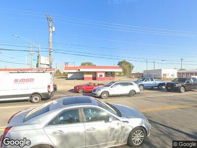
1538 N Keowee St Dayton, OH 45404
McCook Field NeighborhoodEstimated Value: $163,765
--
Bed
--
Bath
3,600
Sq Ft
$45/Sq Ft
Est. Value
About This Home
This home is located at 1538 N Keowee St, Dayton, OH 45404 and is currently estimated at $163,765, approximately $45 per square foot. 1538 N Keowee St is a home located in Montgomery County with nearby schools including Kiser Elementary, Ruskin Elementary School, and Deca Prep.
Ownership History
Date
Name
Owned For
Owner Type
Purchase Details
Closed on
Jan 4, 2023
Sold by
Shteiwi Limited Liability Company
Bought by
R & R Takhar Llc
Current Estimated Value
Purchase Details
Closed on
Aug 19, 2015
Sold by
The Shteiwi Limited Liability Company
Bought by
City Of Dayton
Purchase Details
Closed on
Nov 7, 1997
Sold by
Friedman Barry A and Timbanard Joann
Bought by
Shteiwi Ltd Liability Company
Create a Home Valuation Report for This Property
The Home Valuation Report is an in-depth analysis detailing your home's value as well as a comparison with similar homes in the area
Home Values in the Area
Average Home Value in this Area
Purchase History
| Date | Buyer | Sale Price | Title Company |
|---|---|---|---|
| R & R Takhar Llc | $135,000 | First American Title | |
| City Of Dayton | $270 | None Available | |
| Shteiwi Ltd Liability Company | $140,000 | -- |
Source: Public Records
Tax History Compared to Growth
Tax History
| Year | Tax Paid | Tax Assessment Tax Assessment Total Assessment is a certain percentage of the fair market value that is determined by local assessors to be the total taxable value of land and additions on the property. | Land | Improvement |
|---|---|---|---|---|
| 2024 | $4,878 | $47,890 | $11,840 | $36,050 |
| 2023 | $4,878 | $47,890 | $11,840 | $36,050 |
| 2022 | $5,850 | $46,050 | $11,390 | $34,660 |
| 2021 | $5,903 | $46,050 | $11,390 | $34,660 |
| 2020 | $5,931 | $46,050 | $11,390 | $34,660 |
| 2019 | $6,279 | $47,790 | $11,390 | $36,400 |
| 2018 | $6,296 | $47,790 | $11,390 | $36,400 |
| 2017 | $6,285 | $47,790 | $11,390 | $36,400 |
| 2016 | $6,439 | $47,790 | $11,390 | $36,400 |
| 2015 | $6,573 | $51,050 | $14,650 | $36,400 |
| 2014 | $6,573 | $51,050 | $14,650 | $36,400 |
| 2012 | -- | $48,710 | $15,900 | $32,810 |
Source: Public Records
Map
Nearby Homes
- 2139 Ome Ave
- 2400 Ome Ave
- 2005 Ontario Ave
- 2739 Lindale Ave
- 2946 Lindale Ave
- 1309 Leonhard St
- 520 Deeds Ave
- 1827 Woodhaven Ave
- 625 Maryland Ave
- 930 Webster St Unit 932
- 423 Deeds Ave
- 924 Webster St
- 78 Vincent St
- 406 Deeds Ave
- 531 Maryland Ave
- 729 Troy St
- 136 E Hudson Ave
- 42 Mary Ave
- 260 Grove Ave
- 46 Glenwood Ave Unit 46 48
