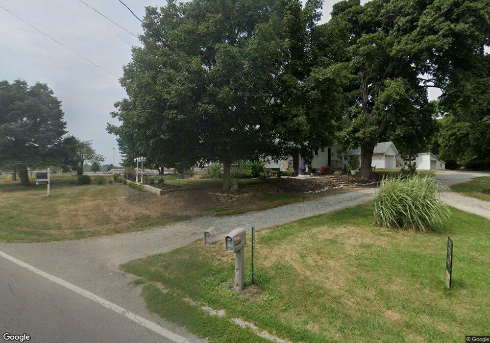
15385 State Route 67 Kenton, OH 43326
Estimated Value: $716,245
3
Beds
2
Baths
1,978
Sq Ft
$362/Sq Ft
Est. Value
About This Home
This home is located at 15385 State Route 67, Kenton, OH 43326 and is currently estimated at $716,245, approximately $362 per square foot. 15385 State Route 67 is a home located in Hardin County with nearby schools including Kenton Elementary School, Kenton Middle School, and Kenton High School.
Ownership History
Date
Name
Owned For
Owner Type
Purchase Details
Closed on
Oct 25, 2023
Sold by
Kaylor Hugh W and Kaylor Kristen A
Bought by
Ohio Power Company
Current Estimated Value
Purchase Details
Closed on
Oct 7, 2022
Sold by
Kaylor Hugh W
Bought by
Striff Timothy L and Striff Cheryl L
Home Financials for this Owner
Home Financials are based on the most recent Mortgage that was taken out on this home.
Original Mortgage
$132,905
Interest Rate
5.66%
Mortgage Type
New Conventional
Purchase Details
Closed on
Jun 3, 2013
Sold by
Kaylor Hugh W and Kaylor Kristen A
Bought by
Kaylor Hugh W and Kaylor Kristen A
Purchase Details
Closed on
Aug 24, 1993
Bought by
Kaylor Dorothy V Revocab
Create a Home Valuation Report for This Property
The Home Valuation Report is an in-depth analysis detailing your home's value as well as a comparison with similar homes in the area
Home Values in the Area
Average Home Value in this Area
Purchase History
| Date | Buyer | Sale Price | Title Company |
|---|---|---|---|
| Ohio Power Company | $625,000 | Whitman Title | |
| Striff Timothy L | $139,900 | -- | |
| Kaylor Hugh W | -- | None Available | |
| Kaylor Dorothy V Revocab | -- | -- |
Source: Public Records
Mortgage History
| Date | Status | Borrower | Loan Amount |
|---|---|---|---|
| Previous Owner | Striff Timothy L | $132,905 |
Source: Public Records
Tax History Compared to Growth
Tax History
| Year | Tax Paid | Tax Assessment Tax Assessment Total Assessment is a certain percentage of the fair market value that is determined by local assessors to be the total taxable value of land and additions on the property. | Land | Improvement |
|---|---|---|---|---|
| 2024 | $7,841 | $58,360 | $58,360 | $0 |
| 2023 | $7,841 | $25,260 | $25,260 | $0 |
| 2022 | $670 | $40,840 | $16,460 | $24,380 |
| 2021 | $2,005 | $40,840 | $16,460 | $24,380 |
| 2020 | $1,753 | $40,840 | $16,460 | $24,380 |
| 2019 | $2,035 | $48,980 | $25,590 | $23,390 |
| 2018 | $1,985 | $48,980 | $25,590 | $23,390 |
| 2017 | $1,972 | $48,980 | $25,590 | $23,390 |
| 2016 | $1,975 | $51,490 | $32,940 | $18,550 |
| 2015 | $1,906 | $51,490 | $32,940 | $18,550 |
| 2014 | $1,029 | $51,440 | $32,890 | $18,550 |
| 2013 | $733 | $34,520 | $15,970 | $18,550 |
Source: Public Records
Map
Nearby Homes
- 125 Hester St
- 460 Oriental St
- 79 Broadway St
- 777 Maydoll Dr
- 115 Scioto St
- 618 N High St
- 530 E Franklin St
- 513 E Franklin St
- 506 E Franklin St
- 215 Henry St
- 324 E North St
- 416 N Cherry St
- 602 N Wayne St
- 121 S High St
- 510 Decatur St
- 233 N Main St
- 328 N Detroit St
- 120 E Ohio St
- 12126 Pamela Dr
- 12160 Pamela Dr
- 15385 State Route 67
- 000 Sr 67 E
- 0 Sr 67 Morningside Dr Unit 207851
- 0 0 Morning Side Dr
- 0 Morningside Dr
- 999 E Columbus St
- 989 E Columbus St
- 980 Meadow Ln
- 977 E Columbus St
- 995 Meadow Ln
- 985 Meadow Ln
- 815 Morningside Dr
- 15694 State Route 67
- 867 Summit St
- 195 Hester St
- 175 Hester St
- 155 Hester St
- 826 Summit St
- 822 Summit St