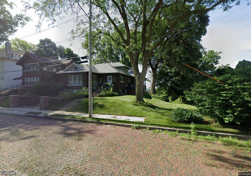
1539 Clay St Davenport, IA 52804
Riverview Terrace NeighborhoodEstimated Value: $147,000 - $209,000
4
Beds
2
Baths
1,885
Sq Ft
$92/Sq Ft
Est. Value
About This Home
This home is located at 1539 Clay St, Davenport, IA 52804 and is currently estimated at $173,781, approximately $92 per square foot. 1539 Clay St is a home located in Scott County with nearby schools including Walnut Hill Elementary School, South Christian Elementary School, and Christian County Middle School.
Ownership History
Date
Name
Owned For
Owner Type
Purchase Details
Closed on
Oct 30, 2020
Sold by
Merle E Arp Marital Trust and Arp Jean W
Bought by
Arps And Krafts Farm Llc
Current Estimated Value
Purchase Details
Closed on
Oct 14, 2020
Sold by
Kraft Kent and Kraft Wendy
Bought by
Arps And Krafts Farm Llc
Purchase Details
Closed on
Dec 5, 2019
Sold by
Kraft Wendy K
Bought by
Wendt K Kraft Ret
Create a Home Valuation Report for This Property
The Home Valuation Report is an in-depth analysis detailing your home's value as well as a comparison with similar homes in the area
Home Values in the Area
Average Home Value in this Area
Purchase History
| Date | Buyer | Sale Price | Title Company |
|---|---|---|---|
| Arps And Krafts Farm Llc | -- | None Listed On Document | |
| Arps And Krafts Farm Llc | -- | None Available | |
| Wendt K Kraft Ret | -- | None Available |
Source: Public Records
Tax History Compared to Growth
Tax History
| Year | Tax Paid | Tax Assessment Tax Assessment Total Assessment is a certain percentage of the fair market value that is determined by local assessors to be the total taxable value of land and additions on the property. | Land | Improvement |
|---|---|---|---|---|
| 2025 | $2,522 | $151,340 | $21,040 | $130,300 |
| 2024 | $2,456 | $151,340 | $21,040 | $130,300 |
| 2023 | $2,464 | $151,340 | $21,040 | $130,300 |
| 2022 | $2,474 | $124,250 | $21,040 | $103,210 |
| 2021 | $2,474 | $124,250 | $21,040 | $103,210 |
| 2020 | $2,384 | $118,520 | $21,040 | $97,480 |
| 2019 | $2,332 | $112,490 | $21,040 | $91,450 |
| 2018 | $2,154 | $112,490 | $21,040 | $91,450 |
| 2017 | $2,234 | $106,760 | $21,040 | $85,720 |
| 2016 | $2,148 | $106,764 | $0 | $0 |
| 2015 | $2,148 | $108,444 | $0 | $0 |
| 2014 | $2,216 | $108,444 | $0 | $0 |
| 2013 | $2,172 | $0 | $0 | $0 |
| 2012 | -- | $114,524 | $24,410 | $90,114 |
Source: Public Records
Map
Nearby Homes
- 1604 W 9th St
- 1446 Clay St
- 1414 W 9th St
- 1701 W 8th St
- 1445 W 7th St
- 1309 Clay St
- 1505 W 14th St
- 1824 W 8th St
- 1335 W 13th St
- 1854 W 8th St
- 4735 W 12th St
- 1321 W 13th St
- 1419 N Division St
- 1207 N Marquette St
- 817 N Marquette St
- 1119 W 8th St
- 1410 W 4th St
- 1111 W 8th St
- 1604 N Division St
- 1514 N Marquette St