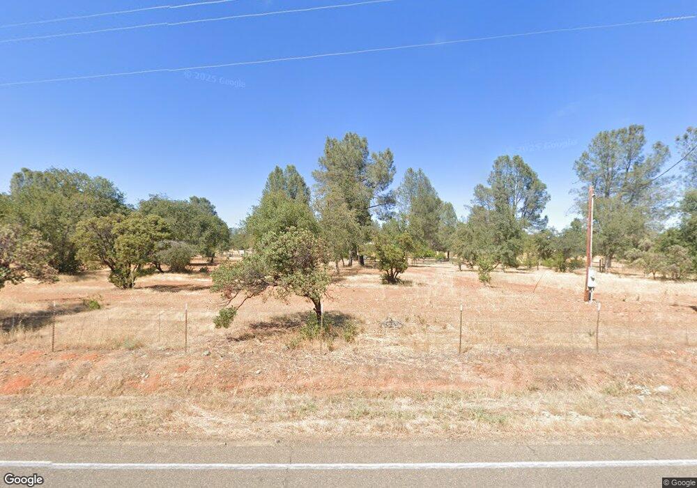
15390 Cloverdale Rd Anderson, CA 96007
Estimated Value: $623,000 - $739,963
4
Beds
3
Baths
2,044
Sq Ft
$333/Sq Ft
Est. Value
About This Home
This home is located at 15390 Cloverdale Rd, Anderson, CA 96007 and is currently estimated at $681,482, approximately $333 per square foot. 15390 Cloverdale Rd is a home located in Shasta County.
Ownership History
Date
Name
Owned For
Owner Type
Purchase Details
Closed on
Jan 3, 2002
Sold by
Clarizio Fred A and Clarizio Patricia A
Bought by
Lipani Michael A and Lipani Colleen
Current Estimated Value
Home Financials for this Owner
Home Financials are based on the most recent Mortgage that was taken out on this home.
Original Mortgage
$189,000
Outstanding Balance
$75,529
Interest Rate
6.73%
Mortgage Type
Seller Take Back
Estimated Equity
$605,953
Purchase Details
Closed on
Jan 26, 2000
Sold by
Shuman Frank W Revoc Trust
Bought by
Clarizio Fred A and Clarizio Patricia A
Create a Home Valuation Report for This Property
The Home Valuation Report is an in-depth analysis detailing your home's value as well as a comparison with similar homes in the area
Home Values in the Area
Average Home Value in this Area
Purchase History
| Date | Buyer | Sale Price | Title Company |
|---|---|---|---|
| Lipani Michael A | $279,000 | Fidelity National Title Co | |
| Clarizio Fred A | $45,000 | Chicago Title Co |
Source: Public Records
Mortgage History
| Date | Status | Borrower | Loan Amount |
|---|---|---|---|
| Open | Lipani Michael A | $189,000 |
Source: Public Records
Tax History Compared to Growth
Tax History
| Year | Tax Paid | Tax Assessment Tax Assessment Total Assessment is a certain percentage of the fair market value that is determined by local assessors to be the total taxable value of land and additions on the property. | Land | Improvement |
|---|---|---|---|---|
| 2025 | $2,191 | $457,044 | $96,011 | $361,033 |
| 2024 | $2,239 | $448,083 | $94,129 | $353,954 |
| 2023 | $2,239 | $439,298 | $92,284 | $347,014 |
| 2022 | $2,314 | $430,685 | $90,475 | $340,210 |
| 2021 | $4,641 | $422,241 | $88,701 | $333,540 |
| 2020 | $4,224 | $384,000 | $105,000 | $279,000 |
| 2019 | $4,016 | $365,000 | $100,000 | $265,000 |
| 2018 | $3,882 | $355,000 | $95,000 | $260,000 |
| 2017 | $3,771 | $340,000 | $80,000 | $260,000 |
| 2016 | $3,549 | $330,000 | $75,000 | $255,000 |
| 2015 | $3,503 | $320,000 | $75,000 | $245,000 |
| 2014 | -- | $313,000 | $60,000 | $253,000 |
Source: Public Records
Map
Nearby Homes
- 0 Cloverdale Rd Unit SN25180858
- 6400 Dale Ln
- 15557 Cloverdale Rd
- 15947 Butterfield Ln
- 17895 Duck Canyon Rd
- 17795 Duck Canyon Rd
- 14485 Small Farms Rd
- 0 Lower Coal Pit Dr Unit 25-3995
- 0 Lower Coal Pit Rd Unit 25-4389
- 14575 Lower Coal Pit Dr
- 40 Acres Heavenly Valley Ln
- 0 Small Farms Dr Unit OC25228200
- 3.97 Acres Renshaw Ln
- 5941 Oak St
- 16433 China Gulch Dr
- 7600 Camino Del Encina Dr
- 6703 High Valley Rd
- 16325 Tacoma Ln
- 15888 El Camino Robles Rd
- 15189 La Paloma Way
- 15400 Cloverdale Rd
- 0 Cloverdale Rd Unit CRSN22122985
- 0 Cloverdale Rd Unit 18-6850
- 0 Cloverdale Rd Unit 10-2429
- 0 Cloverdale Rd Unit 10-217
- 0 Cloverdale Rd Unit 8-3502
- 0 Cloverdale Rd Unit 7-2203
- 0 Cloverdale Rd Unit 4-5079
- 0 Cloverdale Rd Unit 6-5994
- 0 Cloverdale Rd Unit 6-400
- 0 Cloverdale Rd Unit 4-4855
- 0 Cloverdale Rd Unit 3-103369
- 0 Cloverdale Rd Unit 1-93215
- 0 Cloverdale Rd Unit 96-43316
- 0 Cloverdale Rd Unit 13-641
- 0 Cloverdale Rd Unit 19-4622
- 0 Cloverdale Rd Unit 99-81380
- 0 Cloverdale Rd Unit 22-2065
- 0 Cloverdale Rd
- 6546 Dale Ln
