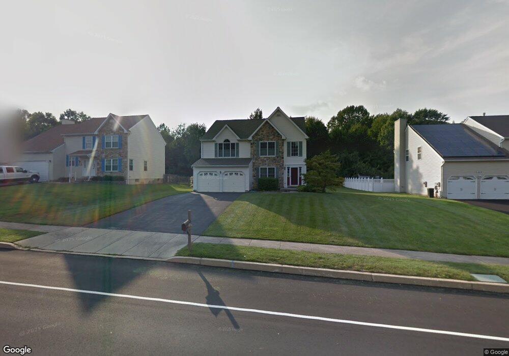
154 Delmont Ave Warminster, PA 18974
Estimated Value: $509,000 - $735,783
4
Beds
3
Baths
2,850
Sq Ft
$229/Sq Ft
Est. Value
About This Home
This home is located at 154 Delmont Ave, Warminster, PA 18974 and is currently estimated at $653,696, approximately $229 per square foot. 154 Delmont Ave is a home located in Bucks County with nearby schools including Willow Dale El School, Log College Middle School, and William Tennent High School.
Ownership History
Date
Name
Owned For
Owner Type
Purchase Details
Closed on
Apr 24, 1998
Sold by
Heritage Woods Edge Lp
Bought by
Dyer Scott and Dyer Jocelyn
Current Estimated Value
Home Financials for this Owner
Home Financials are based on the most recent Mortgage that was taken out on this home.
Original Mortgage
$130,000
Outstanding Balance
$24,699
Interest Rate
7.11%
Estimated Equity
$628,997
Create a Home Valuation Report for This Property
The Home Valuation Report is an in-depth analysis detailing your home's value as well as a comparison with similar homes in the area
Home Values in the Area
Average Home Value in this Area
Purchase History
| Date | Buyer | Sale Price | Title Company |
|---|---|---|---|
| Dyer Scott | $206,900 | -- |
Source: Public Records
Mortgage History
| Date | Status | Borrower | Loan Amount |
|---|---|---|---|
| Open | Dyer Scott | $130,000 |
Source: Public Records
Tax History Compared to Growth
Tax History
| Year | Tax Paid | Tax Assessment Tax Assessment Total Assessment is a certain percentage of the fair market value that is determined by local assessors to be the total taxable value of land and additions on the property. | Land | Improvement |
|---|---|---|---|---|
| 2025 | $8,662 | $41,040 | $6,640 | $34,400 |
| 2024 | $8,662 | $41,040 | $6,640 | $34,400 |
| 2023 | $8,395 | $41,040 | $6,640 | $34,400 |
| 2022 | $8,216 | $41,040 | $6,640 | $34,400 |
| 2021 | $8,025 | $41,040 | $6,640 | $34,400 |
| 2020 | $7,912 | $41,040 | $6,640 | $34,400 |
| 2019 | $7,492 | $41,040 | $6,640 | $34,400 |
| 2018 | $7,313 | $41,040 | $6,640 | $34,400 |
| 2017 | $7,098 | $41,040 | $6,640 | $34,400 |
| 2016 | $7,098 | $41,040 | $6,640 | $34,400 |
| 2015 | $6,852 | $41,040 | $6,640 | $34,400 |
| 2014 | $6,852 | $41,040 | $6,640 | $34,400 |
Source: Public Records
Map
Nearby Homes
- 1277 Beverly Rd
- 1274 Beverly Rd
- 1309 Clyde Rd
- 64 Villa Dr Unit 206
- 100 Villa Dr Unit 224
- 159 Villa Dr Unit 91
- Faraday Plan at Liberty Ridge
- Westmont Plan at Liberty Ridge
- Northbrook Plan at Liberty Ridge
- 1130 Victoria Rd
- 603 Liberty Ridge Rd
- 13 Eagle Ct
- 605 Liberty Ridge Rd
- 607 Liberty Ridge Rd
- 611 Liberty Ridge Rd
- 604 Liberty Ridge Rd
- 616 Liberty Ridge Rd
- 1334 Mallard Cir
- 1002 Windsor Rd
- 442 Acorn Dr
- 164 Delmont Ave
- 144 Delmont Ave
- 134 Delmont Ave
- 174 Delmont Ave
- 157 Delmont Ave
- 163 Delmont Ave
- 149 Delmont Ave
- 141 Delmont Ave
- 184 Delmont Ave
- 124 Delmont Ave
- 171 Delmont Ave
- 133 Delmont Ave
- 179 Delmont Ave
- 194 Delmont Ave
- 104 Delmont Ave
- 148 Wellington Dr
- 154 Wellington Dr
- 1341 Beverly Rd
- 140 Wellington Dr
- 187 Delmont Ave