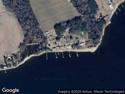
154 Pierson Point Rd Arapahoe, NC 28510
Estimated Value: $151,000 - $727,000
4
Beds
3
Baths
1,458
Sq Ft
$255/Sq Ft
Est. Value
About This Home
This home is located at 154 Pierson Point Rd, Arapahoe, NC 28510 and is currently estimated at $371,237, approximately $254 per square foot. 154 Pierson Point Rd is a home with nearby schools including Pamlico County Primary School, Fred A. Anderson Elementary School, and Pamlico County Middle School.
Ownership History
Date
Name
Owned For
Owner Type
Purchase Details
Closed on
May 4, 2023
Sold by
Whorton Mark
Bought by
Knowles Worlise L and Knowles Lacy
Current Estimated Value
Purchase Details
Closed on
Apr 28, 2023
Sold by
Delorenzo Dave
Bought by
York Kevin Ernest and York Theresa
Purchase Details
Closed on
Apr 25, 2023
Sold by
Parrish Darrell and Parrish Debra
Bought by
Savage Charles N and Savage Frances M
Purchase Details
Closed on
Apr 18, 2023
Sold by
Byrnes Mary Elizabeth
Bought by
Elwood Betsie B
Purchase Details
Closed on
Apr 17, 2023
Sold by
Rogers Kevin L
Bought by
Ethridge David Newton and Kasprzyk Ethridge Jeanine
Purchase Details
Closed on
Jan 11, 2013
Sold by
Hill Marvin Earl
Bought by
Harrison Nancy Hill
Create a Home Valuation Report for This Property
The Home Valuation Report is an in-depth analysis detailing your home's value as well as a comparison with similar homes in the area
Home Values in the Area
Average Home Value in this Area
Purchase History
| Date | Buyer | Sale Price | Title Company |
|---|---|---|---|
| Knowles Worlise L | $352,000 | None Listed On Document | |
| York Kevin Ernest | $300,500 | None Listed On Document | |
| Savage Charles N | $210,000 | None Listed On Document | |
| Elwood Betsie B | $185,000 | None Listed On Document | |
| Ethridge David Newton | $230,000 | None Listed On Document | |
| Harrison Nancy Hill | -- | None Available |
Source: Public Records
Tax History Compared to Growth
Tax History
| Year | Tax Paid | Tax Assessment Tax Assessment Total Assessment is a certain percentage of the fair market value that is determined by local assessors to be the total taxable value of land and additions on the property. | Land | Improvement |
|---|---|---|---|---|
| 2024 | $735 | $105,697 | $47,600 | $58,097 |
| 2023 | $713 | $105,697 | $47,600 | $58,097 |
| 2022 | $703 | $105,697 | $47,600 | $58,097 |
| 2021 | $703 | $105,697 | $47,600 | $58,097 |
| 2020 | $703 | $105,697 | $47,600 | $58,097 |
| 2019 | $711 | $107,385 | $38,080 | $69,305 |
| 2018 | $714 | $0 | $0 | $0 |
| 2017 | $714 | $0 | $0 | $0 |
| 2016 | $711 | $0 | $0 | $0 |
| 2015 | $711 | $108,159 | $40,500 | $67,659 |
| 2014 | $553 | $84,176 | $40,500 | $43,676 |
Source: Public Records
Map
Nearby Homes
- 77 Indian Trail
- 1099 Hardison Lee Farm
- 215 River Rd
- 511 Neuse Village Rd Unit C5
- 15 Sandy Bay Dr W
- 175 Southern
- 193 Southern
- 109 Elbert Lee Rd N
- 27 Elbert Lee Rd N
- 51 Meadow Ln
- 67 Meadow Ln
- 313 Southern
- 78 Morning Side S
- 429 Country Club Dr
- 89 Country Club Dr Unit A4
- 135 Minnesott Beach Rd
- 2 White Hall Rd
- 401 Hardison Dr
- 179 Corrolla Loop
- 157 Corrolla Loop
- 154 Pierson Point Rd
- 164 Pierson Point Rd
- 146 Pierson Point Rd
- 134 Pierson Point Rd
- 182 Pierson Point Rd
- 126 Pierson Point Rd
- 153 Pierson Point Rd
- 172 Pierson Point Rd
- 192 Pierson Point Rd
- 193 Pierson Point Rd
- 210 Pierson Point Rd
- 74 Pierson Point Rd
- 230 Pierson Point Rd
- 246 Pierson Point Rd
- 171 Indian Trail
- 557 River Rd
- 153 Indian Trail
- 544 River Rd
- 115 Indian Trail
- 512 River Rd
