Estimated Value: $98,000 - $241,000
--
Bed
1
Bath
1,136
Sq Ft
$150/Sq Ft
Est. Value
About This Home
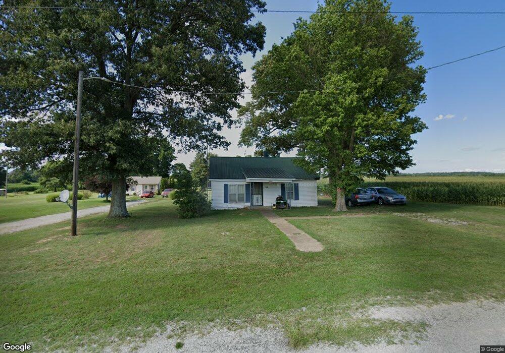
This home is located at 154 Robert R Thornton Rd, Dyer, TN 38330 and is currently estimated at $170,315, approximately $149 per square foot. 154 Robert R Thornton Rd is a home located in Gibson County with nearby schools including Rutherford Elementary School and Gibson County High School.
Ownership History
Date
Name
Owned For
Owner Type
Purchase Details
Closed on
May 12, 2015
Sold by
Pryor Julia
Bought by
Mcelrath John and Mcelrath Patricia
Current Estimated Value
Home Financials for this Owner
Home Financials are based on the most recent Mortgage that was taken out on this home.
Original Mortgage
$26,183
Outstanding Balance
$20,193
Interest Rate
3.79%
Mortgage Type
New Conventional
Estimated Equity
$150,122
Purchase Details
Closed on
Jan 9, 2002
Sold by
Mccaslin Kenneth H
Bought by
Mccaslin Sheila
Purchase Details
Closed on
Nov 17, 2001
Sold by
Mccaslin Kenneth H
Bought by
Mccaslin Sheila
Purchase Details
Closed on
Jun 1, 1996
Bought by
Pryor Julia
Create a Home Valuation Report for This Property
The Home Valuation Report is an in-depth analysis detailing your home's value as well as a comparison with similar homes in the area
Home Values in the Area
Average Home Value in this Area
Purchase History
| Date | Buyer | Sale Price | Title Company |
|---|---|---|---|
| Mcelrath John | $25,402 | -- | |
| Mccaslin Sheila | -- | -- | |
| Mccaslin Sheila | -- | -- | |
| Pryor Julia | $5,000 | -- |
Source: Public Records
Mortgage History
| Date | Status | Borrower | Loan Amount |
|---|---|---|---|
| Open | Mcelrath John | $26,183 |
Source: Public Records
Tax History Compared to Growth
Tax History
| Year | Tax Paid | Tax Assessment Tax Assessment Total Assessment is a certain percentage of the fair market value that is determined by local assessors to be the total taxable value of land and additions on the property. | Land | Improvement |
|---|---|---|---|---|
| 2025 | $1,100 | $53,325 | $0 | $0 |
| 2024 | $1,100 | $51,250 | $6,200 | $45,050 |
| 2023 | $938 | $30,150 | $3,525 | $26,625 |
| 2022 | $917 | $30,150 | $3,525 | $26,625 |
| 2021 | $917 | $30,150 | $3,525 | $26,625 |
| 2020 | $917 | $30,150 | $3,525 | $26,625 |
| 2019 | $262 | $30,150 | $3,525 | $26,625 |
| 2018 | $261 | $8,250 | $1,550 | $6,700 |
| 2017 | $257 | $8,250 | $1,550 | $6,700 |
| 2016 | $257 | $8,250 | $1,550 | $6,700 |
| 2015 | -- | $8,250 | $1,550 | $6,700 |
| 2014 | -- | $8,375 | $1,550 | $6,825 |
Source: Public Records
Map
Nearby Homes
- 153 New Hope St
- 505 E College St
- 163 Monroe St
- 901 S Trenton St
- 205 Division St
- 139 Peach St
- 354 E Maple St
- 217 Central St
- 342 E Walnut St
- 142 S Poplar St
- 299 E Walnut St
- 0 Royal St
- 107 Hopper St
- 707 N Main St
- 112 Fox St
- 23 Gravettes Crossing Rd W
- 117 Washington St
- 130 Callis Dr
- 113 Mcknight St
- 502 E Main St
- 156 Robert R Thornton Rd
- 169 Robert R Thornton Rd
- 173 Robert R Thornton Rd
- 32 Herman Cavitt Rd
- 42 Herman Cavitt Rd
- 44 Herman Cavitt Rd
- 46 Herman Cavitt Rd
- 54 Herman Cavitt Rd
- 64 Herman Cavitt Rd
- 66 Herman Cavitt Rd
- 68 Herman Cavitt Rd
- 70 Herman Cavitt Rd
- 264 Boham Rd
- 136 Boham Rd
- 156 New Hope Rd
- 135 Boham Rd
- 145 New Hope Rd
- 123 New Hope Rd
- 368 New Hope Rd